


GPS Chart Plotters
Page 103
R
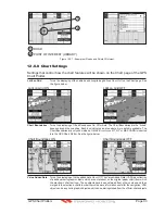
13. ADVANCED SETTINGS
The Advanced Setup menu allows customization of many GPS functions, Alarms and
NMEA interfacing.
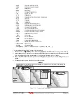
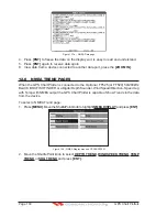
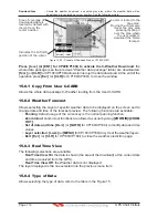
1. Press
[MENU]
. Move the ShuttlePoint knob to highlight
SETUP MENU
and press
[ENT]
.
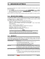
2. Move the ShuttlePoint knob to highlight
ADVANCED SETUP
and press
[ENT] or
move
the ShuttlePoint knob to the right.
While in this menu you will see many selections which are described in the next sections.
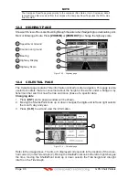
13.0 INPUT/OUTPUT (NMEA)
The CP180 has 2 NMEA inputs and 3 NMEA outputs, while the CP180i has 1 NMEA inputs
and 2 NMEA outputs. The CP300 has 4 NMEA inputs and 5 NMEA outputs, while the CP300i
has 3 NMEA inputs and 4 NMEA outputs.
These Ports may be set up to receive and output the following.
·
NMEA0183 - NMEA devices set to 4800 Baud (default setting)
·
FF525 (or FF520) 50/200kHz BLACK BOX FISH FINDER - refer to Fish Finder
Owner’s Manual
·
C-Com - C-Weather refer to Section 15
·
Radar - SI-TEX optional Radar refer to Radar Owner’s Manual
·
AIS 38400 - AIS Receiver, refer to Section 14
·
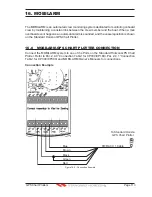
MOBILARM - Mobil-arm receiver, refer to Section 16
·
Disabled - allow the port to be disabled.
NOTE
When a Port is configured, both the Input and Output have the same setting.
Port1 is set to Radar, both the Input and Output wires are set to SI-TEX proprietary Radar
sentences. This means other devices should not be connected to the Input or Output wires.
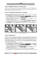
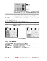
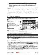
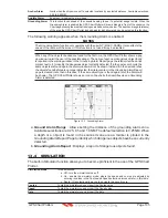
13.1 NAVIGATE
The Navigate menu allows customization of the Coordinate System (Loran TD's), Map
Datum, Map Orientation Resolution (angle the vessel has to change before the chart is
redrawn) and Static Navigation. See the following table
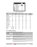
Coordinate System
: Selections are:
a. TD: Time Difference, based on Loran (see the following Par. 13.1.0)
b. UTM: Universal Transverse Mercator Grid
c. ddd mm.mmm: Degrees Minutes and Thousands of Minutes
d. ddd mm.mm: Degrees Minutes and Hundredths of Minutes
e. ddd mm.ss: Degrees Minutes and Seconds (default)
Map Datum
: Allows selection of Map Datums. The default Datum is WGS84 as C-MAP B
Y
J
EPPESEN
cartography has been compiled using the WGS84 Datum. A datum is a mathematical
model of the Earth which approximates the shape of the Earth, and enables calculations
such as position and area to be carried out in a consistent and accurate manner.
Map Orientation Resolution
: Sets the angle the vessel has to change before the chart is redrawn. The default setting
is 30 degrees. Example: if the vessel is heading 000T at a speed of 25 Knots, the display
will redraw:
a. In Home mode the GPS Chart Plotter centers the location of the vessel in the center
of the display. To keep the vessel in the center of the display the GPS Chart Plotter
will occasionally redraw.
Содержание CP180
Страница 1: ...CP180 CP180i CP300 CP300i Owner s Manual Color GPS Chart Plotters R ...
Страница 4: ...Page 6 GPS Chart Plotters R ...
Страница 12: ...Page 14 GPS Chart Plotters R ...
Страница 38: ...Page 40 GPS Chart Plotters R ...
Страница 48: ...Page 50 GPS Chart Plotters R ...
Страница 60: ...Page 62 GPS Chart Plotters R ...
Страница 68: ...Page 70 GPS Chart Plotters R ...
Страница 76: ...Page 78 GPS Chart Plotters R ...
Страница 80: ...Page 82 GPS Chart Plotters R ...
Страница 108: ...Page 110 GPS Chart Plotters R ...
Страница 118: ...Page 120 GPS Chart Plotters R ...
Страница 120: ...Page 122 GPS Chart Plotters R ...
Страница 126: ...Page 128 GPS Chart Plotters R ...
Страница 130: ...Page 132 GPS Chart Plotters R ...


