


ALAN MAP 600
user’s manual
17
50m – 100m - 200m (0.2miles) - 500m (0.5miles) – 1Km (1mile) –
2Km (2miles) – 5Km (5miles) – 25Km (25miles) 100Km (100miles).
Fade in/out Scale, coordinates, direction and speed
– hold
+
pressed the key for approx. 2 seconds.
4. Viewing mode
– The symbol on the bottom right, beside the
scale, constantly displays the active viewing mode of the map:
Navigation mode
– the display indicates the area relative
to your current position. The cursor is not shown, but as soon as
you move the Joystick, it will appear close to your current
position.
View map mode
– the display indicates another area
different from that of your position. The cursor is always visible to
allow you to move between different areas of the map, and to
use various functions.
You can switch between the two modes by briefly pressing
.
This provides quick movement from the area viewed in which
you are travelling to a place where you are going, and vice-
versa. This allows you to check the information on any place
while keeping an eye on navigation, as desired.
5. Map viewing reference
– When you enlarge/reduce the map,
the black point inside the grey square changes format and
position depending on the settings, representing the size and
position of the viewed area with respect to the entire map.
6. Streets
– Normally, the
Map
page also shows the streets
memorized in the electronic map. If you wish to hide/unhide
these streets, hold down the
-
button for two seconds.
7. Reference icons
– Indicates the presence of various
cartographic points pre-programmed into the map: airports,
railway stations, hotels, restaurants, etc. These symbols can be
made to appear/disappear individually on the map.
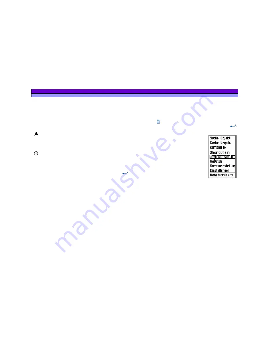
8.3.1 Menu of the map page – Gerneral
Press the button (Menu) to select one of the following
function. The functions will be activated by pressing the
Button:
a.
Search by City
is the searching
function to find points of Interrests in
the map (city, Street, Hotel, ...).
b.
Nearest Search
is the searching
function in the nearest surrounding
with reference to a special point
(e.g. the actual position).
c.
Map Info
shows the information
about the pointed region.
d.
Shortcut On/Off
means to show or
hide the Airline (dotted) from actual
Position to a Reference Point
e.
Navigating Route
allows to select
Options for the Auto-
Routing.
f.
Map Scale
to change the map scale by moving the
cursor sideward.
g.
Setup Map
- settings to change the view of the map.
h.
System Settings
for access to the settings menu.
i.
Menu for the main menu
for access to the main menu.


