


ALAN MAP 600
user’s manual
15
8 Description of the main pages
8.1
Selecting the main pages
To change the Main Pages, press the
ESC
button untill the
wanted page appears. The page appears in the following order:
The Satellite page only is displayed after turning on the device.
Afterward this page can be opened by using the Main Menu.
If the Auto-Routing-Function is active, instead of the Compass page the
Arrow Guide page is displayed.
The Compass page is shown , if the
GoTo
function to a Point or a
Route with
Set Navi
was activated.
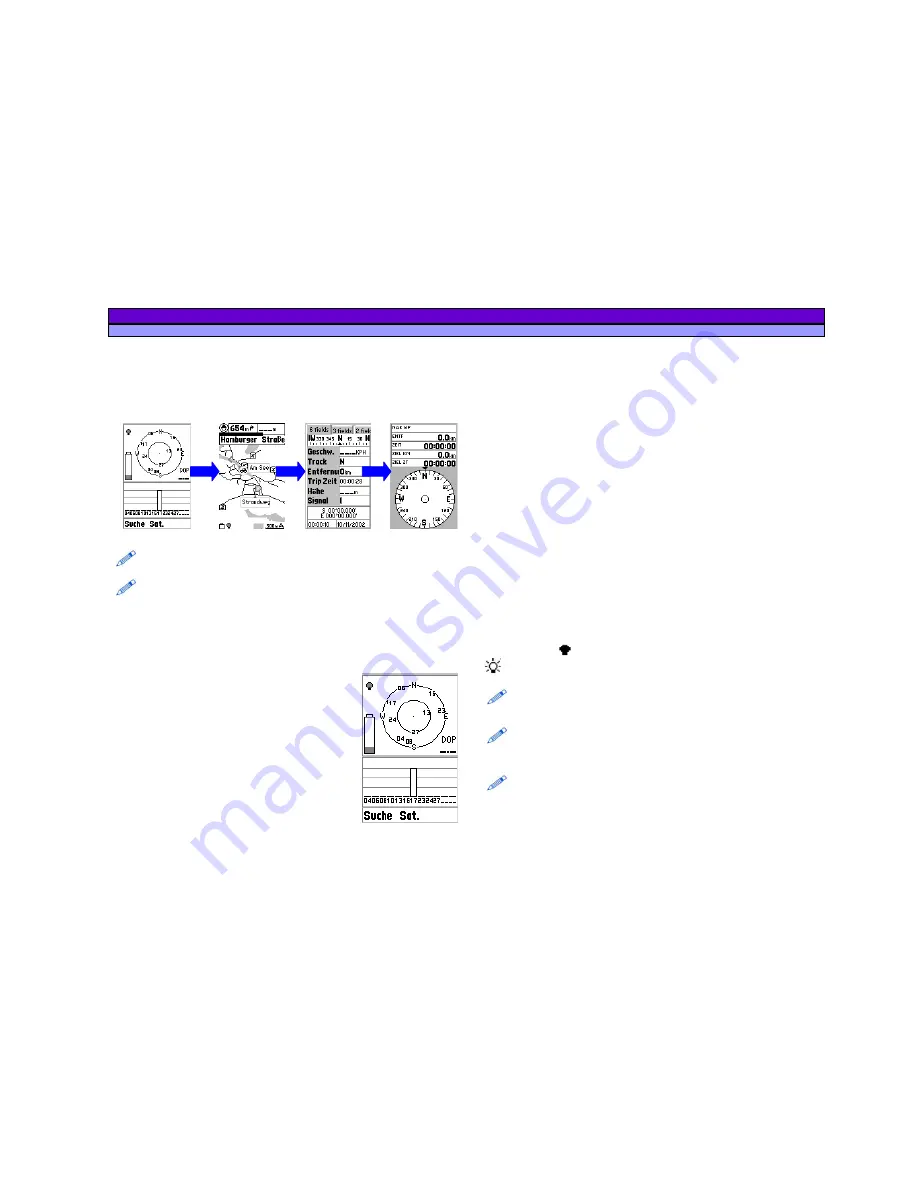
8.2 Satellite
page
The
Satellites
page shows the acquisition of
satellites by the receiver and is useful for
optimising the antenna’s directional pointing.
1. Concentric circles
– represent the
approximate position of each satellite
(orientation towards North) relative to your
position.
The two circles indicate the elevation (the
external one represents the horizon, the
internal one a 45-degree angle from the
horizon).
The centre of the internal circles indicates the perfectly vertical
position. The numbers which appear are the identification
numbers of the satellites received. The dark numbers represent
the acquired satellites (from which you can read data). In this
example, satellites , , , and are acquired. Satellite is at 45° from
you and number is on the horizon.
2. DOP
(Dilution Of Position) – indicates errors introduced to the
system.
3. Vertical bars
– represent the signals of the satellites received.
Below each one appears the identification number of the
satellite, its length being proportionate to the intensity of the
signal received. The dark bars indicated satellites acquired.
4. Coordinates of your position/DGPS
– appear once the GPS has
acquired at least 3 satellites (at least three dark bars must
appear, as described in the above paragraph) or DGPS is
displayed if WAAS or EGNOS signal has been received.
5. Battery icon
– indicates the remaining battery power.
6. Backlight icon
– indicates if display backlighting is active.
When it is dark , the backlighting is deactivated; when it is light
, it is activated.
It is important to keep in mind satellites are being acquired only if
Acquiring Sats appears at the bottom of the display. If Simulation
appears, you will need to change the navigation mode.
During the satellite acquisition phase, it is possible to monitor the signal
and optimize the pointing of your antenna to lengthen the bars and
hasten the acquisition process.
If the message Poor GPS Signal! appears, check that there are no
obstacles above you that might impede MAP 600’s reception of the
satellite signals (tree branches, beams, poles, etc). In particular, do not
use this function while inside a building or vehicle (without at least using
an external antenna). Press to confirm, move to a more open area, and
try the procedure again.


