


ALAN MAP 600
user’s manual
16
8.2.1
14
Menu of the satellite page
Press the
button to access the following options:
a.
Navigation/Stop Navigation
for selecting navigation or
simulation mode.
b.
Einstellung
for access to the settings menu.
c.
Hauptmenü
for access to the main menu.
If you do not need to actually navigate, but are only using your
receiver to enter settings or consult maps, we suggest you
deactivating the receiver by entering
Simulation
mode. This
mode considerably reduces the battery consumption.
Navigation activates navigation, while
Stop Navigation
deactivates it by selecting simulation mode. When
Simulation
mode is activated, this will be displayed at the bottom of the
Satellites
screen in the place of your coordinates.
From the
Satellites
page, you can switch from Navigation to
Simulation without entering the
Settings
menu: press highlight
Navigation
or
Stop Navigation
(Simulation mode) and press
to confirm.
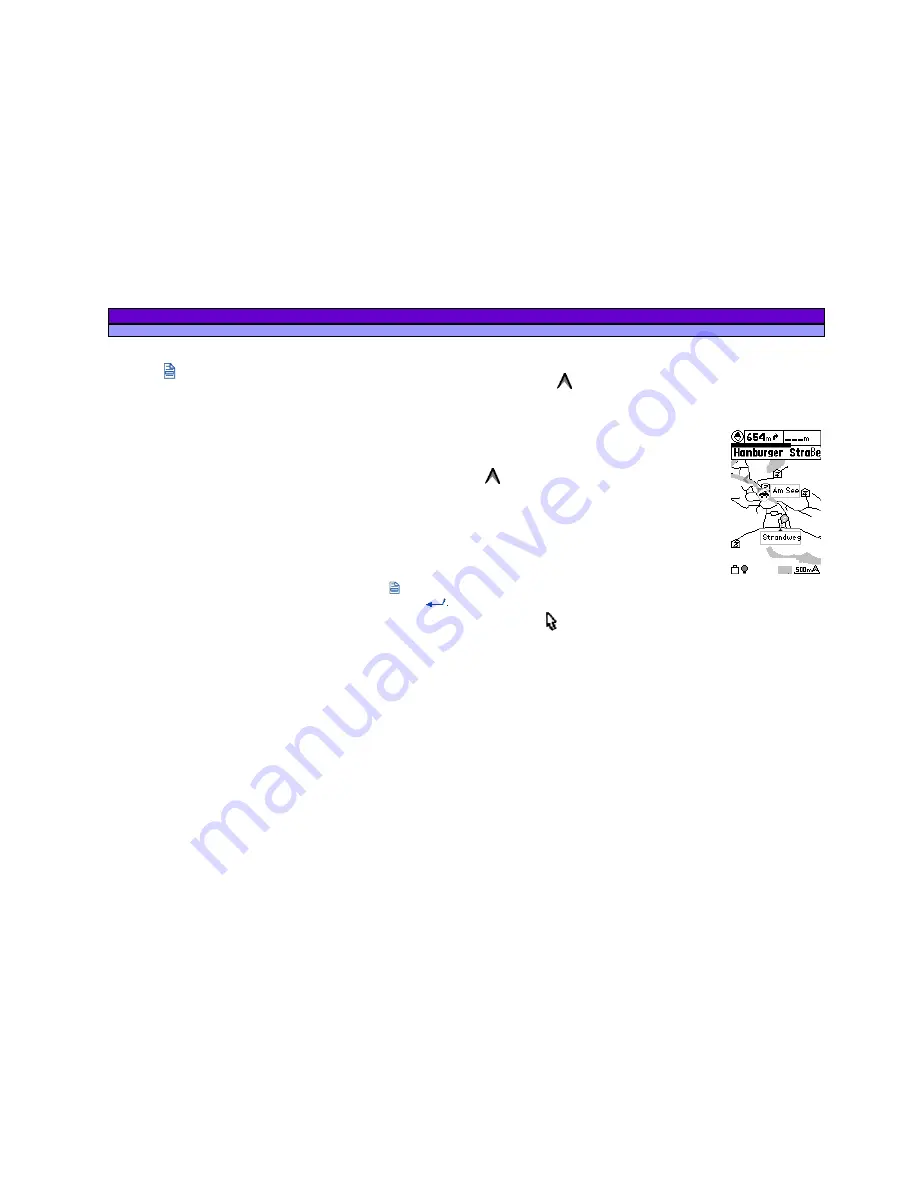
8.3 Map
page
This page shows your position and direction of movement, shown
by the symbol
inside the GPS’ memorized map. In this map,
you can create geographical references (waypoints) or routes
as desired.
The
Map
page includes the following details:
1. Direction and current position
– The symbol
shows the current position and the angle
of direction of movement (displayed either
towards North or towards a preset
destination). This is obviously different from a
traditional compass as it indicates direction
only during movement. Furthermore, if the
symbol is dark, this means that you have
acquired the minimum three satellites
necessary for navigation, otherwise position your GPS better for
acquisition.
2. Cursor
– A useful instrument which allows you to verify
the coordinates of a point by simply moving the cursor to that
position using the Joystick. The cursor also allows you to move
the displayed area of the map: just move the cursor close to the
edge of the map and that part of the map will appear on the
screen.
3. Scale of map, position coordinates, direction and speed
–
Scale and coordinates of position are shown right down in the
display, direction and speed are indicated above in the left
corner of the display.
The following functions can be implemented:
Change the scale
– briefly press the zoom
+
and
-
buttons to
increase or decrease the scale. The scales available are:


