52
Tutorial 2: Working with Data
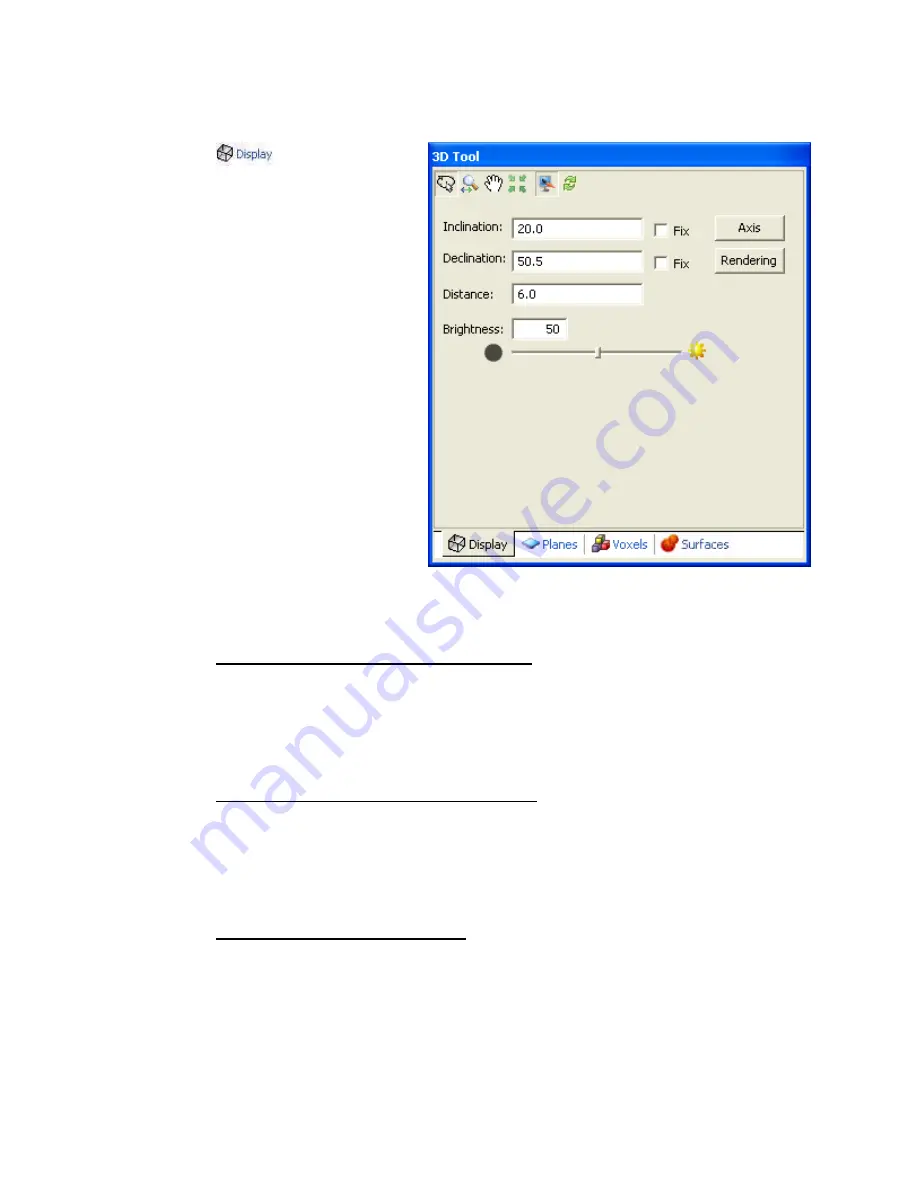
Display Tab
The
tab enables you to
modify the overall Display of the 3D
View:
•
Select the
3D Viewing Tools
(
Rotate
,
Zoom
,
Pan
,
Centre
,
Redraw
)
•
Specify and fix the
inclination
of the View
•
Specify and fix the
declination
of the View
•
Specify the viewing
distance
from the central focal point of
the View
•
Modify the
brightness
level by
moving the slider bar or
specifying a %
•
Click the
[Axis]
button to
display the
Axis Options
dialog
•
Click the
[Rendering]
button to
display the
Rendering Options
dialog
Using the 3D Display Tab
T
O SPECIFY AND FIX THE INCLINATION OF THE GRID
:
1.
Click inside the
inclination
box and specify the inclination you want for the 3D
grid.
2.
Check the Fix box, and then click the OK button. The grid will be redrawn on
your map with the new fixed inclination.
T
O SPECIFY AND FIX THE DECLINATION OF THE GRID
:
1.
Click inside the
declination
box and specify the declination you want for the 3D
grid.
2.
Check the Fix box, and then click the OK button. The grid will be redrawn on
your map with the new fixed inclination.
T
O SPECIFY THE DISTANCE OF THE GRID
:
The
distance
specifies the distance away from the centre focal point relative to the longest
displayed dimension. For example, a value of 5 will place the viewpoint 5 times the size
of the grid away from the centre of the grid.
1.
Click inside the distance box and specify the distance you want for the 3D grid.


