53
INFORMATION ON THE MAP DISPLAY
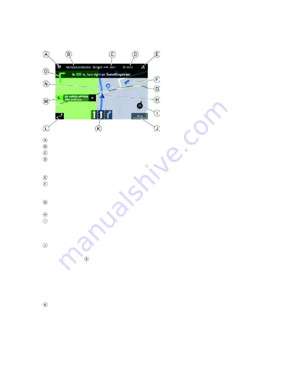
If the navigation system is activated, the following information is displayed:
Navigation menu
Destination/ next stopover
Remaining distance to the destination/next stopover
Estimated time of arrival or remaining travel time to destination/next stopover.
Tap the time display to toggle between the arrival time and the remaining travel
time.
Navigation settings
POI cluster:
Indicates that there are more POIs around the icon. After tapping the icon a list
button appears, showing the respective POIs listed.
Specific POIs, e.g. petrol stations, car parks or restaurants, are shown by the
corresponding icons.
Current vehicle position icon
Compass:
Red arrow pointing north if the map view is in the direction of travel.
Tap on the compass to adjust the display of the map view: 2D north-up, 2,5D or 3D
direction of travel
The currently selected map scale:
·
To change the scale on the map, rotate the right rotary encoder/push
button
or use the touch screen.
o
Pinch gesture:
Touch surface with 2 fingers and bring them closer together.
o
Spread gesture:
Touch surface with 2 fingers and move them apart.
·
When the auto-zoom mode is activated, the map scale is adjusted
automatically by the navigation system (increases/decreases).
Lane recommendation
Shows all lanes of the current street. The recommended lanes to follow the
calculated route are shaded in blue.


