C-4
hsb
2
Plus Series Fishfinders
Appe
ndi
x C:
C-
MA
P C
har
t Card
Fe
at
ur
es
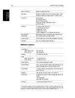
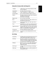
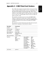
The following chart features are always displayed:
Menu option
Chart features
PORTS
Ports:
Berthing facility
Causeway
Checkpoint
Crane
Dam
Distance mark
Dock area
Dry dock
Dyke area
Dyke crown
Floating dock
Gate
Gridiron
Harbour facility
Hulk
Landing place
Landing stairs
Lock basin
Oil barrier
Pile
Pontoon
Ramp
Shoreline construction
Slipway
Weir
Small craft facility
Services:
Coast Guard station
Pilot boarding place
Rescue station
Signal station, traffic
Signal station,
warning
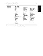
Port Information:
Port area
Harbour master
Coast Guard
Police
Customs
Health emergency
Post office
Yacht club
Boat yard
Accessories
Electrical/electronic repairs
Engine repairs
Sailmaker
Fishing/diving gear, SCUBA
Hotel/Inn
Restaurant
Bank/Exchange office
Pharmacy
Port/Marina
Slipway
Boat hoist
Crane
Fuel station
Water
Electricity
Showers
Launderette
Public toilets
Post box
Public telephone
Refuse bin
Visitor’s berth
Chandler
Provisions
Bottle gas
Car Parking
Parking for boat and trailers
Caravan site
Camping site
Sewerage pump-out station
CARTOGRAPHIC
OBJECTS
Line, generic
Area, generic
NATURAL FEATURES
Land area
Bridge
ROCKS
Underwater Rock
WRECKS Wrecks
Summary of Contents for hsb2 PLUS
Page 1: ...hsb2 PLUS Series Fishfinders Owner s Handbook Document number 81195_2 Date August 2002...
Page 2: ......
Page 34: ...1 22 hsb2 Plus Series Fishfinders Database Lists...
Page 64: ...2 30 hsb2 Plus Series Fishfinders Transmitted Data...
Page 110: ...4 14 hsb2 Plus Series Fishfinders MOB...
Page 160: ...5 50 hsb2 Plus Series Fishfinders Review Your Passage Plan...
Page 172: ...6 12 hsb2 Plus Series Fishfinders Data Log Mode...
Page 200: ...8 8 hsb2 Plus Series Fishfinders Worldwide Support...
Page 204: ...A 4 hsb2 Plus Series Fishfinders Appendix A Specifications...
Page 216: ...C 6 hsb2 Plus Series Fishfinders Appendix C C MAP Chart Card Features...
Page 228: ...viii hsb2 Plus Series Fishfinders...

