61
Main Menu
GPS Tab
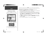
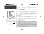
‘Acquiring Satellites’ appears when the GPSMAP 196 is fi rst
turned on and looking for satellites overhead.
Receiver Status, Accuracy and DOP
Receiver status is indicated at the top fi eld of the page, with the current Accuracy and Dilution Of
Precision (DOP) to the right of the sky view. DOP is an indication of satellite geometry quality mea-
sured on a scale of one to ten (lowest numbers the best, highest numbers the poorest). Accuracy uses
DOP and other factors to calculate horizontal position accuracy in feet or meters.
The status fi eld will show one of the following conditions:
• Searching the Sky— the receiver is looking for any satellites.
• AutoLocate— the receiver is looking for any satellite whose almanac has been collected. This
process can take up to fi ve minutes.
• Acquiring Satellites— the receiver is looking for and collecting data from satellites visible at its last
known or initialized position, but has not collected enough data to calculate a fi x.
• 2D GPS Location— at least three satellites with good geometry have been acquired and a 2 dimen-
sional position fi x (latitude and longitude) is being calculated. ‘2D Differential’ will appear when you
are receiving DGPS corrections in 2D mode and a ‘D’ will show on the strength bar of satellites being
corrected.
• 3D GPS Locaion— at least four satellites with good geometry have been acquired and your position
is now being calculated in latitude, longitude and altitude. ‘3D Differential’ will appear when you are
receiving DGPS corrections in 3D mode and a ‘D’ will show on the strength bar of satellites being cor-
rected.
• Lost Satellite Reception— the receiver is no longer tracking enough satellites for a 2D or 3D fi x.
• Receiver Not Usable— the receiver is unusable, possibly due to interference or abnormal satellite
conditions. Turn the unit off and back on to reset.
• Simulating GPS— the receiver is in simulator mode.
• GPS Off—the GPS receiver is turned off.
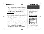
‘3D GPS Location’ is displayed when the GPSMAP 196 is
receiving a suffi cient number of satellites to determine a latitude,
longitude and altitude position.
190-00283-00Backup.indd 61
12/8/2002, 8:09:24 PM
Summary of Contents for GPSMAP GPSMAP 196
Page 1: ...Pilot s Guide Reference GPSMAP 196 196PG Covers indd 1 12 9 2002 4 34 25 PM...
Page 18: ...8 Basic Operation This page intentionally blank 190 00283 00Backup indd 8 12 8 2002 8 08 50 PM...
Page 121: ...190 00283 00Backup indd 111 12 8 2002 8 10 01 PM...
Page 122: ...190 00283 00Backup indd 112 12 8 2002 8 10 01 PM...


