10
Main Pages
Map Page
Map Page Operating Modes
Two basic map operating modes, position mode and panning mode, determine what information is
shown on the map display. Position mode pans the map to keep the present position symbol centered in
the display area, and is the normal mode of operation when viewing the Map Page. Panning mode pans
the map to keep the pointer within the display area, and is used to view map information outside your
current area (without changing scales), measuring distance to map features from your current position
or for retrieving database information from the map. The GPSMAP 196 will always power up in the
position mode, with the last known location centered on the map display. With the Map Page displayed,
pressing the
ARROW KEYPAD
will activate panning mode.
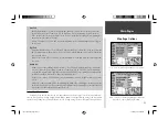
When the pointer is active, an additional data window will appear at the top of the screen to indi-
cate the position, range and bearing to the pointer or a selected waypoint or map item.
Using Panning Mode and the Pointer
The pointer allows you to pan away from your present position and scroll to other map areas around
the world. As you pan past the edge of the current map display, the screen will actively scroll forward
to provide continuous map coverage. (Keep in mind that the present position symbol moves with the
scrolling map, and may not be visible on the display screen.)
NOTE: When the pointer reaches the edge of the map, the unit may pause briefl y as it
loads new map data.
To move the pointer:
1. Press the
ARROW KEYPAD
to move the pointer in an up, down, left or right direction.
As you move the pointer, the distance and bearing from your present position to the pointer will be
displayed in the data window, along with the cursor’s position coordinates. In panning mode, zoom-
ing in or out will center the pointer on the screen. When the pointer is stationary, a fi xed coordinate
position will appear in the position fi eld, and the distance and bearing from your present position will
change as your vehicle moves.
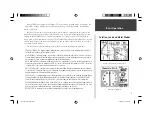
Use the
ARROW KEYPAD
to pan the map. When panning a
pointer appears on the map.
Place the pointer on a map feature to display additional informa-
tion. For waypoints, airports or navaids, press
ENTER
to
display a waypoint information page for the selected point.
)
190-00283-00Backup.indd 10
12/8/2002, 8:08:51 PM
Summary of Contents for GPSMAP GPSMAP 196
Page 1: ...Pilot s Guide Reference GPSMAP 196 196PG Covers indd 1 12 9 2002 4 34 25 PM...
Page 18: ...8 Basic Operation This page intentionally blank 190 00283 00Backup indd 8 12 8 2002 8 08 50 PM...
Page 121: ...190 00283 00Backup indd 111 12 8 2002 8 10 01 PM...
Page 122: ...190 00283 00Backup indd 112 12 8 2002 8 10 01 PM...


