7
Your GPSMAP 196 is designed to be fl exible. The unit provides “ Aviation Mode”, “ Land Mode” and
“Water Mode” settings, allowing you to tailor many features specifi cally for airborne, automotive or
marine applications.
In Land or Water modes, some alert messages—which would be appropriate in the cockpit—are
disabled to prevent nuisance messages not applicable to the current use. Additionally, there are many
settings on the GPSMAP 196 you can make on your own. For example, speed can be displayed in
knots, miles per hour or kilometers per hour. The GPSMAP 196 provides the fl exibility to have separate
settings for each mode (and saves them in memory so you do not have to re-enter them the next time
you switch between modes).
The list below describes the differences you will observe when switching between modes.
VEHICLE SYMBOL—An airplane symbol indicates your current position on the map in Aviation Mode. In
Land or Water modes, a pointer symbol is used.
MAP SETTINGS—All map settings, such as level of detail, North reference (North Up, Track Up, etc.), Auto
Zoom min/max limits, and text size will be saved by mode. When you switch between modes, your prefer-
ence settings for each mode are retained and used for the map display.
GOTO NAVIGATION—In Aviation Mode, when a GOTO is initiated the course line (and course guidance) is
fi xed at the point where you started the GOTO. By contrast, in Land or Water modes, the GOTO course line
is always tied to your current position and moves as you move.
UNITS OF MEASURE—Your preferred settings for speed, altitude, distance and temperature are retained
for each mode. This makes it easy to switch between, for example, miles/miles per hour in Land Mode and
nautical miles/knots in Aviation and Water modes.
PAGE LAYOUT—The main pages can be custom-tailored to your preferences by changing the page layouts.
You may fi nd that you prefer different page layouts for different modes (applications) and the GPSMAP
196 will save your page layouts for each mode so they are ready the next time you select that mode.
APPROACH/ARRIVAL ALARMS—Each mode allows you to confi gure the unit for a different application. In
each of these modes you will likely be operating at signifi cantly different speeds. For this reason, you may
fi nd it useful to have different alarm time or alarm distance settings in each mode.
RECENT LIST—A separate list of recently used destinations is kept for each operating mode.
Aviation, Land and Water Modes
Basic Operation
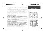
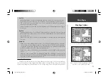
Map Page and graphic HSI in Aviation Mode.
RMI Page in Land Mode.
190-00283-00Backup.indd 7
12/8/2002, 8:08:50 PM
Summary of Contents for GPSMAP GPSMAP 196
Page 1: ...Pilot s Guide Reference GPSMAP 196 196PG Covers indd 1 12 9 2002 4 34 25 PM...
Page 18: ...8 Basic Operation This page intentionally blank 190 00283 00Backup indd 8 12 8 2002 8 08 50 PM...
Page 121: ...190 00283 00Backup indd 111 12 8 2002 8 10 01 PM...
Page 122: ...190 00283 00Backup indd 112 12 8 2002 8 10 01 PM...


