12. ROUTES
12-9
12.4.5
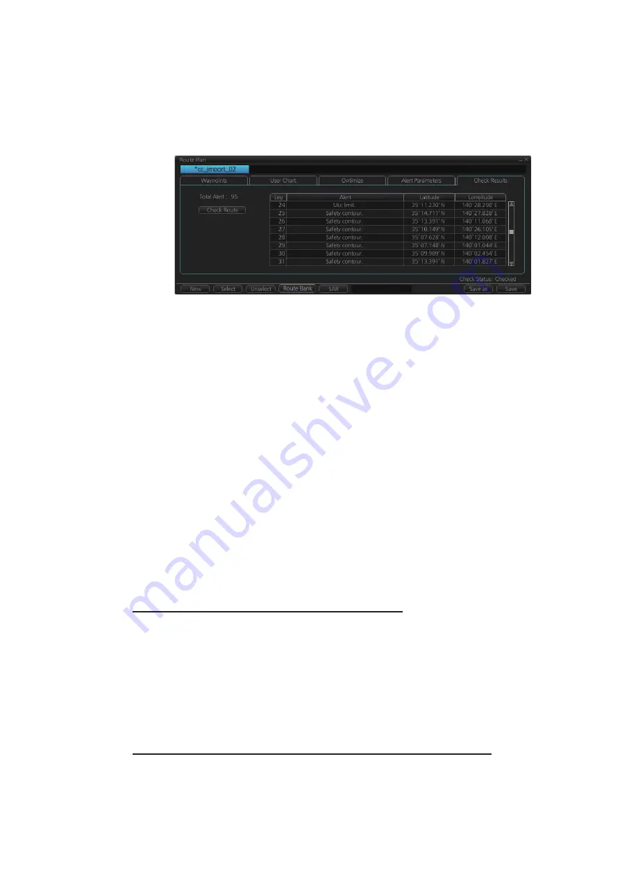
How to use the Check Results page
The [Check Results] page allows you to make safe water calculation for your route.
Click the [Check Route] button to do the check. After the button is operated, the alert
type and latitude and longitude position of the alert appear for applicable legs on the
route.
Note 1:
In order to display charts with correct updated situation, always use current
date during your voyage. If your voyage lasts more than one week, set current date at
least once per week during your voyage.
Note 2:
A route check can take longer with C-MAP charts. Wait until the completion
of the check.
Note 3:
When a chart is installed or updated, use the [Check Route] button on the
[Alert Parameters] page to re-check all routes before starting any voyage. If a route
which has not been checked is selected for a voyage, the error message "Route check
is not done in PLAN mode." appears at the bottom of the monitor page.
12.5
How to Modify an Existing Route
12.5.1
How to change waypoint position
To change position of a waypoint you have the following choices:
• Drag and drop waypoint using the left button.
• Enter latitude and longitude on the [Waypoints] page in the [Route Plan] dialog box.
How to drag and drop waypoint to new position
1. Put the cursor on the route waypoint to move then push the right button to show
the context-sensitive menu.
2. Select [Edit].
3. Press and hold down the left button while rolling the trackball to move the cursor
to a desired position. Release the button when the cursor is at the desired posi-
tion. Right-click the display area to show the context-sensitive menu then select
[Finish].
How to change latitude and longitude from the Waypoints page
1. Show the [Waypoints] page.
2. Put the cursor on the digit to change in the Latitude or Longitude field.
3. Enter position from the Control Unit’s keyboard, or spin the scrollwheel.
Summary of Contents for FCR-2119-BB
Page 66: ...1 OPERATIONAL OVERVIEW 1 40 This page is intentionally left blank ...
Page 134: ...2 RADAR CHART RADAR OPERATION 2 68 This page is intentionally left blank ...
Page 182: ...4 AIS OPERATION 4 22 This page is intentionally left blank ...
Page 198: ...5 RADAR MAP AND TRACK 5 16 This page is intentionally left blank ...
Page 290: ...9 VECTOR S57 CHARTS 9 12 This page is intentionally left blank ...
Page 296: ...10 C MAP CHARTS 10 6 This page is intentionally left blank ...
Page 392: ...16 NAVIGATION SENSORS 16 16 This page is intentionally left blank ...
Page 398: ...17 AIS SAFETY NAVTEX MESSAGES 17 6 This page is intentionally left blank ...
Page 466: ...24 CONNING DISPLAYS 24 4 Example 2 General navigation Example 3 General navigation ...
Page 467: ...24 CONNING DISPLAYS 24 5 Example 4 General navigation Example 5 All waters navigation Silence ...
Page 534: ...FURUNO FCR 21x9 BB FCR 28x9 SERIES SP 6 E3607S01D M This page is intentionally left blank ...
Page 541: ......


