8-38
8. GPS OPERATION (ADVANCED)
GPS SET
MENU
»
GPS
GPS Position (continued)
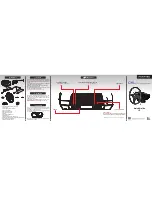
<3. When the caller’s TX format is D-PRS Position
(Base station)>
Compass*
1
Displays the caller’s direction from
your position.
Latitude
Displays the caller’s latitude.
Longitude
Displays the caller’s longitude.
GL
Displays the grid locator based on
the latitude and longitude of the
caller’s position.
ALT
Displays the caller’s altitude.
DST
Displays the caller’s distance from
your position.
POWER
Displays the caller’s TX power level.
HEIGHT
Displays the caller’s antenna height.
GAIN
Displays the caller’s antenna gain.
DIRECT
Displays the direction of caller’s
antenna was pointing.
Symbol
Displays the caller’s D-PRS symbol.
SSID
Displays the caller’s SSID.
GPS Time Stamp
Displays the time that the caller
acquired the position data.
Call sign
Displays the caller’s call sign (with
SSID).
<4. When the caller’s TX format is D-PRS Object/
Item>
Compass*
1
Displays the Object/Item’s direction
from your position.
Object/Item name
Displays the Object/Item’s name.
Latitude
Displays the Object/Item’s latitude.
Longitude
Displays the Object/Item’s longitude.
GL
Displays the grid locator based on
the latitude and longitude of the
Object/Item’s position.
ALT
Displays the Object/Item’s altitude.
DST
Displays the Object/Item’s distance
from your position.
COURSE
Displays the Object/Item’s direction
over ground.
SPEED
Displays the Object/Item’s speed.
POWER
Displays the Object/Item’s TX power
level.
HEIGHT
Displays the Object/Item’s antenna
height.
GAIN
Displays the Object/Item’s antenna
gain.
DIRECT
Displays the direction that the
Object/Item’s antenna was pointing.
Symbol
Displays the Object/Item’s D-PRS
symbol.
SSID
Displays the caller’s SSID.
GPS Time Stamp
Displays the time that the caller sent
the Object’s data.
Call sign
Displays the caller’s call sign (with
SSID).
L
When the object or Item is disabled, “KILLED” is
displayed.
*
1
You can change the direction in the Quick Menu window.


