Tutorials
35
Tutorial: Plan a Long Distance Trip
When you are using Street Atlas USA to plan a long trip, use the many features on the
Route tab to customize your route.
Before you leave on your trip
Step 1—Create your route
Create a route
—there are several ways to do this. When you create a route, you can
add or
insert stops or vias
if you want to travel through specific locations. In this scenario, we
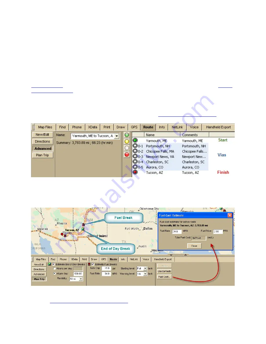
created a route from Yarmouth, Maine, to Tucson, Arizona, and inserted several vias
because we want to go through specific locations.
Click the Advanced button on the Route tab to see the route details.
Tip Another thing you can do on the Advanced subtab is
set your route preferences
to fine
tune the way the route is created.
Step 2—Set your end of day and fuel break preferences
Click Plan Trip on the Route tab and set your preferences. Then, click Apply. Your End of
Day Breaks and Fuel Breaks are displayed on the map.
To view the estimated fuel cost, click Fuel Cost.
Step 3—Print your route map and directions
You can
print your route map and directions
.
1.
Click the Print tab and then click Route.
Содержание Street Atlas USA 2011
Страница 2: ......
Страница 10: ......
Страница 36: ...Street Atlas USA 2011 26 GeoTagger Print Print Screen ...
Страница 40: ...Street Atlas USA 2011 30 ...
Страница 52: ...Street Atlas USA 2011 42 Step 8 Exit the MapShare Wizard Click Close to exit the MapShare Wizard ...
Страница 96: ......
Страница 192: ......
Страница 208: ......
Страница 224: ......
Страница 226: ......
Страница 242: ......
Страница 244: ......


