


46
5.8
Creating Mission Files using Google Earth
As an alternative to manually entering Mission file marker coordinates as values, a
Mission file can be created by importing KML markers graphically positioned using the
Google Earth™ application.
In its basic form, Google Earth is a freely downloadable Windows application that
displays a graphical virtual 3D globe overlaid with high resolution aerial imagery of the
Earths terrain.
By using mouse and on-screen controls, the user can position and zoom the virtual
observation “camera” above the site where they wish to create a mission file, and use
Google Earths tools to graphically position and name markers ready for import into
Artemis Manager.
5.8.1
Installing Google Earth
To create KML files, Google Earth needs to be installed on your computer if not already.
To download the latest version of Google Earth, open an internet browser and visit
www.google.com/earth
.
Follow the links and on-screen instructions to download and install Google Earth
onto your computer.
At the time of writing, the current version of Google Earth was v7.1.2 (found by
choosing “Help » About Google Earth” from the menu).
Subsequent software releases may mean some of the screen-shots will differ but the
basic concepts presented here should remain valid.
For further details on the use of third-party software applications with Artemis please
refer to the “Notices” section on page 66 of this manual.
Further information on how to use Google Earth, including a comprehensive set of
tutorials is available on the Google Earth website at the link given above.
5.8.2
Preparing Google Earth for use
Once Google Earth has been successfully installed, it is recommended that several
configuration changes are made to its default settings.
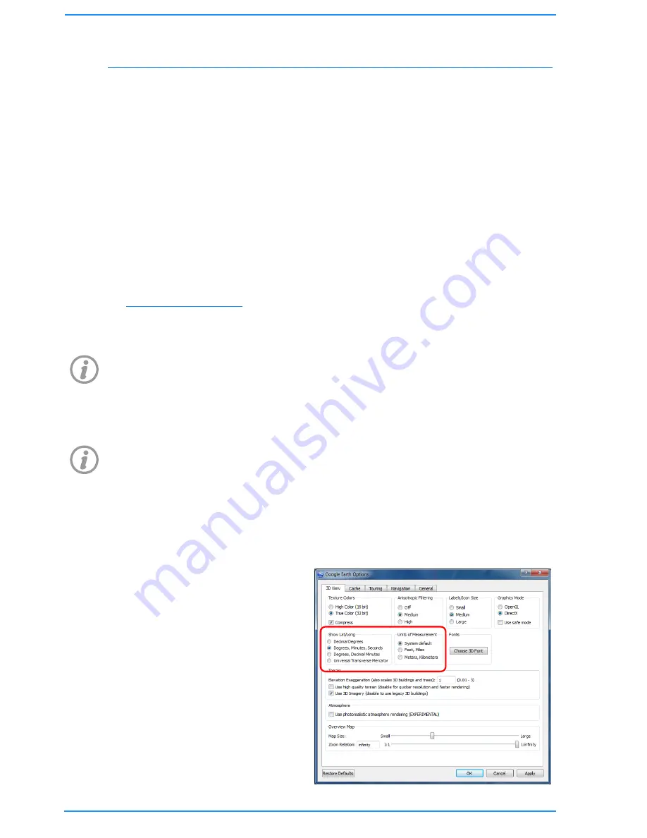
From the menu, choose “Tools » Options”, to show the “Google Earth Options”
window.
In the Options window under the
“3D View” tab, first choose how
you want latitude and longitude
values to appear and distance
units to be displayed in the “Show
Lat/Long” and “Units of
Measurement” group boxes
respectively.
Содержание BP00707
Страница 1: ...Diver Sonar Navigator USER GUIDE...
Страница 2: ......
Страница 71: ......
Страница 72: ...P N BP00697 4 UM 141 P00697 04 March 2015 Distributor...


