32
PLOTTER OPTIONS
Plot Trail
The line extending from your present position is
called a plot trail. This unit lets you customize the
plot trail with the following menu items. All of the
items on the Plotter Options menu affect the plot
trail.
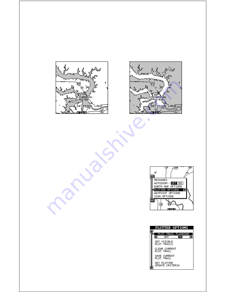
Fill With Gray
When the AirMap 300 is first turned on, all water is filled with gray to
distinguish it from land, which is clear. (See below) To make the land fill
with gray and water remain clear, press the down arrow key until the “Fill
With Gray” menu is highlighted, then press the left arrow key. Press the
EXIT key to return to the mapping screen.
FILL WITH GRAY - LAND
FILL WITH GRAY - WATER
Normally, you'll want to fill water with gray when you're using the GPS
receiver on land and fill land with gray when you're using it on the water.
Plot Trail Flashing
Since there can be many lines on the mapping dis-
play, it’s helpful at to make the plot trail flash. This
usually makes it easier to see. The default for plot
trail flashing is on. To turn it off, highlight the “Plot
Trail Flashing” label on the “Plotter Options” menu,
then press the left arrow key. Press the EXIT key
to return to the map. Repeat the above steps to
turn the flashing on.
Summary of Contents for AirMap 300
Page 1: ...INSTALLATION AND OPERATION INSTRUCTIONS AirMap 300 TM...
Page 85: ...81 WINDOW BOXES These boxes are used on Map 3 and Nav 1 only 1 2 3 4 5 6 7 8 9 10 11 12...
Page 86: ...82 13 14 15 16...
Page 87: ...83 WINDOW GROUPS This is a listing of window groups A through O A B C D E F G H I J K L...
Page 88: ...84 M N O...
Page 94: ...90...


