98
iGage
iG8 User Manual
The NGS returns three styles of reports:
Standard: Single Page Report
Extended: St baseline d State Plane in
US Survey Feet or International Feet as appropriate
St XML: Single Page + XML
For new OPUS users, the ‘Format Extended’ includes
one important addition: State Plane coordinates are
shown in both Meters and US Survey Feet (or
International Feet) at the bottom of the report. We
keep ‘Extended’ checked by default for this reason.
Prior to submitting an OPUS report, you can modify any
of the Option settings, however checking this box
results in the extended output always being checked.
Utilities
(Hidden when Simple)
Additional utilities for working with observations are
included.
“1. Undelete Occupations”
When you delete an observation, it is actually moved to
a special “_Deleted” folder.
Clicking the Undelete Occupation button allows you to
specify a deleted observation to restore. When an
occupation is undeleted, it is always returned to the
_New project.
“2. HcRINEX Convertor”
Files are stored on the receiver in an ‘.HCN’ binary file.
When the tool downloads a file, it is automatically
converted to standard RINEX using the HxRINEX tool.
Clicking this button runs the HcRINEX tool in manual
mode. You can browse for HCN files and manually
convert them to standard RINEX files. Results are
always placed in a subfolder named ‘RINEX’ under the
file to be converted.
“3. Mark One File Unread”
When files are downloaded from the receiver, they are
not deleted from the receiver. The filename on the
receiver is modified to begin with an underscore ‘_’.
This function allows you to specify a single file to mark
as ‘unread.’ Once a file is unread the next download
action will re-download and convert the file.
“4. Mark All GPS Files Unread”
This function marks EVERY observation file on the
receiver as unread. The next download will read every
single file on the receiver. (This will take quite a bit of
time if your receiver had hundreds of files.)
GPS Settings
(Hidden when Simple)
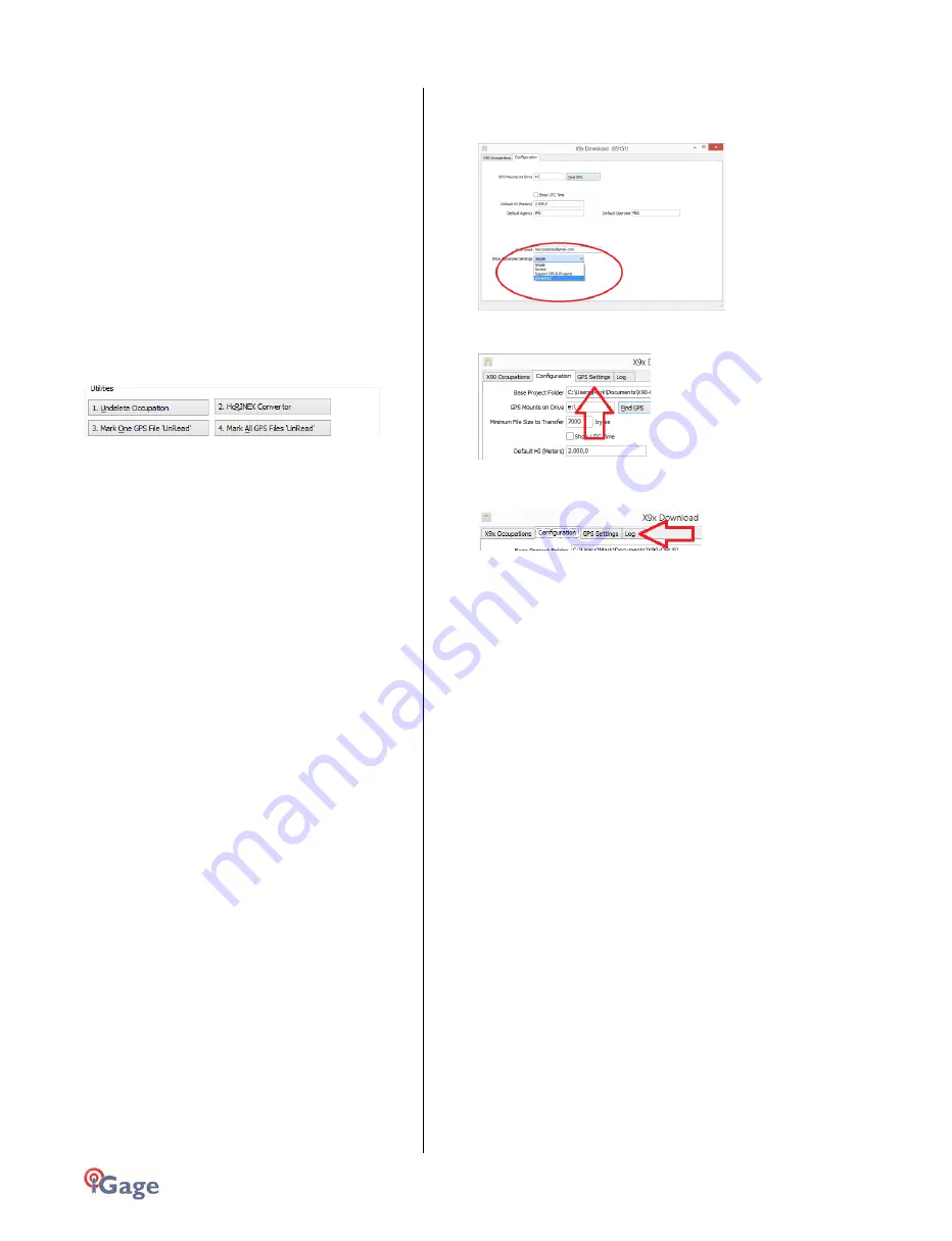
To modify the ‘GPS Settings’ or view the log, select the
'Configuration' tab, then choose 'Show Advanced
Settings = Advanced.’
When ‘Advanced’ is selected, two additional tabs will
be displayed:
The ‘Log’ Tab
The ‘Log’ tab shows detailed results of the current
program operation. It may be useful to debug some
aspect of file processing.
GPS 'Settings' Tab
The GPS Settings options on the download tool are not
compatible with the iG8. You can use the front panel
controls or the Wi-Fi connection to make interval
changes to the iG8.
OPUS: What is it?
OPUS (Online Positioning User Service) is a free service
provided by the NGS (National Geodetic Survey.)
From the NGS Website:
“This Online Positioning User Service (OPUS) provides
simplified access to high-accuracy National Spatial
Reference System (NSRS) coordinates. Upload a GPS data
file collected with a survey-grade receiver and obtain an
NSRS position via email.
OPUS requires minimal user input and uses software
which computes coordinates for NGS' Continuously
Operating Reference Station (CORS) network. The
resulting positions are accurate and consistent with other
National Spatial Reference System users.”
Here are direct links to more detailed information:
http://geodesy.noaa.gov/INFO/OnePagers/OPUSOnePager.pdf
http://geodesy.noaa.gov/OPUS/about.jsp
One of the most important contributors to vertical
accuracy computed by OPUS-Static is the length of
occupation. Longer times are better.
If you are concerned about elevation, please remember
that a 2 hour OPUS static observation has an expected


