AIR_Manual_506a_ENG_rev_1.pdf
Page 40/96
6.17
MAP
The Map instrument enables you to view several graphic information sets
(layers) at the same time.
The Map instrument is to be found on page 12, by default.
The Map can be placed on any page (using the Digifly AirPages software) and it
can go from 120x120 to 240x240 pixels and any size in between.
I
t
is always “North up”
The zoom is fully automatic depending on the route’s navigation requirements.
The scale is displayed, on the lower right corner: in meters, up to 1,000
(3,300ft), and in Km over 1,000mt.
Map layers:
There are four layers available: Terrain (topography), NAV (Navigation), FAI-Triangle Assistant and Airspace CTR
6.17.1
TERRAIN (first layer):
This layer traces the digital elevation terrain map with 10 different shades of grey.
With your Digifly AIR, you get FREE world wide digital topographic maps! The digital terrain elevation map files
are created with the Digifly AirTools free software
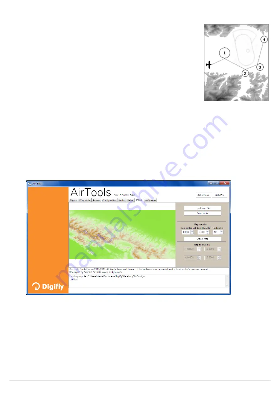
In order to view the Terrain Layer (digital elevation of the terrain) you should have previously:
a) created the digital terrain elevation map files with AirTools, using the “Maps” tab:
o
Enter the latitude and longitude (in decimal degrees) of your desired map’s center
o
Set the radius in km (e.g. 200km)
o
Click on the “Create map” button. The program may prompt you to accept downloading some extra
information from the Digifly website. Accept.
o
Click on the “Save to file” button to save the new map file in your computer.
N.B. The file name must have the xxxxxxxx.dgm format, where “xxxxxxxx” can be up to 8 characters.
o
Close the AirTools program.
o
Insert the microSD card into your computer then copy & paste the map file on the microSD.
o
Remove the microSD from the computer and insert it into your Digifly Air with the instrument turned OFF.


