47
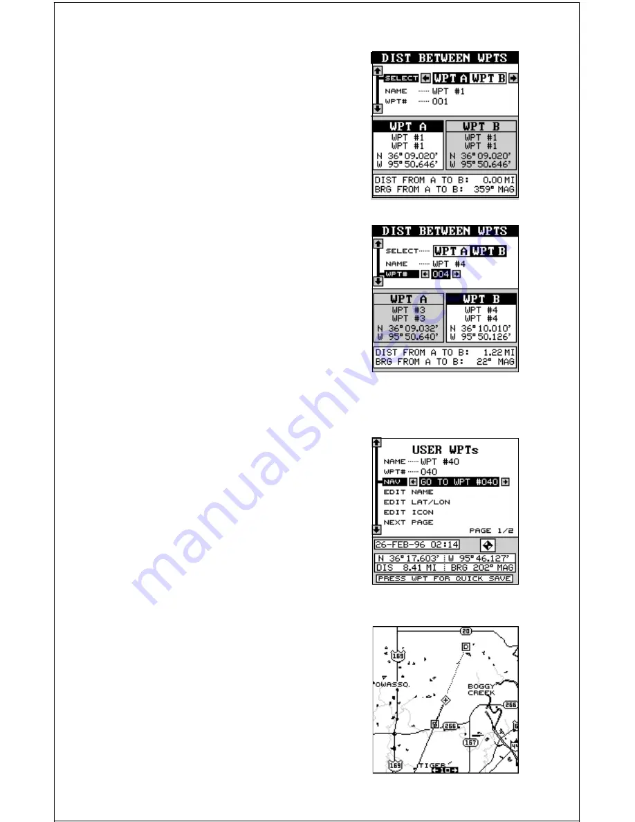
The black box is resting on the “Select WPT A”
label. Now press the down arrow key to move
the black box to either the name or waypoint
number labels. You can select a waypoint by
name or number. In this example, we used the
number method and we’re going to measure
the distance between waypoint numbers three
and four.
Once you have the first waypoint showing on
the screen, then you need to choose the other
waypoint that you’re going to measure. Move
the black box back to the “Select” label at the
top of the screen, then press the right arrow
key to select “B”. Now choose the waypoint that
you wish measure. The distance and bearing
from the first waypoint “A” to the second
waypoint “B” shows at the bottom of the screen.
You can select more waypoints to measure at
this time or press the EXIT key to erase this
screen.
Navigate To a Waypoint
Once you have waypoints stored in the
GlobalMap Sport’s™ memory, you’ll want to
recall and navigate to them. To do this, press
the WPT key, then move the black box to the
“NAME” or “WPT#” label. Now press the right
or left arrow keys to select the desired waypoint.
In this example, we’re navigating to waypoint
number 40. Once you’ve selected the waypoint,
move the black box to the “NAV” label and press
the right arrow key. This star ts the GlobalMap
Sport™’s navigation system. It will show navi-
gation data to the selected waypoint on all navi-
gation and mapping screens.
Navigating to a Waypoint using the Map
The unique “birds-eye” view used by the map-
ping screen gives you an easy way to navigate
to a waypoint. On the map screen shown be-
low, the diamond with a cross in it is your
present position. The box with the “S” in it was
your starting location when you recalled the


