www.javad.com
111
Coordinate Systems
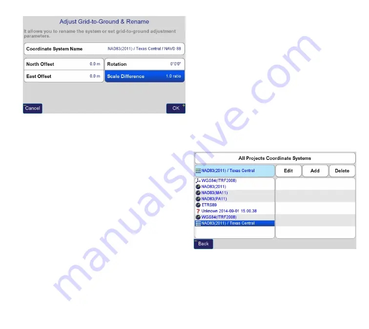
If desired, the name of the coordinate system can be
changed to something more abbreviated by selecting
Adjust Grid-to-Ground and Rename. Here it is possible
to type in a new name for the newly created coordinate
system.
This button can also be used to create a modified State
Plane system that applies a scale factor from 0,0 which
can be useful for creating a system that mimics State Plane
while also allowing for Grid inverses that are very near to
actual horizontal surface distances. To do this, select the
Scale Difference button and enter the ratio or ppm value
for the scale factor. A calculator screen appears that allows
for reciprocal calculation, Memory Recall (MR), a toggle
to change from ppm to ratio, and a Factors screen button
which can be used to calculate the combined factor (scale
factor x elevation factor) needed for the Grid-to-Ground
factor. Tips: if using an already existing modified system
provided by others, use the full precision of the provided
scale factor. However, if this system is newly created, use
six places beyond the decimal as this will provide plenty
of precision for Grid-to-Ground applications and allow
for a shorter number for metadata. When renaming the
system, use the scale factor in the name. This will keep this
system from being confused with an actual State Plane
system and allow the user to quickly recognize the scale
factor used in the modified system should another project
in a different area be compatible with that scale factor. A
simple method to accomplish this is to consider the ppm
value. For example, a scale factor of 1.000060 could also
be expressed as +60ppm. The name of a modified system
using a factor of 1.000060 could then be named NAD83/Tx
C60/NAVD88 to show that this modified system is
using a +60ppm scale factor.
Once satisfied with the coordinate system options, press
Done, which returns to the Coordinate System screen. At
any time, a Page (which can be thought of as a sub-project)
or the entire Project can be set to any Coordinate System in
the list. This doesn’t change the internal coordinates in the
database, only how they appear to the user.
Unknown Coordinate Systems
Unlike other survey software that places all points, regardless
of coordinate system on the same 2D Cartesian grid,
J-Field
converts coordinates to Latitude, Longitude and Ellipsoid
Height, which requires that entered or imported coordinates
Содержание TRIUMPH-LS
Страница 1: ...U S E R S G U I D E TO T H E T R I U M P H L S E Version 20160121 ...
Страница 17: ...www javad com 17 Introduction ...
Страница 39: ...www javad com 39 Collect Screens ...
Страница 59: ...www javad com 59 Stake Out Points ...
Страница 91: ...www javad com 91 Stake Out Alignments ...
Страница 93: ...www javad com 93 Using ShapeTags and Codes Data Structure ...
Страница 105: ...www javad com 105 Using ShapeTags and Codes ...
Страница 149: ...www javad com 149 Localization ...
Страница 165: ...www javad com 165 Appendix B NGS AntCal Appendix B NGS AntCal Data http www ngs noaa gov ANTCAL Antennas jsp manu Javad ...
Страница 166: ...www javad com 166 Appendix B NGS AntCal Appendix B NGS AntCal Data http www ngs noaa gov ANTCAL ...


