Geophysical Survey Systems, Inc.
SIR® 4000
Manual
MN72-433 Rev F
50
3
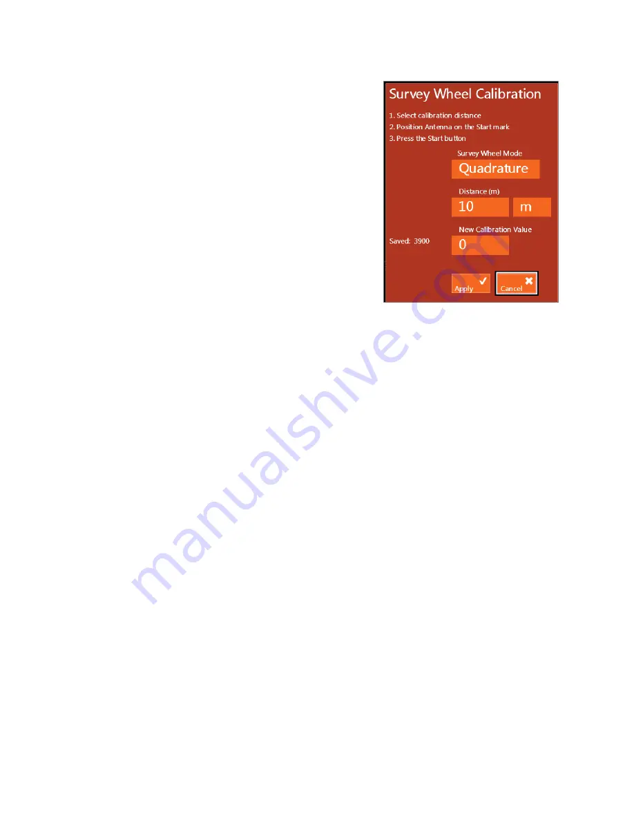
Survey Wheel Calibration:
If you’re switching between
different carts or moving from one type of terrain to another
you should recalibrate the survey wheel in order to
accurately track distance. To manually calibrate the antenna
you will need to lay out a measured line on your survey
surface.
a)
Select Survey Wheel Mode: Quadrature or Pulse.
b)
Select calibration distance – The default distance is
10 meters or feet. This distance can be changed, and a
longer distance provides a more accurate calibration.
c)
Position Antenna on the Start mark – The antenna or
system can be positioned anywhere at the start if you use
the same point on the antenna or system when you stop.
d)
Press the Start button – This is the green Start button
located on the keypad of the SIR 4000.
e)
Move antenna to the stop mark – This should match the same location on the antenna or system
where you started.
f)
Press Stop button – This is the red Stop button located on the keypad of the SIR 4000.
If necessary, you can manually enter the calibration value:
1
Use either the Control Knob or Arrow keys to navigate to the New Calibration Value box.
2
Press the Control Knob of the Enter key to highlight the New Calibration Value box.
3
Rotate the Control Knob or use the up and down arrows to enter in the correct value.
4
Click the right arrow to save and exit.
Once the desired survey wheel calibration is achieved select Apply. The current value will be saved and
the Calibrate SW menu will close. Press the Quit Toolbar key to return to the main Introduction Screen.
Step 3 – Data Collection
1
To begin data collection press the green Start button once.
2
At the end of your profile, press the red Stop button once or press and hold the green Start button.
This halts the collection of the current data file; you won’t be able to scroll across the profile or
perform any of the functions on the command bar.
•
If AutoSave is set to On the file will automatically be saved. A new file will immediately begin
using the same collection parameters as the previous file.
•
If AutoSave is set to Off a system prompt will pop up giving you the option to save or discard the
file. Choose to save or discard using the Control knob or the Directional Keys.
3
To continue data collection after choosing to save or discard a file, position yourself at the beginning
of your next profile. Then press the green Start button one time to begin the next data file. The
previous data will be cleared and a new file opened. New files will be collected with the same
collection parameters as the previous file.
Содержание SIR 4000
Страница 1: ......
Страница 4: ......
Страница 116: ...Geophysical Survey Systems Inc SIR 4000 Manual MN72 433 Rev F 110 ...
Страница 140: ...Geophysical Survey Systems Inc SIR 4000 Manual MN72 433 Rev F 134 ...
Страница 150: ...Geophysical Survey Systems Inc SIR 4000 Manual MN72 433 Rev F 144 ...
Страница 156: ...Geophysical Survey Systems Inc SIR 4000 Manual MN72 433 Rev F 150 ...


