Going to a Destination (con’t.)
A
data field
at the top of the page will now display the bearing and distance to
the second route waypoint. To get started, let’s enter a speed for our vessel, which
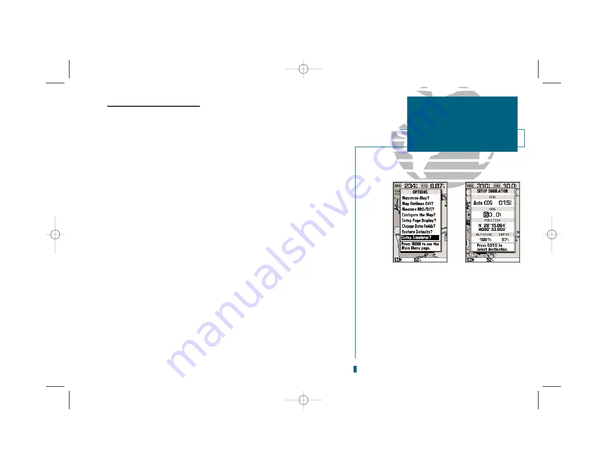
we can do from the ‘Setup Simulator?’ listing on the map options menu. The
setup simulator page
is available from any page in the main page sequence.
To enter a boat speed:
1. Press the
O
key to display the map options menu.
2. Use the
R
keypad to select the ‘Setup Simulator?’ option and press
T
.
3. Once the setup simulator page appears, press
T
to access the SOG field.
4. Use the
R
keypad to enter a speed of 60 knots.
5. Press
T
to finish, and
J
to return to the map display.
Once a speed has been entered, you’ll notice that the map will begin to move
slowly, keeping your boat centered on the display. To get a better view of what’s
going on, zoom in to a closer map scale.
1. Press the
H
key to select the 16 nm scale.
You’ll now have a clearer picture of the route we are navigating, along with an
outline-only presentation of the surrounding shoreline. Because the usable range
of the built-in database is only valid to 64 nm scale (32nm in the U.S.), we no
longer have full cartography available.
Keep in mind that whenever you do exceed the usable range of the built-in
database or the G-chart cartridge in use, the range field will display ‘OVR ZM’ or
‘NO MAP’ to indicate that you should exercise extreme caution using the cartogra-
phy data. See pages 42 and 85 for more information on map scales and using G-
chart detailed cartography.
13
GETTING STARTED
Simulator Setup
A
B
A.
To enter a boat speed or define the simulated
course, highlight the ‘Setup Simulator?’ option
and press EDIT/ENTER.
B.
Enter a boat speed of 60 knots to begin the tour.
Sixty knots will allow you to complete the Getting
Started tour in approximately 10-15 minutes.
19000138.10A.QXD 11/11/99 8:47 AM Page 13


