background image

Chapter 4: Integrated Radar Operations

4-3

Tr

ue

 a

nd

 R

el

at

iv

Mo

ti

on

The reference used for the Course Up depends on the information available. 
The first available in the following list is used:

1. A locked heading (i.e. the heading being used by an autopilot) over a 

SeaTalk connection

2. The heading at the time Course Up was selected

If 1. is in use and a new course (locked heading) is selected, the picture 
automatically rotates to the new Course Up.
If 2. is in use, press the 

HDG MODE

 soft key then 

COURSE UP

 to manually reset 

the Course Up to the new course.

Selecting the Heading and Motion Mode

Press the 

HDG MODE

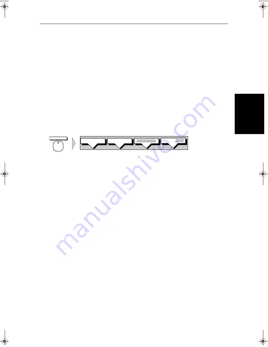
 default soft key to obtain the following display, when 

heading information is available:


The currently selected mode is highlighted, and is indicated in the radar status 
bar (N-UP, C-UP or H-UP and TM or RM). 

To change the heading and motion mode:

1. Press the 

HDG MODE

 default soft key.

2. Press the soft key corresponding to the mode you require. The radar picture 

changes to the selected mode.

3. Press 

ENTER 

to clear the heading mode soft keys. The current orientation 

is indicated in the status bar.

Note: 

True Motion is only available in Course Up and North up mode.

If you re-select Course Up when this is already the current mode, the Course 
Up reference is reassessed according to the current data.

Effect on VRM/EBLs

VRM/EBLs do not move on the screen, unless you change the range, offset the 
centre, or change the heading mode.

In Head Up mode, the VRM/EBLs are fixed with respect to the ship’s 
heading marker.

In North Up mode, the VRM/EBLs are fixed with respect to North.

In Course Up mode, the VRM/EBLs are fixed with respect to the selected 
course.

HDG MODE


COURSE UP

NORTH UP

D3641-3

HEAD UP

TRUE REL

81186_2.book  Page 3  Monday, December 17, 2001  8:35 AM

Summary of Contents for Pathfinder Radar

Page 1: ...Distributed by Any reference to Raytheon or RTN in this manual should be interpreted as Raymarine The names Raytheon and RTN are owned by the Raytheon Company ...

Page 2: ...Distributed by Any reference to Raytheon or RTN in this manual should be interpreted as Raymarine The names Raytheon and RTN are owned by the Raytheon Company ...

Page 3: ...hsb2 PLUS Series LCD Display Owner s Handbook Document number 81186_2 Date 14th December 2001 ...

Page 4: ......

Page 5: ...nergy It is important that the radar is turned off whenever personnel are required to come close to the scanner to perform work on the scanner assembly or associated equipment It isrecommended that the radar scanner is mounted out of range of personnel above head height Avoidlookingdirectlyattheantennaasyoureyesarethemostsensitivepartof the body to electromagnetic energy Whenproperlyinstalledand o...

Page 6: ...the best of our knowledge was correct as it went to press However our policy of continuous improvement and updating may change product specifications withoutpriornotice Asaresult unavoidabledifferencesbetween theproduct and handbook may occur from time to time for which liability cannot be accepted by Raymarine Raymarine is a registered trademark of Raymarine Limited SeaTalk is a registered tradem...

Page 7: ...nical Services representatives or your local dealer will be available to answer any questions you may have Warranty To register your hsb2 series display unit ownership please take a few minutes to fill out thewarrantyregistrationcard found at theend of this handbook It is veryimportantthatyoucompletetheownerinformationandreturnthecardto the factory in order to receive full warranty benefits EMC Co...

Page 8: ...ons 1 12 1 3 The Chartplotter Display 1 13 Chartplotter Display Options 1 14 Chartplotter Functions 1 15 1 4 Operating Controls 1 16 Trackpad and Cursor 1 16 Dedicated Keys 1 18 Soft Keys 1 18 Pop Up Menus 1 19 Database Lists 1 20 Chapter 2 Getting Started Adjusting the Display 2 1 2 1 Introduction 2 1 Conventions Used 2 1 Simulator 2 1 2 2 Switching the Display On and Off 2 2 Simulator Mode 2 5 C...

Page 9: ...2 Range Control 3 2 Changing the Range 3 2 Determining Actual Radar Range 3 3 3 3 Interpreting and Adjusting the Radar Picture 3 4 Identifying False Echo Returns 3 5 Adjusting Gain Sea Clutter Rain Clutter and Tune 3 7 Changing the Targets Display 3 11 3 4 Measuring Range and Bearing Using VRM EBLs 3 13 Measuring Range and Bearing to Target from Vessel 3 14 Measuring Range and Bearing Between Targ...

Page 10: ...ormation 5 4 5 3 Working with Waypoints 5 8 Introduction 5 8 Placing a Waypoint 5 9 Selecting a Waypoint 5 12 Waypoint Data Display 5 12 Editing the Waypoint Details 5 13 Erasing a Waypoint 5 14 Moving a Waypoint 5 14 Using the ST60 or ST80 Navigator Keypad 5 15 5 4 Working with Routes 5 18 Creating a New Route 5 19 Saving the Current Route 5 22 Clearing the Current Route 5 23 Retrieve a Route Fro...

Page 11: ... 1 6 2 Measuring Distances Using the VRM EBL Key 6 2 6 3 Alarms and Timers 6 4 Alarm Reporting 6 4 Setting Alarms and Timers 6 5 6 4 Man Overboard MOB 6 6 6 5 Cursor Echo 6 7 6 6 GPS Setup 6 8 6 7 Data Log Mode 6 10 Chapter 7 Setting Up the System Defaults 7 1 7 1 Introduction 7 1 7 2 Changing the Set Up Parameters 7 2 7 3 System Set Up Parameters 7 4 Data Boxes 7 6 Bearing Mode 7 6 Cursor Referen...

Page 12: ... Options 7 12 Custom Scale 7 12 Bearing Alignment 7 13 Antenna Size 7 13 Send on HSB 7 13 7 5 MARPA Set Up Parameters 7 14 7 6 Advanced Settings 7 15 Display Timing 7 15 STC Preset 7 16 Tune Preset 7 16 7 7 Chart Set Up Parameters 7 17 Customize Chart 7 17 Plotter Mode 7 18 Chart Orientation 7 18 Object Information 7 19 Waypoint Options 7 19 Vectors 7 19 Radar Chart Synch 7 19 Datum Selection 7 19...

Page 13: ...ments 8 16 EMC Conformance 8 20 8 8 Integrated Systems 8 20 hsb2 High Speed Bus Multiple Display Systems 8 20 SeaTalk and NMEA In 8 23 Using the SeaTalk Auxiliary Junction Box 8 28 Data Output 8 29 Data Conversion 8 30 8 9 Integrated System Checks 8 31 Chart Display RL70 PLUS RL70RC PLUS RC520 PLUS 8 31 Received Data 8 31 Transmitted Data 8 31 Chapter 9 Maintenance and Problem Solving 9 1 9 1 Main...

Page 14: ...unction Box B 1 Raystar 112 105 Apelco 182 and 182XT B 2 Raystar 120 WAAS Satellite Differential Receiver B 6 Appendix C C MAP Chart Card Features C 1 Appendix D SeaTalk and NMEA Data Received and Transmitted D 1 Appendix E Connecting a Raymarine Heading Sensor E 1 G Series Course Computer E 1 Appendix F Abbreviations F 1 Index xiv ...

Page 15: ...er 5 and Chapter 6 To change the system set up defaults read Chapter 7 DetailsforinstallingaradarscannerareprovidedintheRadarScannerUser s Handbook supplied with your scanner Note Many illustrations in this handbook show example screens The screen you see on your display depends on your system configuration and set up op tions so it may differ from the illustration This handbook is organized as fo...

Page 16: ... the display unit s It should be referred to when you are ready to install the system Details to connect the display to other equipment are also provided To install a complete radar system you will also need to read the Owner s Handbook supplied with the scanner Chapter 9 provides information on user maintenance and what to do if you experience problems The Appendices provide additional informatio...

Page 17: ...ty Radar Display Unit providingRadar Master Fishfinder Repeater and Chart Repeater functionality Chart Display Unit providing Chart Master Fishfinder Repeater and Radar Repeater functionality Combined DisplayUnit providing both Radar and Chart Master or Fishfinder and Chart Master functionality Integrated System Additional instruments are connected via hsb2 Seatalk or NMEA interfaces hsb2 High Spe...

Page 18: ...se front end receiver and a variety of clutter attenuation controls to maintain target resolution Installation of the scanner is described separately in the Scanner Owner s Handbook The scanner is adjusted and operated from the display unit so these details are provided in this Handbook Thescannercanbeswitchedbetweentransmitandstand bymodes Italsohas a power saving timed transmit mode which pauses...

Page 19: ...hartplotter Displays chart information from the C MAP NT chart cards C Cards Uses position data from GPS DGPS WAAS or Loran C technology Displays and transfers SeaTalk NMEA and hsb2 data Provides full control of data from other hsb2 instruments Several full screen operating modes including Radar Chart Data Log or Sonar if appropriate data is available View radar and chart simultaneously in half sc...

Page 20: ... Options described in Chapter 2 allow you to switch the cursor and data boxes On Off The cursor box and user selected data boxes can be moved around the screen Operating Modes On a single hsb2 unit you can view a full screen radar or chart You can also set Windows On to split the display into two half screen windows to show supplementary data or on a combined display unit display radar and chart s...

Page 21: ...750W 50 18 550N 001 18 650W 6 86KM 7 23KM 7 23KM 6 67KM 5 74KM 5 00KM 4 63KM 5 00KM 5 74KM HSB SeaTalk D4285 1 Operating Mode for Stand Alone Units Additional Modes for Linked Units or combined Radar Chartplotter DISPLAY DISPLAY TIME POSITION CMG DMG CLEAR LOG STOP LOG 15 30 16 00 16 30 17 00 17 30 18 00 18 30 19 00 19 30 346 H 180 H 012 H 206 H 043 H 245 H 093 H 302 H 145 H 50 21 890N 001 20 610W...

Page 22: ...ter 2 Multi display systems If you have several hsb2 series Radar and Chartplotter displays connected operation is similar to acombined Pathfinder Radar Chartplotter Unit three full screen modes radar chart and data log are available on all displays In addition if you have an hsb2 series Fishfinder display connected you can setanydisplaytofishfindermode ifthesystemincludesachartplotter similar fun...

Page 23: ... MARPA Agyrocompassprovidesthebestperformanceinallconditions Alternatively you could use a fluxgate compass with rate gyro stabilization MARPA requires heading data to be frequently updated we recommend a dataoutput rateofgreaterthan8Hz headingdatamustthereforebeprovided on NMEA In multiple display systems heading must be connected via NMEA to each display that will be used for MARPA We recommend ...

Page 24: ... information The Status Bar is also illustrated The radar display can show additional information depending on your currently selected options set up selections and the data available from other equipment The example displays on the following pages show some of these features Functions are available to control the display as follows Zoom the Display Offset your vessel from the centre of the radar ...

Page 25: ... the current cursor position as either Range Bearing or Lat Long You can move this box to your preferred position on the screen or turn it off Default Display 126 T AUTO T IR 3nm RR 1 2 H UP RM RV3 MARPA D3993 3 Status Bar Selected range in nautical miles Range ring interval Not displayed if range rings are off Range rings displayed if rings are on Current heading if data available or Course Over ...

Page 26: ... Add marks to record important or dangerous locations Man Overboard MOB to navigate back to a person or object 10 Target MARPA Operation of these radar functions is described in Chapter 3 and Chapter 4 G S T AUTO IR RC FTC FTC EX 126 T 13 48 06 5 7kts 14 4m 6 3kts 3nm RR BRG RNG R nm CURSOR COG SOG TIME SPEED DEPTH WPT 1 2 50 49 13N 203 T 1 20nm 01h 30m 001 12 09W H UP POSITION 063 1 65 120 T Wayp...

Page 27: ...the vessel is shown as a circle The chartplotter screen includes a status bar that displays chart scale with either cursor position range and bearing or when the cursor is homed to the vessel by pressing FIND SHIP vessel position Speed Over Ground SOG Course Over Ground COG and fix type VES POS DIF FIX or SD FIX Any waypoints you have placed are displayed unless you turned them off in Chart Set Up...

Page 28: ...donagain theScreenPresentationset tings are retained in memory Figure 1 3 Typical Chartplotter Display Custom Chart Details The chartplotter set up options include a sub menu to customize the cartographic features This menu allows you to switch features On Off or control them using the CUSTOM soft key The factory default settings for the Custom chart options are as follows Status Bar Vessel Positi...

Page 29: ...LUS series Chartplotter includes the following functions Display C MAP NT C Card chart information including Ports and Tides if available View chart information if available for the Nearest Port Place Move Erase and Edit a Waypoint Goto Waypoint or Cursor Create Save Name Edit and Follow a Route Review Route and Waypoint Lists Display vessel s track Save and Name the Track for re call to screen Sm...

Page 30: ...ems Note Thecursoristhecross hairsymbol visibleonthedisplay Youmove thecursorusingthetrackpadanduseittoselectapositionoritemonthechart ThecontrolkeysareshowninFigure 1 4 Theyareback litfornight timeuse When you use a control a help message is displayed at the top of the screen unless you switch help off as described in Chapter 7 The following paragraphs describe the controls and on screen faciliti...

Page 31: ...ckthedefaultsoft keys are displayed unless they have been switched OFF in system set up If not press ENTER until they are displayed The cursor is normally displayed as a crosshair However if you have not movedthecursorformorethanfiveseconds whenyounextmoveitthecursor is outlined by a circle so it is easier to locate on the screen Context Sensitive Cursor Control The cursor is context sensitive Whe...

Page 32: ...following happens i The associated operation is actioned e g change chart scale RANGE ii A pop up menu is displayed providing further options iii A set of soft keys is displayed providing further functions As you press a key a single audio beep confirms the key action If the key press is not valid for the current screen or mode three rapid beeps sound to indicate that no response is available If r...

Page 33: ...ingle audio beep confirms the key action If the key press is not valid for the current screen or mode three rapid beeps sound to indicate that no response is available If required you can turn the key beeps off as part of your set up procedure see Chapter 7 Pop Up Menus Pop up menus usually provide set up options When a pop up menu is on screen a set of associated soft keys is also displayed as sh...

Page 34: ...menus when a database list is on screen a set of associated soft keys is also displayed you use the trackpad to select an item from the list then use the appropriate soft key to edit the item For example you canerase a waypoint or a route GOTO WAYPOINT EDIT WAYPOINT MAKE NEW WAYPOINT WAYPOINT TRANSFER D4262 1 WAYPOINT LIST SYMBOL NAME WAYPOINT 001 WAYPOINT 002 WAYPOINT 003 WAYPOINT 004 WAYPOINT 00...

Page 35: ... may consist of a single key press or a sequence of numbered steps are indicated by a symbol in the margin Whentheprocedurerequiresyoutopressasoftkey thesoftkeyiconisshown in the margin Simulator The display unit includes a simulator function that allows you to practice operating your radar or Chartplotter without data from the scanner or GPS system You will need to use the set up options to switc...

Page 36: ... the scanner operating as follows Standby mode You should use this mode when you are not operating the radar for short time periods The scanner does not transmit and the antenna does not rotate so the radar uses less power However the scanner remains poweredsowhenyoureturntotransmitmode themagnetrondoesnotneedto warm up Scanner off mode You should use this mode when you do not require the radar bu...

Page 37: ...witchonandadjustthedisplaybacklightingandcontrast ifrequired as described later in this chapter To switch to Stand by mode press the POWER key The display returns to the Stand by screen and the scanner transmission and rotation stops To use Scanner off mode 1 Ensure that the radar is in Standby mode warming up or if the unit is a Repeater displaying a message that radar data is not available 2 Pre...

Page 38: ...aychart should be used only as a backup to official government charts and traditional methods of navigation Whenyouhavereadandunderstoodthecaution presstheCONTINUEsoft key The chart is displayed If this is the first time the chartplotter has been turned on and no chart card is installed the display shows the small scale world map and the default soft keys Otherwise the display shows the selected c...

Page 39: ...em Set Up Menu and switch off simulator mode when you have finished To view a simulated image 1 Press MENU followed by the SYSTEM SET UP soft key The set up menu pop up is displayed 2 UsethetrackpadtomovetheselectionbarovertheoptionSIMULATOR The simulator soft keys are displayed 3 In the system set up menu press RADAR to view a simulated radar image DATA to view the chart display with simulated po...

Page 40: ...HT soft key 3 The LIGHT soft key toggles lighting ON OFF 4 Usethe trackpad up or down toincrease or decreasethesetting selecting one of the eight lighting levels You can press and hold the trackpad to change the setting more rapidly The lighting level is adjusted as you change the setting 5 Press the appropriate soft key or the right arrow on the trackpad to select the CONTRAST control Adjust the ...

Page 41: ...e labels The remainder of this section describes how to select the mode of operation and switch half screen windows on off The following sections describe how to set up the display for the Radar and for the Chart The controls are summarized in the fold out illustration on pages 2 11 and 2 12 Selecting the Mode of Operation YouusetheDISPLAYkeytoselectthefull screenmode Ifthedataisavailable on your ...

Page 42: ...shown press ENTER or CLEAR The default soft keys are displayed The selected mode is shown full screen in Radar and Chart mode you can switch on half screen windows for additional display as described in the following section If youpressDISPLAY again thepop upandsoft keysfor thecurrentmodeare shown Selecting a Half Screen Window for Display Note Windows can only be used with Radar or Chart screens ...

Page 43: ...n the radar and the chart window If a window is active i e control of the cursor via the trackpad is available in thatwindow andyouswitchwindowsoff controlautomaticallyreturnstothe full screen upper window mode Radar Chart To change the active window press the RDR CHRT soft key to toggle control between the radar and chart display The current active display is highlighted in red on the RDR CHRT la...

Page 44: ...ure 2 6 Radar Half Screen Window Options CDI Window SELECT WINDOW WINDOWS OFF ON ZOOM OFF ON SELECT WINDOW WINDOWS OFF ON ZOOM OFF ON BDI Window Navdata Window Chart Window D4150 1 SELECT WINDOW WINDOWS OFF ON ZOOM OFF ON SELECT WINDOW WINDOWS OFF ON ZOOM OFF ON RDR CHRT ...

Page 45: ...k Press ENTER to finish Press and hold for 2 seconds to activate or cancel MOB VRM EBL Used to measure range and bearing to between targets Press to place VRM EBL if one not already placed Adjust position using trackpad and press ENTER to finish Press to display soft keys if VRM EBL already placed D5664_1 GAIN Controls the presentation of radar targets GAIN controls for background noise speckle SE...

Page 46: ... soft keys display Press again to toggle through display modes then ENTER Press and hold for 2 seconds for full screen display Press soft key to place waypoint at cursor or vessel or display the waypoint list user card menu and asscociated soft keys Press ENTER to finish MARKS MOB Controls waypoints and Man Overboard function Press to display waypoint soft keys Press and hold for 2 seconds to acti...

Page 47: ...r Chart Grid On and Off The radar range rings can be turned on or off They are normally left on but youmaywishtoturnthemoffifyouareusingVRM EBLsorguardzones see Section 3 4 and Section 3 5 to make the display clearer The Chartplotter display includes grid lines of latitude and longitude which you can use to help determine position on the chart The grid lines can be switched on if required If you a...

Page 48: ...teen data boxes that can be displayed in the half screen window To switch the group of data boxes on or off 1 Press the SCREEN default soft key 2 Press the DATABOXES soft key to toggle the setting from ON to OFF or from OFF to ON To return to the default soft key display press ENTER If you turn the data boxes on and none are displayed you need to select the ones you require using the system set up...

Page 49: ...tive Waypoint on a Radar Display Custom Options Chart mode When chart details have been customized in the Chart Set Up menu as describedinSection 7 7 theSCREENsoftkeycanbeusedtoswitchthecustom chart options off or on When set to ON all chart options set to CUSTOM in the Customize Chart menu are displayed when set to OFF options set to CUSTOM are not shown The factory default for custom chart optio...

Page 50: ...at will be covered by the Zoom Window you should offset the centre see the next sec tion to move the area to another part of the screen before selecting Zoom mode Note YoucannotuseZoomandWindowsatthesametime if youturnoneon the other is turned off automatically and restored when the first is turned off again To enlarge an area 1 Press the DISPLAY key The soft key labels are updated 2 Press the ZOO...

Page 51: ...OOM soft key to set the function OFF Alternatively you can press and hold DISPLAY for 2 seconds This also removes any grouped data boxes Offsetting the Center The radar picture is normally shown with your vessel at the center of the display However you can move the center so that your vessel is offset by up to 66 of the radius anywhere on the screen Note You cannot offset the center when the radar...

Page 52: ...are displayed to the edgeoftheradarpicture atthestandardringintervalforthecurrentrange If you have selected the longest range scale you cannot offset the center Hiding the Ship s Heading Marker SHM Theradarpictureincludestheship sheadingmarker whichisalinefromyour vessel s position to the edge of the picture at the vessel s current heading In the standard Head Up mode the heading marker is always ...

Page 53: ...lly re center the vessel using the FIND SHIP soft key Changethechartscaletozoomoutandintoanew areacenteredonthecur sor position This method is useful if the area you wish to see is a long dis tance away Changing the Chart Center You can move the area of the chart displayed on the screen using the context sensitive cursor This allows you to center your vessel in the middle of the screen or to move ...

Page 54: ...e drawn with the vessel s position in the center The cursor is homed onto the vessel position and moves with it When the vessel moves near the edge of the chart window the chart is redrawn to place the vessel and cursor at the center again The status bar indicates vessel position speed and course over ground To release the cursor from homed mode press the trackpad to move the cursor away from the ...

Page 55: ...when nochartdataisavailableforthatscale Section 7 7describeshowtosetplotter mode on off You can change the chart scale for two purposes To see either more detail of a smaller area or a larger area in less detail on the screen To move the display to another area of the chart by zooming out to a small scale chart then zooming in on another position centered on the cursor The cartographic detail avai...

Page 56: ...he screen with a larger scale chart showing more detail The cursor is now positioned in the center of the screen The distance indicated at the top left of the screen is updated 3 If further chart enlargement is available using the current chart card you can press the bottom of the RANGE key to zoom in again re positioning the cursor first if required An area of further chart detail is indicated by...

Page 57: ...enarios Thefollowingillustrationsprovideoperatingguidelinesfortypicalnavigation scenarios Thesescenarioscanbeusedasatrainingguide theyshowyouhow to perform a particular operation and they introduce many of the chartplotter functions Eachscenarioindicatesthekeypressesrequiredtoperformparticular tasks A typical chartplotter screen image is shown for each task The scenarios assume you have read the p...

Page 58: ...US Series LCD Display Place and Goto a Waypoint Place and Goto a Waypoint 1 Press MARKS 2 Position Cursor as required Press the soft key 1 2 3 Press the soft key to go to the waypoint selected by the cursor D4267 1 ...

Page 59: ...er 2 Getting Started Adjusting the Display 2 25 Place and Goto a Waypoint 4 The vessel navigates towards the target waypoint See 5 3 Working wth Waypoints Go to an individual Target Point page 5 26 D4267 2a ...

Page 60: ...CREEN ROUTE FIND SHIP MAKE ROUTE EDIT ROUTE CLEAR ROUTE MORE 2 2 Press the soft key 1 3 4 Press the soft key D4268 1 Press the soft key 1 Position Cursor in this example over an existing waypoint Position Cursor for next waypoint then press soft key Repeat to plot all waypoints in sequence ...

Page 61: ...START XTE WAYPOINT ADVANCE STOP FOLLOW GOTO SCREEN ROUTE FIND SHIP 7 5 6 8 Press the soft key D4268 2a Press the soft key Press the soft key The route becomes the current route The vessel starts to navigate to the first target waypoint in the route See 5 4 Working wth routes Follow a route page 5 24 Other Follow Options page 5 25 ...

Page 62: ...SHIP MAKE ROUTE EDIT ROUTE CLEAR ROUTE MORE 2 3 2 Press the soft key 1 4 5 Press the soft key Press the soft key D4269 1 Press the soft key 1 Use the trackpad to move selection bar over required route Time defaults to ETA and assumes the current time is the start time REVERSE ROUTE SAVE ROUTE ROUTE LIST MORE ...

Page 63: ...ur Passage Plan 6 Change the TIME to HOURS the display indicates it will take 32 minutes to reach the destination You can change the PLANNED SOG the display updates to indicate TIME required at the planned speed See Displaying Route Information page 5 18 D4269 2a ...

Page 64: ... Chart 1 2 D4293 1 2 Press the soft keys to set windows ON The Chart window is the default selection 3 Press ENTER 1 Press DISPLAY then press twice more to select RADAR GOTO MORE ROUTE RDR CHRT Press the soft key You can control the chart cursor SYSTEM SET UP CHART SET UP TRACK SET UP GPS SETUP 3 2 Press the soft key 1 Press MENU ...

Page 65: ...ar and chart windows are synchronised and the cursor is homed on the vessel D4293 1a Press the soft key See 2 3 Controlling the Display 6 5 Cursor Echo 7 3 System Parameters 7 6 Chart Set Up 4 2 Press the soft key 3 Press ENTER twice 1 Move selection bar over Radar Chart Synch Move the chart cursor you can see chart cursor move on the radar screen You can move the cursor over a radar target to det...

Page 66: ...2 32 hsb2 PLUS Series LCD Display Displaying the Radar and Synchronizing Radar Chart ...

Page 67: ...in sea clutter and rain clutter changing the targets display and tuning the radar Measuring range distances and bearings using Variable Range Markers VRMs and Electronic Bearing Lines EBLs Setting up guard zones and handling alarms Using MARPA for target tracking and risk analysis Note Until you are familiar with interpreting the radar display you should take every opportunity to compare the radar...

Page 68: ...n the radar picture Their number and spacing are adjusted automatically if you change the range scale They can be turned off see Switching Radar Range Rings or Chart Grid On and Off on page 2 13 Changing the Range Figure 3 1 Changing the Radar Range Each time you press the RANGE key the range changes to the next available setting The system will beep three times if no further range scale is availa...

Page 69: ...ine of sight and is limited by the height of the scanner and the height of the target as shown in Figure 3 1 Table 3 2 lists some range examples Figure 3 2 Determining Radar Range Table 3 1 Radar Range Scales Maximum Range nm Number of Range Rings Range Ring Interval nm 0 125 0 25 0 5 0 75 2 2 4 3 0 0625 0 125 0 125 0 25 1 5 3 6 6 0 25 0 5 6 12 24 48 72 6 6 6 6 6 1 2 4 8 12 Table 3 2 Radar Range A...

Page 70: ...as a distant large object on the radar However with experience the approximate size of different objects can be determined by the relative size and brightness of the echoes Some targets such as buoys and small boats can be difficult to differentiate since they bob and toss about in the waves and do not present a consistent reflecting surface Consequently these echoes have a tendency to fade and br...

Page 71: ... narrow beam This produces side lobe patterns shown in Figure 3 3 Side lobes have no effect on distant or small surface objects However the echo from a large object at short range may produce an arc on the radar screen similar to a range ring or a series of echoes forming a broken arc Side lobe echoes normally occur at ranges below 3nm and can be reduced by adjusting the SEA control Figure 3 3 Sid...

Page 72: ...beyond the true target s echo on the same bearing as shown in Figure 3 5 This is not very common Figure 3 5 Multiple Echoes Blind Sectors or Shadow Effect Funnels and masts located near the antenna may cause shadows In shadow areas beyond the obstruction there will be a reduction of the beam intensity although not necessarily a complete cut off However there will be a blind sector if the subtended...

Page 73: ...and values remain set even when you turn the radar off and on again Rain and FTC are reset to Off at power on The status bar indicates which controls are switched to Auto or On as shown in Figure 3 6 Figure 3 6 Radar Status Bar To adjust a parameter 1 Select a range appropriate to the adjustment you wish to make The opti mum Tune setting varies slightly for different ranges depending on the pulse ...

Page 74: ...efault Auto Offshore or Manual mode In Auto Offshore mode thePathfinderPlusRadaroptimizesitssettingstoaccountfortheeffectsofsea clutter In harbours or close proximity to land different auto settings may be necessary to cater for the effects of land clutter To avoid losing small targets it is therefore advisable to set the Sea control to Auto Harbour mode Alternatively set both Sea and Gain to Manu...

Page 75: ...from your vessel remain unchanged Youcan use the gain and Seacontrol to helpminimize the effects of side lobes see Identifying False Echo Returns on page 3 5 Note On short range scales do not set the Sea control so high that all clutter is removed since this could stop you seeing echoes from close targets Tuning the Receiver The TUNE control is used to fine tune the receiver in the scanner for max...

Page 76: ... 8 Rain Clutter When the FTC control is turned up only the leading edge of large rain clutter echoes is displayed while the effect on smaller ship echoes is only slight This means that you can also use the control on shorter ranges to distinguish between two very close echoes on the same bearing which may otherwise merge and appear as one echo When the FTC control is turned up the receiver is less...

Page 77: ...gh lighted 2 Press the appropriate soft key to toggle the required setting between OFF and ON Note If an option is not available for the current setting its soft key label is grey When you press the key the system beeps and the setting remains OFF For the Wakes mode press the WAKES soft key to step the highlighted selection through the wake options You can use the soft keys to change the settings ...

Page 78: ...nge at which target expansion is available Target expansion overridesthenormalpulselength therebyincreasingthesizeofthetargetseen on the screen However this is at the expense of range resolution Target Wakes You can see the direction and speed with which targets are moving relative to your vessel by selecting the target wakes display option When wakes are switched on the target is displayed at the...

Page 79: ...nge you have marked is maintained VRM EBLs also move if you offset the centre When a VRM EBL pair is active its bearing and range are displayed in its associated data box which can be moved deleted or reinstated The bearing information is displayed as either the bearing relative to your vessel s heading or if heading data is available from a position fixer or compass the actual bearing in degrees ...

Page 80: ...r which you require the bearing or range When you turn on a VRM EBL it is displayed in its last used position Note If the VRM s last used position is outside the radar picture at the cur rent range setting it is placed at its default position instead This is one third of the range for VRM1 and two thirds for VRM2 Placing a VRM EBL Placing and positioning VRM EBLs on the Pathfinder Plus Radar displ...

Page 81: ...M EBL to display the VRM EBL soft keys The labels for the two left hand soft keys indicate the current status of the two VRM EBLs 2 Pressthesoft keyfortheVRM EBL you require to togglethesettingfrom OFF to ON The soft key labels are cleared and the radar pictureshows the VRM EBL and its associated data box 3 Position the EBL VRM using the trackpad and press ENTER to drop it The radar shows the VRM ...

Page 82: ...erequiredVRM EBLsoftkeytotogglethesettingfromON to OFF Alternatively you can delete an existing VRM EBL using the context sensitive cursor To do so 1 Move the cursor over the VRM EBL you wish to control until the letters VRM EBL or VRM EBL are displayed 2 Press CLEAR This has the same effect as turning the VRM EBL off using the VRM EBL soft keys It turns off the VRM EBL pair irrespective of the cu...

Page 83: ... to move the origin of the VRM EBL to the required posi tion over the first target 6 PressENTER todrop theVRM EBLinits new position orCLEAR to aban don the operation and return the VRM EBL to its previous position The radar shows the VRM EBL as a short dashed line VRM EBL1 or a long dashed line VRM EBL2 and the cursor returns to normal control 7 Usethecontext sensitivecursortotakecontroloftheVRMan...

Page 84: ...ta box using the context sensitive cursor 1 Move the cursor over the box until the letters BOX are displayed and press ENTER to take cursor control of the box 2 Use the trackpad to move the box to its new location and press ENTER to drop it and return to normal cursor operation Each VRM EBL data box is switched on and off with its associated VRM EBL However whenoneorbothVRM EBLsareactive youcantur...

Page 85: ...ned The guard alarm sounds when a target enters a guard zone exceeding the target density threshold within the zone the alarm also sounds on a repeater display The alarm sensitivity control allows you to set the threshold above which a new target will trigger an alarm and also to turn the alarm on or off Note A guard zone only operates when the whole zone is displayed on the screen or could be dis...

Page 86: ...place a guard zone 1 Press ALARMS The soft keys are displayed u The soft keys indicate the current status of the two guard zones 2 If necessary press the soft keyfor theguard zone yourequire totogglethe setting between OFF and ON The soft keys are cleared If you turned a guardzoneon itisdisplayedinitslast usedpositionwithonecornerunder cursor control The radar picture shows the guard zone as a fou...

Page 87: ...ape or delete an existing guard zone using the context sensitive cursor To do so 1 Movethecursorovertheguardzonecornerorsidethatyouwishtocontrol until the letters GRD are displayed 2 If you wish to delete the whole zone press CLEAR 3 Alternatively if you wish to move the corner or side press ENTER to take control of it The zone boundary is displayed as a solid line and the cursor as a four headed ...

Page 88: ...djust the guard zone size shape to reduce thenumber of targets in the zone You turn the alarm off You decrease the alarm sensitivity The target leaves the guard zone To change the alarm sensitivity setting 1 Press MULTI to display the sliders 2 Press the ALARM soft key to highlight the Alarm slider 3 If required press the soft key again to toggle the setting between OFF and ON You can only move th...

Page 89: ...getdatacanalsobeshownonthescreen Eachtargetiscontinuallyassessed and you are warned if one becomes dangerous or is lost Effective MARPA operation is dependent on accurate own ship s heading plus SOG and COG The better the quality of the heading data the better MARPA will perform MARPA functions without SOG and COG data but only relative vector CPA and TCPA are shown target course and speed cannot ...

Page 90: ...atitisadangerous target Pressing any key silences the alarm and removes the warning but the target symbol remains dangerous Both the distance Own Vessel Safe Zone and the time Time to Safe Zone are selectable as described in Section 7 5 If a target is lost either because the MARPA software has lost contact with it or because it has moved out of range you are warned again with an audible alarmandan...

Page 91: ...sel s true course the rate of motion is the vessel s true speed Consider this motion as if you were in a helicopter looking down watching the targets move across the water This mode can aid navigation Section 7 5 describes how to set the target vector and history parameters Repeater Displays Onanintegratedhsb2 displaysystemtherepeaterdisplay withtheappropriate software version can access the MARPA...

Page 92: ...l a Target To cancel a target using the context sensitive cursor 1 Move the cursor over the target the following soft keys are displayed 2 PresstheCANCEL TARGET softkeytocanceltargettrackingandremovethe symbol from the display The default soft keys are displayed To cancel a target from the database list 1 Press the default soft key MARPA to display the MARPA soft keys 2 Press the MARPA LIST soft k...

Page 93: ...arget Note When you select ON if the data box was already displayed for another target it is updated for the selected target Figure 3 15 MARPA Target Data Box To view or hide target data using the default soft keys 1 Press MARPA to display the MARPA soft keys 2 Pressthe MARPA BOX ON OFF softkeyto toggle thedataboxon The target databoxisdisplayedandthe associatedtargetsymbol isidentified by acir cl...

Page 94: ...CANCEL ALL soft key You are prompted to confirm Press YES to continue all the MARPA targets are cleared from the screen and the data is removed from the MARPA database list Press NO to cancel the operation D4121 1 MARPA ID BRG RANGE COURSE SPEED 0 327 o T 0 63nm 256 o T 3 0kts 1 537 o T 1 70nm 256 o T 2 0kts CANCEL TARGET CANCEL ALL MARPA BOX OFF ON MARPA BOX OFF ON CANCEL ALL ...

Page 95: ...ushouldtake every opportunity to comparetheradar s display patterns with visual targets such as othervessels buoys and coastal structures You should practice har bourand coastalnavigationduringdaylight andin clearweatherconditions Table 4 1 Function of External Data Data Example source Integrated functions available Heading Compass Autopilot Heading value in status bar North Up or Course Up headin...

Page 96: ...at the appropriate speed and heading A map like image is thus displayed with all moving vessels travelling in true perspective to each other and to fixed land masses As your ship s position approaches the edge of the screen the radar display is automatically reset to reveal the area ahead of your ship You can manually reset your ship s position at any time by pressing the TRUE REL soft key twice H...

Page 97: ...d and is indicated in the radar status bar N UP C UP or H UP and TM or RM To change the heading and motion mode 1 Press the HDG MODE default soft key 2 Pressthesoftkeycorrespondingtothemodeyourequire Theradarpicture changes to the selected mode 3 Press ENTER to clear the heading mode soft keys The current orientation is indicated in the status bar Note True Motion is only available in Course Up an...

Page 98: ...nctionisonlyavailablewhenyourvessel spositionisknownvia the SeaTalk or NMEA connection Placing a Mark To place a mark symbol 1 Press the MARKS key The soft keys PLACE MRK AT CURSOR and PLACE MRK AT VESSEL are displayed 2 To place a mark at the cursor position the cursor at the required point If you are displaying the cursor position box showing the lat long position you can check the coordinates t...

Page 99: ...eed either of the following Position data from a GPS or equivalent device Heading and speed data so that the position can be calculated by dead reckoning You can select the type of data used for the MOB position using the Set Up Menus see Section 7 3 To initiate the MOB procedure press and hold the MARKS key for two seconds The Pathfinder Plus Radar then performs all the following tasks automatica...

Page 100: ...default OFF Chart Cursor In displays the cursor from another chartplotter on the radar display or radar window default OFF Note The remote display must have SeaTalk Cursor Out enabled Raymarine recommend that in multi display systems you do not enable Cur sor Out on more than two displays If multiple displays have cursor out en abled the cursors will not be displayed simultaneously but will flash ...

Page 101: ...luding measuring distances and setting alarms are described in Chapter 6 Safety The chartplotter makes it very easy to place a waypoint and travel towards it However you should always check first that the route is safe If you are using the chartplotter in combination with a SeaTalk autopilot the autopilot will prompt for confirmation before it steers the vessel towards the waypoint If you have ent...

Page 102: ...rt window Note You can remove and insert cards while a chart is displayed The chart information is retained on screen until the chartplotter redraws the screen for example when you pan outside the current area or use the RANGE key to change the chart scale Data on achartcard is alsoavailabletoarepeater display where it canbe used independently of the master a display on hsb2 can access up to six r...

Page 103: ... you wish to remove and move the top of the card to the left to clear the retaining pegs The card will spring half way out enabling you to grip the card and remove it from the slot 3 Remember to close the card cover so that it clicks shut to prevent water from entering the card reader assembly Displaying the Chart Data Thenewchartinformationwillbedisplayedwhenyoumovethecursorintoan area covered by...

Page 104: ...an be displayed along with information for the nearest port facility for a selected position Chart source data is also available You use the context sensitive cursor to identify the object and display detailed information To obtain the chart object port or tide information 1 Move the cursor over the symbol for which you require the information An Object data box such as the following is displayed ...

Page 105: ... bythe symbol An objectinformationpop upprovidesthenameofthemarinaorportandalistof the facilities available Where available details for each facility can be displayed This information includes items such as accommodation slip sizes fueling sanitation electrical or other maintenance services provided VHF channels monitored and other safety and navigation information In some areas the chart shows sy...

Page 106: ...or represented by a dotted vertical line on the graph is used to select a time for which the tide height is displayed You can use the soft keys and trackpad to change the date for which tide information is shown Figure 5 3 Tide Data To select a time use the trackpad to move the cursor to the required time To change the day press PREV DAY DAY or TODAY as required Alternatively pressSETDATE tochange...

Page 107: ...display the object information pop up 2 Press the NEAREST soft key The port facility symbols are displayed 3 Use the trackpad to highlight the required facility then press ENTER 4 The nearest ports providing that facility are listed with distance and bear ing to the port If you highlight a port name then press ENTER details for that facility are displayed Typical port data is shown in Figure 5 4 P...

Page 108: ...place waypoints using simulator mode before you install the chartplotter on your vessel Note Radar marks mayalso bedisplayed onthescreenif yourchartplotteris a combined radar chartplotter or is part of an integrated system these are screen annotations you cannot GOTO marks nor include them in routes When you place a new waypoint it is displayed using the default symbol of a cross unless you have c...

Page 109: ... CLEAR You can use the EDIT WAYPOINT soft key to name the waypoint as described in Editing Waypoints below 2 Press CLEAR or ENTER to remove the place waypoint soft keys To place a waypoint as latitude longitude using the Waypoint List 1 PressMARKS followedbytheWAYPOINTLISTsoftkey TheWaypointList and associated soft keys are displayed 2 Press the MAKE NEW WAYPOINT soft key followed by the LAT LONG ...

Page 110: ...nt ves sel position or if not available the cursor position To change the position press the LORAN TDssoftkey theWPT POSITION LORAN TDs screenisdis played with it s associated soft key Note YoucanenterwaypointsasLoranTDswhichareconvertedtoLat Long coordinates However although the waypoint is shown in both Lat Long and LoranTDsintheWaypointList youcansubsequentlyonlyeditthepositionas Lat Long coord...

Page 111: ...ameters are edited using the trackpad as described in Editing the Waypoint Details on page 5 13 4 When editing is complete press the ENTER key to save the waypoint or CLEAR to cancel the operation the display returns to the New Waypoint screen Press the ENTER or CLEAR to return to the Waypoint List CHAIN ASF1 ASF2 SET TD 1 SET TD 2 CHAIN 6731 NELS Lessay SLAVES Y Z 24 39 TD 1 29138 0 TD 2 44713 8 ...

Page 112: ...ails all waypoints in alpha numeric order The selected way point is indicated by the selection bar its position bearing and range are provided 2 Usethetrackpadtomovetheselectionbarupanddownthelisttohighlight the required waypoint The selected waypoint can be edited via the soft keys displayed Waypoint Data Display Waypoint data can be viewed in two ways you can use the context sensitive cursor to ...

Page 113: ...waypoint soft keys are displayed 2 Press the EDIT WAYPOINT soft key The Edit Waypoint soft keys are dis played 3 To edit the symbol press the SYMBOL soft key Use the soft keys shown in the following illustration to highlight the required symbol then press ENTER to confirm the selection Press ENTER or CLEAR to return to the default soft keys 4 To edit the waypoint name press the NAME soft key The N...

Page 114: ...to erase a waypoint that is used in a saved route you are warned WAYPOINT IS USED IN A ROUTE CANNOT BE DELETED To delete a waypoint using the cursor 1 Movethecursoroverthewaypoint untilthelettersWPTaredisplayed The waypoint soft keys are displayed 2 Press the ERASE WAYPOINT soft key The waypoint is removed from the screen and the Waypoint List is updated Note If you have stopped a GOTO see Stop Fo...

Page 115: ...ewaypointusingeitherthecursororthewaypointlistasdescribed above The waypoint soft keys are displayed 2 To edit the waypoint position proceed as previously described in Editing the Waypoint Details on page 5 13 Using the ST60 or ST80 Navigator Keypad If you have an ST60 or ST80 Navigator Keypad connected on SeaTalk it can be used to name or edit your waypoints tracks or routes on any display in the...

Page 116: ... moves to the entry starting with that letter or number If more than one entry begins with that character the selection bar moves to the first one in the list Each time the same key is pressed the selection bar moves to the entry starting with the next character on the key If no entry exists for that character the entry starting with the nearest previous character is selected If the numeric value ...

Page 117: ... keys to move the cursor to the desired character position 2 Press an alphanumeric key until the desired character is displayed Each time you press one of these keys in succession the next character on that key is input or 1 Usetheupanddownarrowkeystoscrollthroughthelistofalpha numeric and special characters until the desired character is displayed just as you would with the trackpad Note that you...

Page 118: ...the GOTO default soft key provides various options as described in Section 5 5 Up to 20 routes can be saved in the route database You can then select a route from the database list as the current route Thecurrent route can beeditedby adding and moving waypoints The current routeisalwaysplacedinthedatabaselistasroutenumber0 soyoucaneditthe current route without affecting the original route in the d...

Page 119: ...o Make and Follow a Route on page 2 26 provides a simple example of how to create a route There are two methods to create routes whilst creating a route you can switch between these methods Placing new waypoints on the chart Selecting existing waypoints from the Waypoint List You can edit a route after you have finished making it as described in Editing a Route on page 5 27 To make a new route by ...

Page 120: ...t key 6 Repeat steps 4 and 5 until you have placed all your waypoints You can have up to 50 waypoints in a route 7 When you have entered all your waypoints either Press the ACCEPT ROUTE soft key or ENTER to complete the route Your route is displayed on the screen and is the current route but it is not active The first waypoint of a new route is outlined with a square indicating that it will be the...

Page 121: ...a waypoint from the New Route column highlight the way point and press the REMOVE WAYPOINT soft key Notes 1 Awaypointcannotbeusedmorethanonceinaroute thosealready used are displayed in a lighter shade of gray Notes 2 TheINSERTWAYPOINTorREMOVEWAYPOINTactionadds removes the highlighted waypoint to from the Route column regardless of which col umn is selected 7 When all waypoints have been entered pr...

Page 122: ...p upandtheNAMEROUTE soft keys are displayed as illustrated in Figure 5 6 3 The next available entry on the route list is highlighted If required you can use the trackpad to select another position in the list this can be a blank slot or an existing route that you no longer require Figure 5 6 Save Route Window 4 If you do not wish to name or re name the route press the NO soft key to clear the list...

Page 123: ...e press YES 3 If the route has not been saved the SAVE ROUTE soft keys are displayed To clear the route without saving it in the route database press NO To save the route in the database press YES The Name route soft keys are displayed and you should continue as described in the previous section Saving the Current Route on page 5 22 The current route is cleared from the screen and the default soft...

Page 124: ...boutarouteleg movethecursorovertheleguntilthe letters RTE are displayed A Route Leg data box such as the following is displayed To removethedatabox move the cursor away from the route or press CLEAR To display information about a route waypoint move the cursor over the waypoint until the letters WPT are displayed The waypoint data box is displayed this box includes the route and waypoint number To...

Page 125: ...rmation about any route in the database 1 Press the ROUTE soft key followed by MORE then press ROUTE LIST The route list is displayed The selection bar indicates the selected route 2 Usethetrackpadtoselecttherequiredroute thenpresstheROUTEINFOsoft key The Route Information pop up is displayed As illustrated in Figure 5 8 this lists the waypoints in the route and details bearing length of each leg ...

Page 126: ...OUTE soft key followed by MORE then press ROUTE LIST The route list is displayed The selection bar indicates the selected route Press the appropriate soft key ERASE ROUTE or NAME ROUTE 2 If you ERASE a route you are prompted to confirm Press NO to cancel the operation then ENTER or CLEAR if you wish to remove the route list Press YES to erase the route from the list then ENTER or CLEAR to remove t...

Page 127: ...so you need to Save the route if you want to keep the changes Inserting a Waypoint into a Route Youcanusethecontext sensitivecursortoinsertoneormorewaypointsinthe current route However if the route is being followed you cannot insert a waypoint into the current leg To insert a new waypoint in the current route 1 Move the cursor over the route leg into which you wish to insert a way point The lette...

Page 128: ... 3 Placeasmanywaypointsasrequired andpresstheACCEPTROUTEsoftkey the default soft keys are displayed Note You can UNDO waypoints in the original route not just the new ones Removing a Waypoint from the Route To remove a waypoint from the current route 1 Move the cursor over the required waypoint until the letters WPT are dis played The waypoint soft keys are displayed 2 Press the REMOVE WAYPOINT so...

Page 129: ...so you can Follow the route back 1 Either press the ROUTE soft key followed by MORE or move the cursor over the required waypoint until the letters RTE are dis played The route soft keys are displayed 2 Press the REVERSE ROUTE soft key The current route is reversed on the screen ROUTE REVERSE ROUTE ...

Page 130: ...joining at a selected waypoint advancing waypoints and restarting XTE Go to an individual point either an existing waypoint or the cursor Stop and Restart Follow Goto An alarm is triggered when you approach a waypoint this section describes what happens when you arrive at waypoints Chapter 6 describes how to set the alarm The chartplotter can also display the vessel s actual track and the track ca...

Page 131: ...Press the ROUTE default soft key followed by MORE The route soft keys are displayed 2 Press the REVERSE ROUTE soft key The current route is reversed on the screen Press ENTER or CLEAR 3 Press the GOTO default soft key The Goto Follow soft keys are displayed 4 Press the FOLLOW ROUTE soft key The soft keys change as follows These options are described in the following sections Alternatively 1 Place ...

Page 132: ...yprevious route leg is removed from the screen but waypoints remain Note WhenfollowingarouteusingaSeaTalkautopilot theautopilotwillnot turn to the new waypoint until it is accepted at the autopilot control unit Other Follow Route Options You can use the soft keys to follow a route from a selected waypoint join a route or if alreadyfollowing you can advance to the next waypoint You can also restart...

Page 133: ...off track and want to go straight to your target rather than get back onto the original track To restart XTE 1 Press the GOTO default soft key the Follow Goto soft keys are displayed 2 PresstheRESTARTXTEsoftkey Therouteoriginmovestothecurrentvessel position thus the XTE becomes zero Going To an Individual Target Point Rather than following a route you can go directly to a selected target point thi...

Page 134: ...ing position with a dashed line The soft key STOP GOTO is displayed 3 To return to the default soft key display move the cursor away from the waypoint or press ENTER or CLEAR Stop Follow or Stop Goto To stop following the route or target point either 1 If necessary press the GOTO soft key then press the STOP GOTO FOLLOW soft key Or 1 Move the cursor over any waypoint or leg in the current route th...

Page 135: ...e list You can save the complete Waypoint and Route Lists to a user cartridge in the chart card slot You can load new Waypoint and Route Lists from a user cartridge in the chart card slot If waypoints are transmitted by other equipment on SeaTalk or NMEA you can receive them on the chartplotter When RECEIVE WPTS FROM ST NMEA is selected any waypoints sent on SeaTalk or NMEA are transferred and app...

Page 136: ...E DATA FROM CARD soft key an appropriatewarningandYes Nosoft keysaredisplayed 4 Press Yes to continue or No to abandon the operation and return to the pre vious screen 5 If the operation is successful confirmation of the number of Routes and Waypoints saved loaded is displayed If the operation fails the Save Failed message is displayed MARKS D5594 1 USER CARD PRESENT WARNING SAVING DATA TO THE USE...

Page 137: ... waypoint transfer press the soft key STOP RECEIVING WAY POINTS Alternatively press ENTER or CLEAR twice to close the Waypoint List To send the waypoint list on NMEA 1 Display the waypoint list as previously described then press the WAY POINT TRANSFER soft key 2 Press the soft key SEND WPT LIST ON NMEA The soft key changes to STOP SENDING WAYPOINTS The waypoint and route lists are transmitted from...

Page 138: ...t had left a visible fixed wake While the track is switched on it is recorded in the display unit s memory You specify the interval at which track points are made and a line is drawn on screen between each point Up to 4500 track points can be saved in total in up to 5 track files each a maximum of 750 points The current track remains on screen even following a power off on until you clear the trac...

Page 139: ...s The distance spacing between track points can be set to 0 1nm 0 5nm or 1 0nm The interval default is a distance of 0 1nm The maximum track length is 750 points When the track has reached this length the first pointsareoverwritten Thetrackissaveduntilyouswitchitoff Whentheunit is powered off the current track thus far is retained in memory Setting a short time interval between track points is bes...

Page 140: ...k You can clear the current track from the screen When you select CLEAR TRACK if thecurrent track hasnot been saved you have the option of savingit To clear the current track 1 Press the CLEAR TRACK soft key 2 If the track has not been saved the SAVE TRACK soft keys are displayed To clear the track without saving it in the Track List press NO To save the track in the list press YES The Name track ...

Page 141: ...d soft keys are displayed 2 The next available entry on the track list is highlighted If required you can use the trackpad to select another position in the list this can be a blank slot or an existing track that you no longer require 3 Press SAVE TRACK The name track soft keys are displayed 4 If you do not wish to name or rename the track press the NO soft key or CLEAR to clear the list The track...

Page 142: ...ved and the selected track is displayed 5 Press ENTER or CLEAR to return to the default display SmartRoute SmartRoute enables the current track or the last segment of a track with breaks tobeconvertedtoaroute thetrackcouldhavebeenretrievedfrom the tracklist SmartRouteplacesawaypointatthelasttrackpoint thenconsiders each point in turn and determines the closest route through the recorded track The ...

Page 143: ... data from equipment connected to your system via a hsb2 SeaTalk or NMEA link IfheadingdataisavailableviabothNMEAandSeaTalk NMEAdatatakespriority Forallotherdata SeaTalk data takes priority see Table 6 1 Function of External Data Data Example source Integrated functions available Heading COG Compass GPS Head Up or Course Up heading modes MOB if speed data also available Radar data Radar system via...

Page 144: ...ler data box is displayed showing the bearing and distance from the starting point to the cursor position The character A appears at the cursor location 3 Use the trackpad to move the cursor to the measurement end point A line connects the cursor to the starting point and the Ruler data box is updated to show the bearing and length of the line as shown in Figure 6 1 4 Press ENTER to fix the end po...

Page 145: ... to the previous position To clear the ruler line and ruler data box either Move the cursor over the ruler line until the letters A B are displayed then press CLEAR or Press VRM EBL the ruler soft keys are displayed Press RULER OFF ON to toggle the ruler line and data box off To clear the ruler data box Press VRM EBL the ruler soft keys are displayed Press RULER DATABOX OFF ON to toggle the ruler ...

Page 146: ...nce Countdown The countdown timer has reached zero Alarm Clock The time matches the specified alarm time The alarms are switched on or off and the limits set using the Alarms Set Up menu accessed from the ALARMS key When an alarm is triggered the alarm buzzer sounds and a pop up window describing the alarm is displayed To silence the alarm and clear the message press any key If the alarm was gener...

Page 147: ...the radius from the waypoint at which the arrival alarm will be triggered The alarm distances can be set in the range 0 01 to 9 99 nm in steps of 0 01nm The timer is set in hours minutes and seconds and the alarm clock in hours and minutes 4 If required press the ALARM OFF ON soft key to toggle the alarm on or off If youturnanalarmoff itsvalueisretainedandwillbeusedwhenyouturn the alarm on again N...

Page 148: ...awsthechartat1 2nm evenifcartographyisnotavailablebutplotter mode is on Marks the current position with a MOB symbol which replaces any current active waypoint and route Displays the MOB data box showing the bearing and distance from your vessel to theMOBwaypoint position and theelapsed timesincetheMOB was initiated Figure 6 3 Displays the position data box showing your vessel s position As your v...

Page 149: ...art dis play or chart window default OFF Chart Cursor In displays the cursor from another or chartplotter on the radar display or radar window default OFF Note The remote display must have SeaTalk Cursor Out enabled Raymarine recommend that in multi display systems you do not enable Cur sor Out on more than two displays If multiple displays have cursor out en abled the cursors will not be displaye...

Page 150: ...angles are used in a triangulation process to calculate position HDOP Horizontal Dilution Of Position is a measure of this accuracy a higher figure signifies greater error In ideal circumstances the figure should be in the region of 1 0 The Fix Status can indicate FIX where a satellite fix has been acquired D FIX where a differential beacon fix has been acquired SD FIX where a satellite differenti...

Page 151: ...cy Boththemenuitemandassociated soft keysshow the currently used differential beacon s frequency in kHz The frequency range available is 283 5kHz to 325 0kHz Bit Rate Both the menu item and associated soft keys show the currently used differential beacon s bit rate in bps The rates available are 50bps 100bps and 200bps Signal Strength and Signal to Noise Ratio These items indicate the received sig...

Page 152: ...t DataLogModethelogisdisplayedfull screen Ifthescreenisfull youusethe trackpad to scroll the list and view further log entries Each line in the log shows Time of log entry Position at time of log entry Course Made Good CMG since last log entry Distance Made Good DMG since last log entry Once you have enabled the data log data is continually logged but you must set the display to Data Log Mode to v...

Page 153: ...y Press DISPLAY to select the chart mode then press ENTER The log continues until you return to the data log mode and press STOP LOG TIME POSITION CMG DMG CLEAR LOG STOP LOG 15 30 16 00 16 30 17 00 17 30 18 00 18 30 19 00 19 30 346 M 180 M 012 M 206 M 043 M 245 M 093 M 302 M 145 M 50 21 890N 001 20 610W 50 18 010N 001 20 070W 50 21 850N 001 19 290W 50 18 500N 001 21 300W 50 20 990N 001 18 280W 50 ...

Page 154: ...6 12 hsb2 PLUS Series LCD Display Data Log Mode ...

Page 155: ... may decide to change the way you have customized some aspects such as the screen and help setting as you become more familiar with your system Onceyouhavesetthevalues theyremainasthedefaultsettingsuntilyoureset them they are retained even if you power off your display This chapter covers the following topics Changing the default set up parameters System parameter functions and default settings Ra...

Page 156: ...and Track Set Up menus are described in Chapter 6 This section provides instructions for displaying and changing the default values The following sections list the parameters and their possible settings and describe the function of each parameter in turn To set the default parameters 1 Press the MENU key to display the set up soft keys the options available depend on the selected operating mode Ra...

Page 157: ...rwards or backwards through the list until the required setting is displayed This setting is retained when you move the selection bar on to the next parameter in the menu list For sliders press the appropriate soft key repeatedly to increase or decrease the slider value in individual steps or press and hold the key to change the setting quickly 5 Once you have set all the required values press ENT...

Page 158: ...LAT LONG TDs OFF or ON OFF or ON OFF or ON OFF or ON OFF or ON OFF or ON OFF APP TRUE or BOTH OFF LAT LON or RNG BRG TTG OFF or ON OFF or ON OFF or ON OFF or ON OFF WIND WPT or BOTH OFF or ON OFF or ON OFF OFF OFF OFF OFF OFF OFF OFF OFF OFF OFF OFF OFF OFF OFF OFF BEARING MODE MAGNETIC TRUE TRUE CURSOR REFERENCE MAG TRUE RELATIVE RELATIVE CURSOR READOUT OFF LAT LONG RNG BRG BOTH RNG BRG DAY NIGHT...

Page 159: ...ON ON ON CURSOR ECHO RADAR CURSOR IN CHART CURSOR IN S T CURSOR OUT CURSOR ECHO LOCAL OFF or ON OFF or ON OFF or ON OFF or ON OFF OFF OFF ON DATE FORMAT DD MM YY MM DD YY MM DD YY TIME FORMAT 12 HOUR 24 HOUR 12 HOUR TIME OFFSET UTC or local offset value Plusorminusupto13hours in whole hours UTC GPS SOG COG FILTER HIGH MEDIUM LOW MEDIUM COMPASS SET UP LINEARISE HEADING ALIGN HEADING Press soft key ...

Page 160: ...Mode The mode magnetic or true of all the bearing and heading data displayed This is indicated in the radar status bar after the heading value Cursor Reference The mode of the bearing data displayed for the cursor readout The bearing information can be displayed in either of two forms Relative The bearing relative to your vessel s heading Mag True The actual bearing in either degrees magnetic or d...

Page 161: ...B Data This option controls whether MOB data is based on position data or on dead reckoning DR Dead reckoning normally provides a better indication of the course to an object in the water on the assumption that your vessel and the object are both subject to the same tide and wind effects Menu Timeout Period With no timeout set menus and soft key labels remain displayed until you clear them by pres...

Page 162: ...alk variation is available then variation is taken from NMEA 3 A calculated variation value using position data if no SeaTalk or NMEA value is available 4 The current manual variation value if no SeaTalk or NMEA value and no position data is available Manual Mode If you select Manual mode by pressing either of the MANUAL keys you can specify the local variation value according to the area in which...

Page 163: ...or over a targetontheradardisplay andchecktheidentityofthetarget bylookingatthe radar cursor position on the chartplotter Press the CURSOR ECHO soft key to display the cursor transfer soft keys The following options can be toggled ON or OFF Radar Cursor In displays the cursor from another radar on the chart dis play or chart window default OFF Chart Cursor In displays the cursor from another or ch...

Page 164: ...Rate Gyro Compass Controls are provided for Linearise Compass which detects and corrects for heading errors caused by metal objects and Align Heading which matches the displayed heading to a known heading or transit Refer to the Handbook supplied with your heading sensor for more details Language Select the language in which you wish information to be displayed The selected language will be used f...

Page 165: ... of two forms Relative The bearing relative to your vessel s heading Mag True The actual bearing in either degrees magnetic or degrees true This option is only available if you are obtaining data from a compass If you choose this mode the selection you made for Bearing Mode determines whether M or T is displayed in the EBL data boxes The current units are shown for the heading value in the status ...

Page 166: ...rn the MARK DISPLAY option OFF any marks you have placed are hidden on the display but retained in the marks database You can turn the option on again to display them at any time To clear all stored marks from the marks database press the CLEAR MARKS soft key and the YES soft key to confirm the deletion Custom Scale You can set up your own range scale When switched ON this is used instead of the P...

Page 167: ...n you first install your system and is described in Radar System Checks and Adjustments on page 8 16 The bearing alignment corrects for display azimuth error It can be set to a value in the range 180 to 179 5 in increments of 0 5 Antenna Size This option is used to specify the size of an open array scanner Refer to the Pathfinder Scanner Owner s handbook for further details Send on HSB SEND ON HSB...

Page 168: ...Zone The safe zone options are used to set the dangerous target alarm limits The safe zone is a ring centred on your vessel within which a target is considered dangerous A target can also be considered dangerous when it is within a specified time of the safe zone You can switch the safe zone on off When the zone is on and a target is acquired the safe zone ring is displayed Target History Target h...

Page 169: ... bar to the required option 4 Use the soft keys to increase or decrease the slider setting As soon as you start to adjust the setting the menu page is cleared so that you can see the effects of the adjustment on the radar picture and the radar is set to 1 8nm range 5 Press ENTER to display the menu again 6 PressCLEAR toreturn to the Menusoft keys and CLEARagain to returnto normal operation If requ...

Page 170: ...this slider until the required display is achieved Note Caution should be observed when adjusting this parameter as poor ad justment can adversely affect auto gain and sea controls Tune Preset The radar tuning is controlled either automatically or manually using the TUNE control see Tuning the Receiver on page 3 9 However this only controls a restricted range of tuning values If the actual tuning ...

Page 171: ...n be toggled between on off and custom custom passes on off control to the SCREEN soft keys see Customizing the Screen Presentation Options on page 2 13 The following features can be set using Customize Chart factory default settings are shown in bold type Table 7 7 Chart Set Up Parameters Parameter Options Factory Default New Default CUSTOMIZE CHART See below for details PLOTTER MODE OFF ON OFF C...

Page 172: ... The chart orientation is normally North Up but can be changed to Course Up or Head Up if heading data is available The orientation modes give the following displays North Up The chart is displayed with north upwards As you change heading the ship s heading marker moves This is the default mode and is the only mode available if there is no heading data Course Up The chart is stabilized and display...

Page 173: ...played as a line from your vessel The length of the vector is determined by your choice of SOG and the time period An infinite vector extends to the edge of the chart screen Heading Vector indicates your current heading COG Vector indicates your course over ground Tide Vector indicates the tide angle Tide information is calculated from the speed through water compass and position data Radar Chart ...

Page 174: ...by moving the cursor to the known vessel position This offset is applied to all incoming position data The default offset value is zero When position offset is switched on all displayed vessel position data is annotated C to indicate it has been corrected To switch the position offset on off 1 Select the POSITION OFFSET option then press the OFFSET OFF ON soft key to toggle the option on off The l...

Page 175: ...youshouldthentestthedisplayasdescribedin Section 8 7 To connect your display to other equipment follow the guidelines in Section 8 8 and Section 8 9 taking particular care to ensure the correct polarity of the SeaTalk supply To install multiple displays install the first display and any other equip ment then test the system as described in Section 8 2 to Section 8 9 You can then install additional...

Page 176: ...the installation considering Location of the display unit as described in Section 8 3 Cable Runs including cables for an integrated system to provide heading and position data etc as described in Section 8 4 EMC Installation Guidelines All Raymarine equipment and accessories are designed to the best industry standards for use in the recreational marine environment Their design and manufacture conf...

Page 177: ...and may change the operating mode Raymarine specified cables are used Cutting and rejoining these cables can compromise EMC performance and must be avoided unless doing so is detailed in the installation manual If a suppression ferrite is attached to a cable this ferrite should not be removed If the ferrite needs to be removed during installation it must be reassembled in the same position Suppres...

Page 178: ... RL70RC RC520 PLUS RL70 RL70RC PLUS RC520 PLUS 7 Mounting bracket assy Trunnion knobs x2 7 Flush Mount Kit W143 W145 M92708 RL70 RL70RC RC520 PLUS All All Power cable Seatalk cable assembly Flat moulded plugs both ends 3 ft 3 in 1 m long 9 ft 9 in 3 m long 16 ft 3 in 5 m long 29 ft 3 in 9 m long W144 W284 W285 W286 W287 All All All All All Flat to male round connector 12 in 0 3 m long Flat to fema...

Page 179: ...ation should be far enough away from devices that may cause interference such as motors generators and radio transmitter receivers see the EMC guidelines earlier in this section Magnetic compass Mount the display unit at least 3 ft 1m away from a magnetic compass Cableruns ThedisplayunitmustbelocatednearaDCpowersource The power cable supplied is 4 9 ft 1 5m but a longer cable can be used if requir...

Page 180: ...ies LCD Display Selecting the Display Unit Location Figure 8 3 7 LCD Display Dimensions DISPLAY GAIN VRM EBL MULTI MARKS ALARMS RANGE ENTER CLEAR MENU POWER Weight 1 2 Kg 2 6 lbs Compass Safe Distance 1 m 39 in D3221_3 ...

Page 181: ...herendforconnectingthepowersupplyandoptionalNMEA inputs see Section 8 8 Integrated Systems Inter unitcable suppliedwiththescannerunit ThisisVinyl coveredand shielded withaconnectorplugatoneendforconnectingtothedisplayunit or extension cable SeaTalk cable optional with SeaTalk connector s at one or both ends hsb2 cable required for multi display systems NMEA Output cable optional with an NMEA OUT c...

Page 182: ...ethemastandthen fedthroughtheradar scableentrance Makesurethatthecabledoesnot chafe where it enters the mast Note Route the cable from the display up to the scanner since this will re quire the smallest clearance hole The type of inter unit cable for connecting the scanner to the display unit depends on your scanner package Refer to the Pathfinder Plus Radar Scanner Owner s Handbook for details wh...

Page 183: ... display unit can be mounted on a dash chart table bulkhead or deckhead Figure 8 4 LCD Display Mounting 1 Loosen the knobs and remove the mounting bracket from the display unit 2 Mark the locations of the mounting bracket screw holes on the mounting surface 3 Use the screws supplied to attach the mounting bracket at the marked loca tions 4 Attach the display unit to the mounting bracket adjust the...

Page 184: ...each corner of the cut out area 5 Using a suitable saw cut along the inside edge of the cut out line 6 Remove the mounting bracket knobs and bracket from the display unit Make sure that the unit fits in the cut out area If the optional screw fitting is required drill four 3 16 in 5 mm holes as indicated on the template Screw the studs into the holes provided at the rear of the display 7 Connect th...

Page 185: ...em 12 V 24 V or 32 V 4 kW Open Array Scanner System RC520 24 V or 32 V 10 kW Open Array Scanner System The power connection to the display should be made at either the output of the battery isolator switch or at a DC power distribution panel Raymarine recommends that power is fed directly to the display via its own dedicated cable system and MUST be protected by a thermal circuit breaker or fuse i...

Page 186: ...ond radar display NMEA Output for NMEA data output in an integrated system Power NMEA Input for 12 V 24 V or 32 V DC power connection two NMEA 0183 inputs and one RF ground screen connection Figure 8 5 Radar Display Connector Panel Thefollowingsectionsdetail the displayunitconnectorsusedwheninstalling a single hsb2 series LCD Display The remaining connector details are provided in Section 8 8 NMEA...

Page 187: ...e repeater display is installed in an exposed position seal the blanking plate with silicon compound 1 2 3 5 4 7 10 11 8 6 9 13 12 White Black Orange Black Black Green Yellow Shield Red Red Violet Blue Grey Video Video RTN Battery ve Tx Trigger Battery ve Data I O Tx Trigger Battery ve Data I O Battery ve Azimuth Azimuth 1 2 3 4 5 6 7 8 9 10 11 12 13 White Black Orange Yellow Green Blue Violet Gre...

Page 188: ...leads are connected for correct polarity Switch off the display unit before you remove the power cord The RED wire must be connected to the feed from the positive battery terminal and the BLACK wire to the feed from the negative battery terminal The shielded wire screen should be connected to the ship s RF ground as previously described in Grounding the System on page 8 11 Any unused wires should ...

Page 189: ...uring bolts are fully tightened and mechanical locking arrange ments as specified are in place Scanner and power connections have been made On the open array scanner set the power switch on the pedestal ON All connecting wires are secured and protected as necessary Note If you are the boat owner and have performed the installation yourself ask your authorised installation dealer to check the insta...

Page 190: ...P D3650 6 SYSTEM SET UP MENU DATA BOXES DATA BOXES BEARING MODE BEARING MODE CURSOR REFERENCE CURSOR REFERENCE CURSOR READOUT CURSOR READOUT DAY NIGHT DAY NIGHT HELP HELP SOFT KEYS SOFT KEYS KEY BEEP KEY BEEP MOB DATA MOB DATA MENU TIMEOUT PERIOD MENU TIMEOUT PERIOD DISTANCE UNITS DISTANCE UNITS SPEED UNITS SPEED UNITS DEPTH UNITS DEPTH UNITS TEMPERATURE UNITS TEMPERATURE UNITS VARIATION SOURCE VA...

Page 191: ...ry To adjust the alignment you need to select a visible target of known bearing that is displayed on the radar and then use the setup options to adjust the radar until the correct bearing reading is obtained To determine the alignment error use one of the methods detailed below 1 Visually identify a suitable target such as a buoy that can be seen towards the edge of the radar screen Typically this...

Page 192: ...otate the picture quickly rather than in single steps 5 Rotate the picture to place the target under the EBL or Heading Marker depending on the method used to obtain the correct relative bearing 6 When the bearing alignment error has been eliminated press ENTER to re display the Radar Set Up menu 7 Press ENTER again to return to the set up soft keys then press CLEAR to return to the normal radar s...

Page 193: ...ock seawall or bridge that is facing your ship Iftheimageisbentorbowed asshowninthefollowingdiagram then you need to adjust the timing Figure 8 10 Radar Display Timing 3 Press the MENU key to display the setup soft keys 4 Press and hold the blank soft key directly to the right of the RADAR SET UP soft key for 5 seconds The Advanced Set Up menu is then displayed 5 Use the trackpad to move the selec...

Page 194: ...t be powered from the display s SeaTalk interface It must be powered from the ship s supply or via a SeaTalk bus Ensure correct polarity of the SeaTalk connection For systems where the ship s power source is 24 V only you may need to install a 24 V to 12 V DC converter This is only necessary if the products being connected to the display are SeaTalk compatible for example compass GPS and instrumen...

Page 195: ...dar fishfinder and chart data on either or both displays You can display some combinations such as radar chart in half screen windows hsb2 Connection Each hsb2 display is supplied with an in line terminator fitted to the HSB socket When connecting two displays via hsb2 plug the cable into the in line terminator on both displays When connecting more than two displays via hsb2 you must fit an hsb2 s...

Page 196: ...DUCER SeaTalk G R Y NMEA OUT POWER NMEA ANTENNA TRANSDUCER SeaTalk SeaTalk DISPLAY FUSE HSB RL70 Plus hsb2 Multi Display Connection RL80C Plus Power Power Power Power D5577 1 hsb2 Splitter hsb2 Splitter hsb2 In line terminator hsb2 HSB cable hsb2 HSB cable hsb2 HSB cable R70 Plus RL70C Plus hsb2 In line terminator Pin 1 screen Pin 3 blue Pin 2 white HSB connector HSB connector Pin Pin name Functio...

Page 197: ...thdata ratherthananyotherdepthdata on SeaTalk If there is no other depth data on SeaTalk Fishfinder depth is transmitted If speed and temperature data are available on SeaTalk the Fish finder uses thisdata if thisdataisnot on SeaTalk from otherinstruments it is transmitted by the Fishfinder For details of received data refer to the table in Appendix D SeaTalk and NMEA Data Received and Transmitted...

Page 198: ... Instruments D5702 1 NMEA 12 24V Supply 12 24V Supply 12 24V Supply 12 24V Supply hsb2 hsb2 SeaTalk Fluxgate Compass SeaTalk NMEA NMEA NMEA SeaTalk GPS hsb2 Series Display hsb2 Series Display hsb2 Series Display Typical SeaTalk System Scanner SeaTalk SeaTalk SeaTalk SeaTalk Course Computer G series Distribution Panel ...

Page 199: ...ruments andfunctionscanbeaddedtoaSeaTalksystem simplybypluggingtheminto the network SeaTalk is a precise high speed bi directional protocol which is flexible enough to adapt to any number of instruments without a central processor SeaTalk equipment can also communicate with non SeaTalk equipment via the NMEA standard Non SeaTalk Pilot hsb2 SeaTalk SeaTalk SeaTalk GPS Rate Gyro Processing Unit hsb2...

Page 200: ...ted only between two hsb2 displays 3 If you are connecting an active compass to the radar the NMEA input has priority You should therefore use an NMEA input channel see Power and NMEA Input Connection rather than the SeaTalk interface unless the com pass only has a SeaTalk output To connect the display unit to the SeaTalk bus connect a standard SeaTalk cable between the SeaTalk connector on the re...

Page 201: ...ction For this reason NMEA 0183 is generally used to connect a data receiver and a transmitter together for example a compass sensor transmitting heading to a radar or a GPS sensor or Chartplotter transmitting position and navigation data to a radar NMEA Input Connection The two NMEA Power input connectors are normally used for non SeaTalk Compass heading data or GPS It can also be used for additi...

Page 202: ...e used for other purposes e g supplying power to a flux gate compass and routing the compass data to the hsb2 series display NMEA In connection or alternatively for connecting a NMEA GPS system The junction box includes SeaTalk cable and connector to attach to display unit Power cable to connect to 12 V power if required Input connections to connect SeaTalk cable from external equipment Spare conn...

Page 203: ...Up on page 7 9 The SeaTalk input output connection is detailed in SeaTalk Connection on page 8 26 The NMEA output connector is a 4 pin connector as illustrated below The 1 5 m NMEA OUT cable has a ferrite clamp attached to ensure EMC conformance Core Black screen Red Yellow Black screen Red Black screen Red Yellow 12V Power Supply Spare Input Cable SeaTalk Power GPS Terminal 1 2 3 1 2 1 2 3 Functi...

Page 204: ...u onlyneedtoconnect NMEA In to the master display which will pass the data to the repeater via SeaTalk You can prevent NMEA heading data being bridged onto the Seatalk bus refer to Bridge NMEA Heading on page 7 8 Note TotransferNMEAdata ortoconvertthedata thedisplaymustbepow ered On Pin 2 white Pin 5 screen Pin 3 blue Pin 4 not connected Pin 1 does not exist on this connector NMEA OUT connector NM...

Page 205: ...tly positioned at the center of the chart display 3 Insert a chart cartridge for the area of your vessel Use the RANGE key to zoom in to check that the chart data is being dis played Received Data If either SeaTalk or NMEA In is connected verify that the expected data is displayed 1 Press DISPLAY and select the NAV DATA WINDOW ON Check that the expected data is displayed 2 If headingdataisconnecte...

Page 206: ...8 32 hsb2 PLUS Series LCD Display Transmitted Data ...

Page 207: ...re firmly attached Wipe the display clean with a damp cloth EMC Servicing and Safety Guidelines Raymarine equipment should be serviced only by authorized Raymarine service technicians They will ensure that service procedures and replace ment parts used will not affect performance Thereareno user serviceable parts in any Raymarine product Some products generate high voltages so never handle the cab...

Page 208: ...two seconds to return the screen to the full screen picture of the top window with all windows cleared At power on the last used values are retained for all the options except for those listed in the following table which are reset to the factory default each time To perform a factory reset 1 Press MENU 2 Press the SYSTEM SET UP soft key to display the System Set Up page see Section 7 3 for detail...

Page 209: ...lease visit out website at www raymarine com recreational support whereyouwillfindaQuestions Answersdatabase serviceinformationand e mail access to the Technical Support department Alternatively if you don t have access to the world wide web call 1 800 539 5539 extension 2444 or 603 881 5200 extension 2444 Our Technical Support Specialists are available to answer questions about installing operati...

Page 210: ...o verify your requirements For Product Repair and Service In the unlikely event your Raymarine unit should develop a problem please contact your authorized Raymarine dealer for assistance The dealer is best equippedtohandleyourservicerequirementsandcanoffertimesavinghelpin getting the equipment back into normal operation Intheeventthatrepairscannotbeobtainedconveniently productservicemay also be o...

Page 211: ...com Accessories and Parts Raymarine accessory items and parts are available through your authorized Raymarine dealer Please refer to the lists of component part numbers and optional accessories in the Installation chapter of this manual and have the Raymarine part number ready when speaking with your dealer IfyouareuncertainaboutwhatitemtochooseforyourRaymarineunit please contact our Customer Serv...

Page 212: ...9 6 hsb2 PLUS Series LCD Display Worldwide Support ...

Page 213: ...kpad Cursor Context sensitive provides range bearing or lat lon Display Type 7 Film Super Twist Neumatic FSTN LCD monochrome with 4 gray scales Resolution 320 x 240 1 4 VGA Display Size 7 7 diagonal 143 mm x 111 mm LCD Contrast 64 levels selectable via soft keys Illumination Day Night Mode Screen 8 levels of backlighting Keypad 3 levels of backlighting Day and Night palettes available Languages UK...

Page 214: ...nic Bearing Lines 2xEBLs floating if required resolution 1 Bearing Scale 360 graduated at 10 intervals Minimum Range 23 m 25 yds Range Discrimination 23 m 25 yds Presentation Modes Head up Course up or North up selectable True or Magnetic Relative or True Motion Scanner Control Interference rejection standby transmit modes pulse selection Tune Rain FTC andSea controls with selectionofmanual orauto...

Page 215: ...er name can be assigned Additional storage available on User Cartridges Waypoint Transfer hsb2 current route via Seatalk NMEA Routes A route plan may contain up to 50 waypoints Up to 20 routes can be stored in the units internal memory Additional storage available on User Cartridges Track History 5 tracks with up to 750 points in each can be stored in the units internal memory Additional storage a...

Page 216: ...tion Waypoint number range bearing and time to go Speed through water Time Cross Track Error Heading Wind Date Log Trip Pilot Status Temperature Man Overboard and cursor position NMEA Input NMEA 0183 GLL GGA GLC GTD VTG BWC BWR RMA RMB RMC XTE VHW HDG HDM HDT DBT DPT APB VLW MWV MTW WPL RTE and ZDA SeaTalk Output Cursor data Guard zone alarm and Navigational data bridged from NMEA NMEA Output User...

Page 217: ...is by connection to a SeaTalk GPS The hsb2 series chartplotter displays are supplied with an Auxiliary Junction Box whose main purpose is to make this connection easier The junction box has two flying leads one with a SeaTalk plug for connection to the display and the other lead is for connection to a 12V power supply the display does not provide power for the GPS The following sections detail the...

Page 218: ...r RaytheonandApelco versions strip back the insulation on all the wires and connect to the Auxiliary Junction Box as shown in the second illustration below CAUTION Ensure the correct polarity of the 12 V supply before applying display or SeaTalk power It is recommended that a multimeter is used to check the connections 12V Power Supply fused From GPS sensor Yellow Green White Brown Red Black To Di...

Page 219: ...n all the wires and connect to the Auxiliary Junction Box as shown in the second illustration below CAUTION Ensure the correct polarity of the 12 V supply before applying display or SeaTalk power It is recommended that a multimeter is used to check the connections 12V Power Supply fused From GPS sensor Yellow Green White Brown Red Black To Display Unit SeaTalk Socket D4297 3 Red Black 12V Power Su...

Page 220: ...evefrom theendof theRaystar 112LPcabletoexposethegreenandbrown wires then connect to the Auxiliary Junction Box as shown in the second illustration below CAUTION Ensure the correct polarity of the 12 V supply before applying display or SeaTalk power It is recommended that a multimeter is used to check the connections 12V Power Supply fused From GPS sensor Yellow Red Screen To Display Unit SeaTalk ...

Page 221: ...he insulationonallthewiresandconnecttotheAuxiliaryJunctionBoxasshown in the illustration below CAUTION Ensure the correct polarity of the 12 V supply before applying display or SeaTalk power It is recommended that a multimeter is used to check the connections Note YoucanusetheGPSSet UppagetomanuallytunetheRaystar114 Re fer to Chapter 6 for details 12V Power Supply fused From Combined GPS DBR senso...

Page 222: ...iliaryJunctionBoxasshownintheillustration below Optional connections to RTCM are also shown Note that the green wire is not used CAUTION Ensure the correct polarity of the 12 V supply before applying display or SeaTalk power It is recommended that a multimeter is used to check the connections From GPS sensor Yellow Red Screen D5478 1 Brown Brown To RTCM if used Black 12V Power Supply fused To Disp...

Page 223: ...y to switch the customized icons off on The factory default for the CUSTOM options is on The chart features controlled from the Customize Chart menu are grouped as detailed below some groups are sub divided into categories Menu Option Chart Features CHART TEXT Names CHART BOUNDARIES Chart Boundaries SPOT SOUNDINGS Spot Soundings DEPTH SHADING LIMIT Reference Depth DEPTH CONTOURS Depths Bathymetric...

Page 224: ...rial sea baseline Submarine transit lane Territorial sea area Restricted area SeaPlane landing area Military practice area Tracksand Routes Deep water route part Deep water route cen terline Fairway Ferry route Navigation line Precautionary area Radar line Radar range Radio calling Recommended route centerline Recommended track Recommended traffic lane part Traffic separation line Traffic separati...

Page 225: ... Lake shore Cultural Features Airport area Built up area Railway Road crossing Road part Runway Sloping ground Square Cable overhead Fence Pipeline overhead Pylon Telepheric Tunnel entrance Building religious Building single Cemetery Fortified Structure Siloway route part Tank Chimney Dish aerial Flagstaff flagpole Flarestack Mast Monument Radar dome plane land ing area Tower Windmill Windmotor IC...

Page 226: ... station Signal station traf fic Signal station warning Port Information Port area Harbour master Coast Guard Police Customs Health emergency Post office Yacht club Boat yard Accessories Electrical electronic repairs Engine repairs Sailmaker Fishing diving gear SCUBA Hotel Inn Restaurant Bank Exchange office Pharmacy Port Marina Slipway Boat hoist Crane Fuel station Water Electricity Showers Laund...

Page 227: ...duction installation Offshore platform AREAS LIMITS No data area CARTOGRAPHIC OBJECTS Incomplete survey area NATURAL FEATURES Ice Ice area Pingo COMPOSITE OBJECTS Airport Anchorage Channel edge Deep water route Defined water Harbour Range system Lighthouse Mooring trot Navigation mark afloat Navigation mark fixed in point Traffic Separation Scheme Sys tem CARTOGRAPHIC AREAS Cartographic II25 area ...

Page 228: ...C 6 hsb2 PLUS Series LCD Display C MAP Chart Card Features ...

Page 229: ... RMB XTE Depth SeaTalk DBT DPT Apparent Wind Angle and Speed SeaTalk MWV relative Boat Speed Through Water SeaTalk VHW Total Log and Trip Log SeaTalk VLW Water Temperature SeaTalk MTW Average Boat Speed through the Water SeaTalk only Heading HDG HDM HDT VHW SeaTalk Locked Heading SeaTalk only Autopilot Steering Compass Magnetic Variation SeaTalk RMC RMA HDG Rudder Angle not displayed SeaTalk only ...

Page 230: ... Bridged from NMEA if selected in the System Set Up menu Data Output SeaTalk NMEA Out Position LAT LON GGA GLL RMC1 RMA Position Loran C TD s RMA Speed Over Ground and Course Over Ground RMC VTG1 RMA Waypoint Data RMB APB BWC BWR1 Depth DBT DPT3 Apparent Wind Angle and Speed Boat Speed Through Water VHW3 Total Log and Trip Log VLW3 Water Temperature MTW3 Heading VHW3 4 Magnetic Variation RMA RMC T...

Page 231: ...thecompass Figure 8 14onpage 25showsatypical Pathfinder system with a Rate Gyro Compass system If you have a different heading sensor or require further assistance please contact your authorized Raymarine dealer or Raymarine Technical Support G Series Course Computer Note A 150 or 400 course computer coupled to the optional GyroPlus unit will provide heading data of equal quality to the 150G or 40...

Page 232: ...rse Computer D5669 2 DISPLAY RANGE MARKS VRM EBL ALARMS GAIN SEA MULTI MOB ENTER CLEAR MENU POWER SeaTalk NMEA NMEA NMEA 12 24V Supply 12 24V Supply SeaTalk SeaTalk GPS G Series Course Computer Distribution Panel To additional hsb2 displays hsb2 Scanner SeaTalk Typical SeaTalk System Fluxgate Compass ...

Page 233: ...RT Cathode Ray Tube CTR Center dB deciBels DC Direct Current DMG Distance Made Good DR Dead Reckoning EBL Electronic Bearing Line EMC Electro Magnetic Compatibility ETA Estimated Time of Arrival FCC Federal Communication Commission FLT Float floating EBL VRM ft feet FTC Fast Time Constant GPS Global Positioning System dGPS differential Global Positioning System GRD Guard Zone GHz Giga Hertz HDG He...

Page 234: ...MRK Mark nm nautical mile NMEA National Marine Electronics Association POS Position of vessel RF Radio Frequency Rng Range rpm Revolutions Per Minute SSB Single Side Band SHM Ships Heading Marker SOG Speed Over Ground STC Sensitivity Time Control T True TFT Thin Film Transistor TTG Time To Go V Volts VHF Very High Frequency VMG Velocity Made Good VRM Variable Range Marker WPT Waypoint XTE Cross Tr...

Page 235: ... Center Control Radar 2 17 Center the Chart 1 13 2 19 Changing the Heading Mode 4 1 Changing the Radar Range 3 2 Changing the Targets Display 3 11 Chart Center 1 13 2 19 Data 4 1 5 2 Nearest 5 7 Object Information 5 4 7 17 7 19 Port 5 4 5 5 Source 5 4 Tide 5 4 5 6 Definition 1 3 Mode 1 6 1 8 Full Screen 2 7 Orientation 7 17 7 18 Course Up 7 18 Head Up 7 18 North Up 7 18 Scale 2 19 2 21 5 2 6 6 Sim...

Page 236: ...oup of Six 2 14 On Off 2 14 Heading 7 4 List of 7 4 Log Trip 7 4 MARPA Target 3 27 MOB 4 5 6 6 Moving 2 14 3 18 On Off 3 18 Pilot 7 4 Position 7 4 Ruler 6 2 6 3 SOG 7 4 Speed 7 4 Temperature 7 4 Tide Set Drift 7 4 Time 7 4 VMG 7 4 VRM EBL 3 18 Waypoint 7 4 Wind 7 4 XTE 7 4 Data Conversion 8 30 Data Display 5 25 Chart Object 5 4 7 17 7 19 Nearest 5 7 Port 5 4 5 5 Source 5 4 Tide 5 4 5 6 Route 5 19 ...

Page 237: ...t 3 6 3 13 Multiple 3 6 Editing a Route 5 19 5 27 a Waypoint 5 8 Using the ST60 80 Navigator Keypad 5 17 Waypoint Details 5 13 Electromagnetic Energy 1 iii EMC Conformance 1 v 8 20 Servicing and Safety Guidelines 9 1 ENTER Key 1 18 Erasing a Route 5 19 5 26 a Waypoint 5 8 5 14 Expansion Radar Targets 3 5 3 11 3 12 External Alarms 6 4 F Factory Reset 9 2 False Echoes 3 4 3 5 Features Chartplotter 1...

Page 238: ...p 7 4 7 7 Keys Dedicated 1 4 1 16 1 18 Soft 1 4 1 16 1 18 7 4 7 7 L Language 7 5 7 10 LCD Display 1 1 Lighting Adjustment 2 6 Local Cursor Echo 4 6 6 7 7 9 Location Display Unit 8 5 Log Trip Data Box 7 4 Loran TDs 5 11 M Magnetron 2 2 Maintenance 9 1 Make and Follow a Route Scenario 2 26 Managing Tracks 5 39 Marks 4 1 4 4 5 8 Clearing 7 11 Deleting 4 5 Moving 4 5 Options 7 11 7 12 Placing 4 4 Symb...

Page 239: ...2 22 7 17 7 18 Radar 2 7 Selecting 2 7 Single Display 1 6 Switching Control 2 9 Orientation Chart 7 17 7 18 P Picture Reset 9 2 Pilot Data Box 7 4 Place and Goto a Waypoint Scenario 2 24 Placing a Guard Zone 3 19 3 20 a Mark 4 4 a VRM EBL 3 14 a Waypoint 5 8 5 9 5 19 Plotter Mode 2 22 7 17 7 18 Pop up Menus 1 16 1 19 Port Data 5 4 5 5 Position a Waypoint 5 8 5 13 Position Data 1 9 4 1 4 5 6 1 6 6 ...

Page 240: ...Loading from a User Cartridge 5 35 Naming 5 19 5 22 5 26 NMEA Transfer 5 35 Retrieving 5 19 5 23 Reversing 5 27 5 29 Saving 5 18 Saving to a User Cartridge 5 35 Transferring 5 18 5 35 Route Leg 5 18 Data Display 5 24 Routine Checks 9 1 Ruler Data Box 6 2 6 3 S Safe Zone 7 14 Safety 1 iii 5 1 Electromagnetic Energy 1 iii EMC Guidelines 8 2 9 1 Navigation Aid 1 iii Saving a Route 5 18 a Track 5 41 S...

Page 241: ...t Up 7 2 T Target Chart 5 30 Arrival 5 30 Goto 5 30 Waypoint 5 30 Targets MARPA 1 12 3 1 Acquire 3 26 Cancel 3 26 Data 3 27 History 7 14 Vector 7 14 Targets Radar 1 4 2 3 Control 3 5 Expansion 3 5 3 11 3 12 Interference Rejection 3 5 3 11 3 12 Wakes 3 5 3 11 Tracking 3 1 Wakes 3 12 Temperature Data Box 7 4 Terminology 1 3 Tide Data 5 4 5 6 Tide Set Drift Data Box 7 4 Tide Vector 7 17 7 19 Time Dat...

Page 242: ...14 7 17 7 19 Placing 5 8 5 9 5 19 Position 5 8 5 13 Removing from a Route 5 19 5 28 Saving to a User Cartridge 5 35 Selecting 5 8 5 12 Symbol 5 8 5 13 7 17 7 19 Target 5 30 Transferring 5 8 5 18 5 35 Transferring on NMEA 5 35 Transferring on SeaTalk 5 35 Waypoint List Creating a Route 5 20 Wind Data Box 7 4 Window Options BDI 1 6 1 8 2 10 CDI 1 6 1 8 2 10 Chartplotter 1 8 2 10 Fishfinder 1 8 Full ...

Page 243: ...ls diodes snap in impeller carriers impellers impeller bearings and impeller shaft are specifically excluded from this Warranty Magnetrons Cathode Ray Tubes CRT TFT Liquid Crystal Displays LCD and cold cathode fluorescent lamps CCFL hailerhornsandtransducersarewarrantedfor1year 12monthsfromdateofsale Theseitems must be returned to a Raymarine facility All costs associated with transducer replaceme...

Page 244: ...Telephone 1 800 539 5539 Ext 2333 or 1 603 881 5200 Ext 2333 Customer Support Telephone 44 0 23 9271 4713 Fax 44 0 23 9266 1228 Technical Support Telephone 1 800 539 5539 Ext 2444 or 1 603 881 5200 Ext 2444 Email techsupport raymarine com Email techsupport raymarine com Product Repair Center Telephone 1 800 539 5539 Ext 2118 Purchased from Purchase date Dealer address Installed by Installation dat...

Reviews: