1
1. Introduction
This manual explains how to implement and use the Z-Max system in RTK or post-
processing surveying modes, using the FAST Survey software installed on the
handheld computer.
Note that this manual focuses on two basic survey functions: Store Points and
Stakeout Points. Note also that the functions supported by FAST Survey to control
conventional systems are not discussed in this manual. For more information on
these functions, please refer to the
FAST Survey Reference Manual
provided on CD-
ROM.
Likewise, the procedure to download land survey projects from the GNSS Studio
software is not discussed in this manual either. For more information on this proce-
dure, please refer to the
GNSS Studio Office Software User Manual
provided on
GNSS Studio Office Software CD-ROM.
If you need information to help you install the base and rover systems, please refer
to the
Z-Max Surveying System Pocket Guide
.
In the last chapter (Appendices), you will find a number of installation and re-in-
stallation procedures that might be useful to you in case of problems with your
handheld computer.
2. Main Screens
MENU Screen
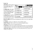
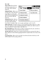
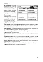
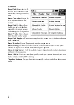
This screen shows 5 different tabs giving access to the main functions of FAST Sur-
vey. Although all function titles on each tab are self-explanatory, a more detailed
definition of these functions is provided in the next pages.
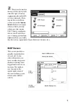
The right arrow located in the upper-right corner of the MENU screen allows you
to access the MAP screen (see page 7).
Summary of Contents for FAST Survey
Page 1: ...FAST Survey Getting Started Guide www thalesnavigation com THALES NAVIGATION...
Page 4: ...ii...
Page 35: ......

