


102
7.
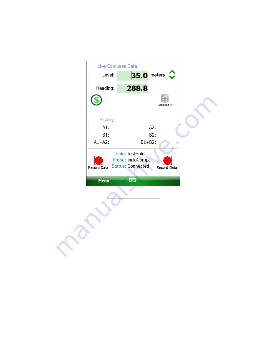
With the compass enabled, a survey is performed as normal (see Section 3.3.1)
and the compass heading can be displayed at any level by tapping on “Menu-
>View Compass Data”, displaying the screen shown in figure 89.
Figure 89 - Live Compass Data
8.
While live compass data is being shown, “Live Inclinometer Data” can be re-
displayed at any time by tapping on “Menu->View Inclinometer Data”.
9.
When done the survey, tap “Menu->Exit Live Readings” and the “Unsaved data”
prompt (see Figure 30) will be displayed. Tap “Yes” to save the
inclinometer/compass survey data.
10.
The inclinometer survey data is saved into a “.gkn” file as normal while the
compass survey data is saved into a “.gks” file. The “.gks” file format is
supported by SiteMaster inclinometer analysis software and is very similar to
standard inclinometer survey data with the following exceptions:
•
A+ data is always in degrees.
•
A- and B- are always zero (0)
•
B+ data is always 90 degrees greater than A+
11.
The compass data file can be viewed (select “Raw Data as Table”) and/or
exported for later use in analysis. See Section H.4 for an example “.gks” file.
Summary of Contents for GK-604D
Page 2: ......
Page 4: ......
Page 12: ......
Page 16: ...4 Figure 4 6000 6100 type probe Figure 5 GK 604 4 Interface ...
Page 28: ...16 Figure 11 Windows Mobile Device Center ...
Page 46: ...34 Figure 35 Viewing Compass Data ...
Page 52: ...40 Figure 41 Stable Indication Figure 42 Unstable Indication ...


