8-6
GTN 625/635/650 Pilot’s Guide
190-01004-03 Rev. P
Map
8.1.1.4 Terrain
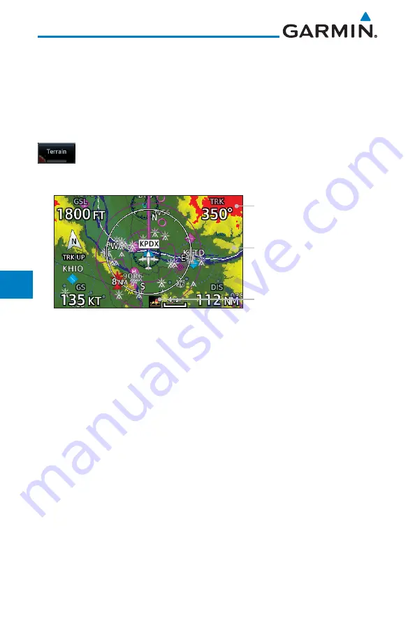
The Terrain Data option selects whether Terrain Data is shown on the Map
page. Terrain and NEXRAD weather may not be displayed at the same time.
Selecting one will disable the other. A Terrain icon will indicate that the Terrain
overlay has been selected. Terrain overlay colors may or may not be shown
depending on the altitude of the aircraft.
1. While viewing the Map Menu, touch
Map Overlays
key, and
then the
Terrain
Map Overlay key to toggle the view of Terrain
data.
Red Terrain - At or
Within 100 ft below
Aircraft Altitude
Yellow Terrain - Between
100 ft and 1,000 ft below
current aircraft altitude
Icon Shows Terrain Overlay
is Active
Figure 8-6 Terrain Map Overlay
2. The colors of the terrain are referenced to your aircraft altitude.
Summary of Contents for GTN 625
Page 608: ...This page intentionally left blank ...
Page 609: ......
Page 610: ...190 01004 03 Rev P ...

