190-02692-00 Rev. A
Garmin G1000 Pilot’s Guide for the Piper PA-32 Saratoga
400
ADDITIONAL FEATURES
SY
STEM
O
VER
VIEW
FLIGHT
INSTRUMENTS
EIS
AUDIO P
ANEL
& CNS
FLIGHT
MANA
GEMENT
HAZARD
AV
OID
ANCE
AFCS
ADDITIONAL FEA
TURES
APPENDICES
INDEX
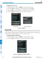
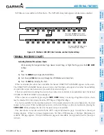
Figure 8-22 CHRT Softkey, Airport Information Page
Pressing the
INFO-1
or
INFO-2
Softkey returns to the airport diagram chart when the view is on a terminal
procedure chart. If the displayed chart is the airport diagram chart, pressing the
INFO-1
or
INFO-2
Softkey
returns to the Airport Information Page.
Another source for additional airport information is from the INFO Box above the chart or to the right of the
chart for certain airports. This information source is not related to the
INFO-1
or
INFO-2
Softkey. When the
INFO Box is selected using the
FMS
Knob, the softkeys are blank. The Denver International airport has three
additional charts offering information; the Airport Diagram, Alternate Minimums, and Take-off Minimums.
In the example shown, TAKE OFF MINIMUMS is selected. Pressing the
ENT
Key displays the IFR Alternate
Minimums Chart.
Pressing the
APR
Softkey displays the approach chart for the airport if available. The aircraft symbol is shown
on the chart only if the chart is to scale and the aircraft position is within the boundaries of the chart. The
aircraft symbol is not displayed when the Aircraft Not Shown Icon appears. If the Chart Scale Box displays a
banner NOT TO SCALE, the aircraft symbol is not shown.
Pressing the
WX
Softkey shows the airport weather frequency information, when available, and includes
weather data such as METAR and TAF from the XM Data Link Receiver. Weather information is available only
when an XM Data Link Receiver is installed and the SiriusXM Weather subscription is current.
Selecting Additional Information:
1)
While viewing the Airport Taxi Diagram, press the
WX
Softkey to display the information windows (AIRPORT,
INFO).
2)
Press the
FMS
Knob to activate the cursor.
3)
Turn the large
FMS
Knob to highlight the INFO Box.


