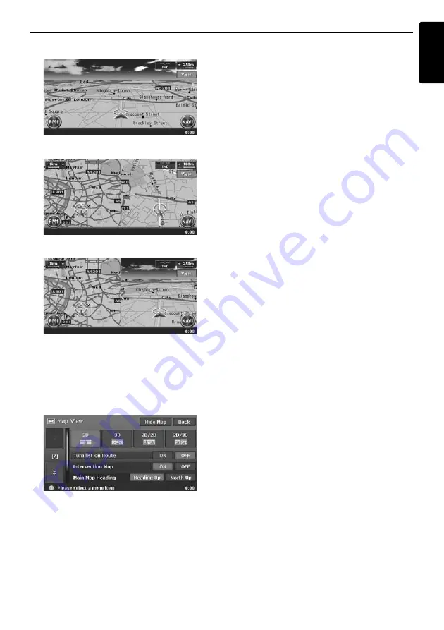
Manipulating the Map Screen
17
MAX983HD
English
•
3D Map
•
2D/2D Map
•
2D/3D Map
Touch the [
View
] key on the Map screen of the
current vehicle location. The Map View menu is
displayed.
Note:
You can also adjust these settings from
[
Navigation
] of the Setting menu.
➜
“
Map View
settings
” (P. 44)
[
D
] / [
d
] key
:
Scrolls the Map View menu screen up or down.
[2D] key
:
Changes to the map represented to the plane just
like the map of atlases.
[3D] key
:
Changes to the 3D map using a viewing position
above the vehicle while looking in the direction of
the car heading.
Note:
To change the 3D angle, set the “
3D Map Angle
” as
mentioned below.
[2D/2D] key
:
Displays two 2D maps right and left on the
divided screen. This is convenient to view two
maps with different scales.
Note:
To change the orientation or scale of the left map,
set the “
Left Map Heading
” or “
Left Map Scale
” as
mentioned below.
[2D/3D] key
:
Displays a 2D map at the left and a 3D map at the
right on the divided screen.
Note:
To change the orientation or scale of the left map,
use the “
Left Map Heading
” or “
Left Map Scale
” as
mentioned below.
“
Turn list on Route
”:
During the route guidance mode: Set to ON to
display the list of the name, distance, and turning
direction of the guidance intersections at the left
of the screen.
• [
ON
]
Displays the Turn List screen.
• [
OFF
]
Hides the Turn List screen.
“
Intersection Map
”:
Changes the setting of the Intersection Close-up
display which displays the turning direction of the
next guidance intersection.
• [
ON
]
Displays the Intersection Close-up display.
• [
OFF
]
Hides the Intersection Close-up display.
“
Main Map Heading
”:
Changes the orientation of the map. This control
is available when the main map or the right map
is set to 2D mode.
• [
Heading Up
]
The map is displayed with the travelling
direction pointing up.
• [
North Up
]
The map is displayed with north pointing up.
“
Left Map Scale
”:
Changes the scale of the left map. This control is
available when a divided map mode is selected.
• [
+
]
Increases the map scale, and shows a more
detailed map.
• [
–
]
Decreases the map scale, and shows the map
of a wider area.


