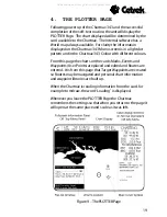
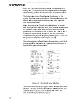
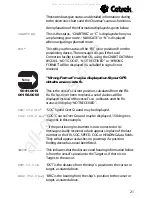
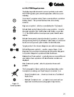


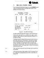
29
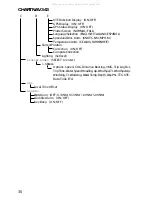
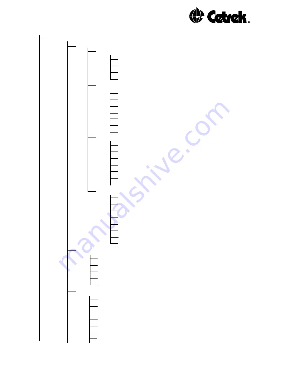
A
B
User Settings (SELECT to enter)
Chart Features (SELECT to enter)
Land Settings
Natural Features (ON/OFF)
Rivers and Lakes (ON/OFF)
Cultural Features (ON/OFF)
Land Marks (ON/OFF)
Marine Settings
Water Turbulence (ON/OFF)
Depth Lines (ON/OFF)
Dep. Areas Limit (SELECT to enter - Set Limit)
Depth Limits/Sound. Range
(SELECT to enter-Set Range)
Spot Soundings (ON/OFF)
Unit (METRIC/FEET/FATHOMS)
Bottom Type (ON/OFF)
Nav-Aids Settings
Ports and Service (ON/OFF)
Attention Areas (ON/OFF)
Tracks and Routes (ON/OFF)
Lights (ON/NO SECTORS/OFF)
Buoys and Beacons (ON/OFF)
Signals (ON/OFF)
Cartography Objects (ON/OFF)
Other Settings
Names (ON/OFF)
Compass (ON/OFF)
Chart Generation (ON/OFF)
Complex Icons (SINGLE/MULTIPLE)
Chart Boundaries (ON/AUTO/OFF)
Track Plot Mode (ON/OFF)
* Course Up - Chartnav 343 Colour only * (ON/OFF)
* Resolution - Chartnav 343 Colour only * (5-30º)
* Change Colour - Chartnav 343 Colour only *
Mark (SELECT to change colour)
Event (SELECT to change colour)
Route (SELECT to change colour)
Target (SELECT to change colour)
Track (SELECT to change colour)
Install. Settings (SELECT to enter)
Nav Input Data Format (NMEA 0183/NMEA 0182/KODEN
717/KODEN 757/FURUNO CIF/IL-MORROW/NAVSTAR2000)
Autopilot (OFF/NMEA 0180-CDX/NMEA 0183/NMEA 0180)
Route Following (AUTOMATIC/MANUAL)
Course and Bearing (TRUE/MAGNETIC)
Fix Datum WGS84 (ON/OFF)
Chart Datum WGS84 (ON/OFF)
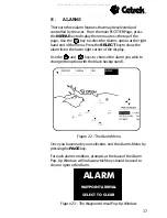
C
D
E Cont.
All manuals and user guides at all-guides.com


