


CHARTNAV 343
36
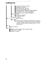
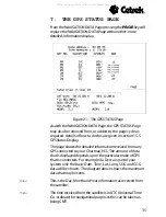
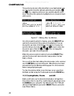
Sat No
Each satellite has its own unique number for identification.
Elevation
This is the angle from the horizon (0º) to the Satellite (up to
90º).
Azimuth
This is the true bearing of the satellite.
SNR
Signal to Noise Ratio, a figure less than 25 will give bad
interference.
Satellites in Use
This is the number of satellites that you are receiving
information from.
Lat/Long
This is the vessels current position co-ordinates calculated by
your GPS.
Fix
This gives an indication of the reliability of the fix. Three
satellites must be in use before a position can be considered
reliable. With more satellites in use a more accurate position is
possible.
S O G
The vessels Speed Over Ground.
C O G
The vessels Course Over Ground.
Altitude
This is the altitude of the vessel/antenna above mean sea level.
H D O P
Horizontal Dilution of Precision should be less than 6 for
accurate data.
V D O P
Vertical Dilution of Precision should be less than 6 for accurate
data.
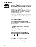
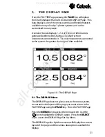
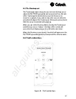
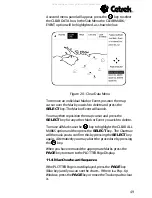
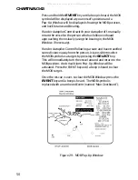
7.1 The GPS Menu
The GPS STATUS Page does not give access to the menu
system, to allow a local time offset to be entered you must
return to the PLOTTER Page using the
PAGE
key.
From the PLOTTER Page, Press the
MENU
key to access the
menu system. Use the
key to highlight the GPS option.
The local time offset controls will be displayed in the Side
Menu. The time received from a satellite is UTC/GMT.
A time offset may be entered in 30 minute steps to give up to
plus or minus 13 hours of offset. Use the
and
keys
to adjust the offset until the required offset value is displayed.
All manuals and user guides at all-guides.com
all-guides.com