


CHARTNAV 343
22
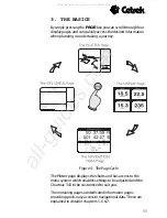
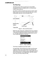
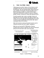
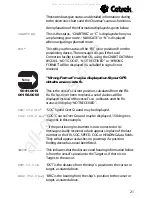
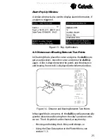
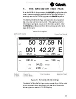
CURSOR:
This is the Lat/long position of the cursor on the chart.
50 40.65 N
001 55.02 W
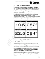
DEPTH
DEPTH is the depth information received from a Depth unit,
if fitted to your system.
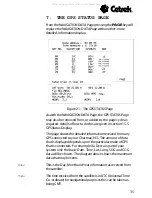
TRACKING: ON
TRACKING tells you if the tracking is set ON or OFF and can
be set to time or distance intervals .
Mem %:100
This shows the percentage of Memory remaining for tracking.
REMAINING
This displays the number of user points available. There is
POINTS
a total of 500 user points which can be made up of MARKS,
EVENTS and Waypoints. A maximum of 99 user points are
available in any one route.
CHART DATUM
This tells you from which standard the chart was digitised. The
following may appear in this area:
WGS84 when selected and available on the card. WGS84
NOT AVAILABLE when selected but not on this chart card or
UNKNOWN for any datum other than WGS84, i.e. the
datum of the original chart.
020.00 NM
This is the present scale of the chart.
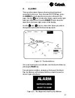
INFORMATION
This is where general purpose information is displayed.
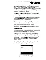
When the
PAGE
key is pressed and held for 3 seconds the
PLOTTER Page gives a Fullscreen Chart Display.
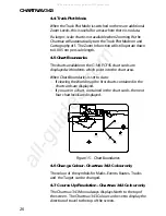
The Data Display Window is no longer shown, instead a
limited information panel is displayed at the top of the screen.
The Chart Datum and Scale are displayed in the bottom right
of the Plotter Page. When required the information section is
also displayed, for example to display A to B Information.
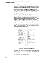
Figure 11 - Fullscreen Information Panel
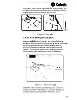
You can set the Chartnav so that it always starts with the
Fullscreen Display, see
section 14.5 Plotter Screen.
All manuals and user guides at all-guides.com


