


MAP 600 – User’s Manual
Page 26
2
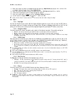
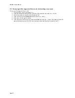
2) After reviewing the various meanings of symbols, press the button to select one of the following options:
–
Hide All/Show all
to hide/show all the symbols
–
Hide Points/Show Points
to hide/show all the symbols except the ones about roads
–
Hide Roads/Show Roads
to hide/show the road symbols only
3) If desired, at this point you can individually hide/show each symbol by positioning with the Joystick on the
related box and pressing the
button in order to hide/show the check box.
4)
Use the Joystick to highlight
and press the
button to confirm in order to save the settings and exit.
In case of errors, you can also exit without saving by highlighting
instead.
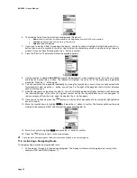
–
Initial Value
Restore the icon settings to their default conditions.
–
Set Location:
In Simulation mode (when you are not actually navigating), the GPS shows the last acquired position. If you
wish to change it to make measurements or other operations, move the cursor to the new location and enable
the Set Location command. The
symbol shows the new position.
9.2.h
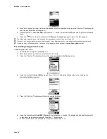
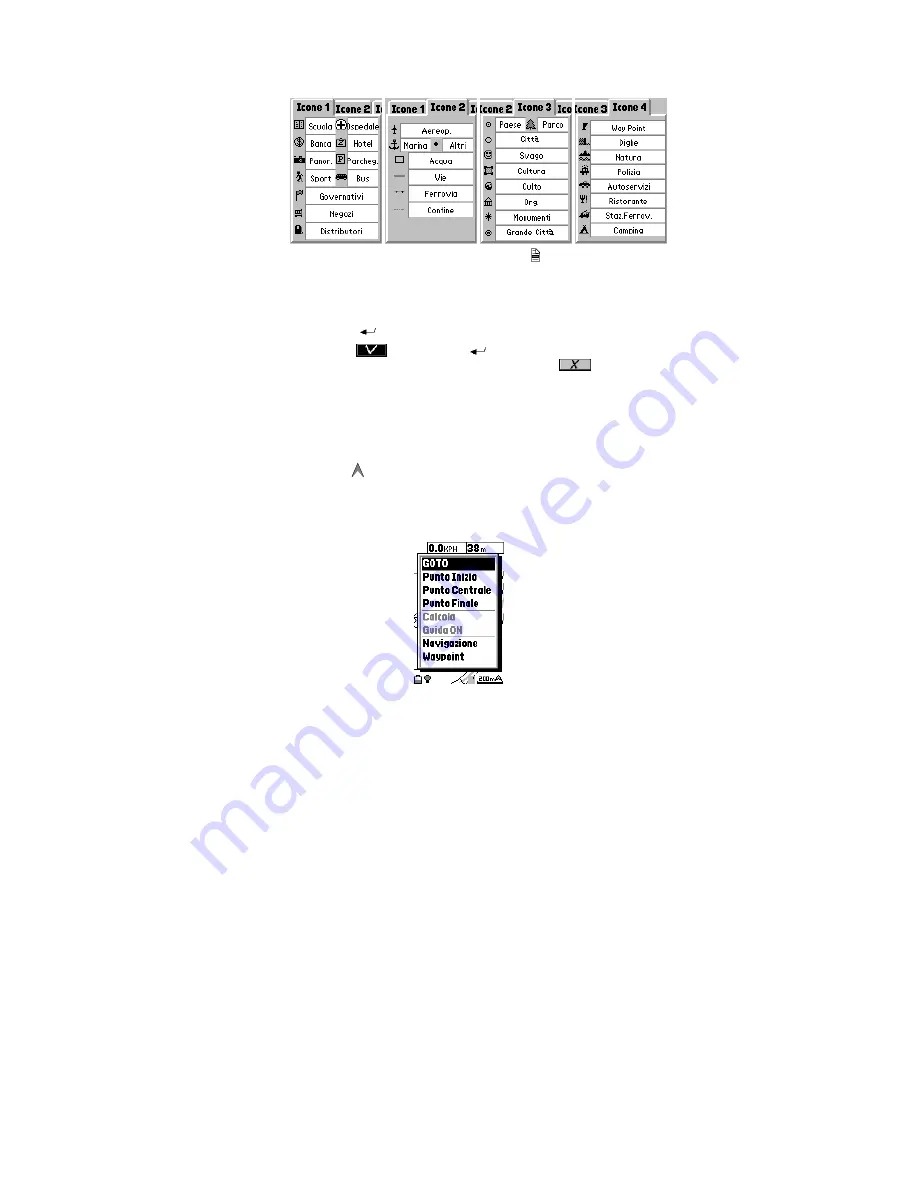
Navigator Menu (diagram 6)
In order to access to all navigator functions, as well as the settings described in par. 9.2.e, you can enter this convenient
menu by pressing and hold the
Enter
button on
Map
page:
1. GOTO –
Selecting with the cursor a point on the map and pressing the Enter button, the GPS automatically calculates
the route that you have to follow in order to arrive to that point.
2. Start Point –
Selecting with the cursor a point on the map, it allows to set a point as “Start Point” of your route.
3. Middle Point –
Selecting with the cursor a point on the map, it allows to set a point as “Middle Point” of your route; up
to 10 middle points can be defined.
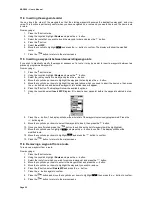
4. End point –
Selecting with the cursor a point on the map, it allows to set a point as “End point” of your route
5. Calculate –
The GPS calculates the route and drives you passing through the selected points.
6. Guide ON/OFF –
It enables or disables the Navigator functions.
7. Edit AR –
This menu has the same functions of the
Navigating Route
menu, see par. 9.2.e.
8. Waypoint –
Selecting a point on the map with the cursor, it allows to set a point as “Waypoint”. For more information
about the Waypoint use, please refer to par.10.
Summary of Contents for MAP600
Page 1: ......


