Specifying aerial overlay opacity
In the 2D chart view:
1. Select the
2D CHART LAYERS
softkey.
2. Use the
AERIAL OVERLAY
softkey to select the ON option.
The opacity bar is displayed above the softkey.
3. Use the rotary control to adjust the opacity, between 1 and 100%.
Specifying the aerial overlay area
In the chart application, with aerial photo overlay enabled:
1. Press the
MENU
button.
2. Select the
Cartography Setup
menu item.
3. Select the
Aerial Photo Overlay
menu item.
4. Select the On Land or On Land and Sea option, as appropriate.
5. Press the
OK
button.
3D chart detail exaggeration
You can exaggerate the vertical size of objects on the 3D chart to
make it easier to interpret what you are seeing.
Sometimes it is easier to see certain topographical features if they
are exaggerated. Adjusting the exaggeration has the effect of
vertically stretching objects on the chart, making it easier to see
their shape and position. This could be particularly helpful if you
are fishing, for example.
Adjusting the 3D chart exaggeration
In the 3D chart view:
1. Select the
PRESENTATION
softkey.
2. Select the
3D VIEW OPTIONS
softkey.
3. Select the
ADJUST EXAGGERATION
softkey.
4. Using the trackpad, select the required amount of exaggeration.
Radar overlay
You can combine the chart with the radar and MARPA functions
to provide target tracking or to help you distinguish between fixed
objects and other marine traffic.
You can enhance the use of your chart by combining it with the
following radar features:
• MARPA.
• Radar overlay (for distinguishing between fixed and moving
objects).
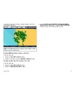
Using the radar to view MARPA targets on the chart
The Mini Automatic Radar Plotting Aid (MARPA) function is used for
target tracking and risk analysis. When the radar overlay is on, all
MARPA targets are displayed in the chart window and associated
MARPA functions can be accessed via the chart.
Using radar overlay to distinguish between fixed and moving
objects
You can overlay radar image data over your chart image allowing
better distinction between fixed objects and other marine traffic. For
best results, switch on Radar-Chart synchronization to ensure radar
range and chart scale are synchronized.
Enabling radar overlay
In the 2D chart view:
1. Select the
2D CHART LAYERS
softkey.
2. Use the
RADAR OVERLAY
softkey to select the ON option.
Accessing MARPA controls on the chart
In the chart application:
1. Select the target using the cursor.
Using the chart
85
Содержание E90W
Страница 2: ......
Страница 4: ......
Страница 16: ...16 E Series Widescreen User reference...
Страница 40: ...40 E Series Widescreen User reference...
Страница 46: ...46 E Series Widescreen User reference...
Страница 68: ...68 E Series Widescreen User reference...
Страница 100: ...100 E Series Widescreen User reference...
Страница 200: ...200 E Series Widescreen User reference...
Страница 210: ...210 E Series Widescreen User reference...
Страница 220: ...220 E Series Widescreen User reference...
Страница 224: ...224 E Series Widescreen User reference...
Страница 228: ...228 E Series Widescreen User reference...
Страница 244: ...244 E Series Widescreen User reference...
Страница 248: ...248 E Series Widescreen User reference...
Страница 249: ......
Страница 250: ...www raymarine com...

