Navigation Tools
Radar/Chart Radar User Guide
6-56
65900010
Anchoring Planning
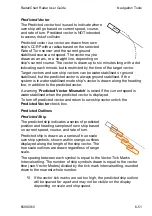
The Anchoring Planning tab enables a precise
anchorage location to be entered. The operator
should enter a head bearing to steer for
anchorage, and may also plan a single drop
bearing object, and/or a single drop range object.
Precision Anchoring
An anchor position may be selected, by entering
Lat/Long coordinate values or by selecting a
location on the chart display.
With anchoring on, either manually enter a
Lat/Lon position using the screen keypad; or, click
on the
On Chart
button, move the cursor to the
desired location on the display and left click.
When an anchorage location is selected, the
system draws an anchorage approach display,
centred on the location, see the figure below.
Содержание VisionMaster FT
Страница 1: ...Radar Chart Radar User Guide Northrop Grumman Sperry Marine B V Part Number 65900010 ...
Страница 2: ......
Страница 4: ...Radar Chart Radar User Guide 65900010 ii Intentionally Blank ...
Страница 24: ...Overview Radar Chart Radar User Guide 1 2 65900010 Single System ...
Страница 42: ......
Страница 114: ......
Страница 212: ......
Страница 304: ......
Страница 370: ......
Страница 450: ......
Страница 462: ......
Страница 502: ......
Страница 516: ......
Страница 532: ......
Страница 533: ......


