Raster imagery
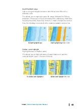
High resolution bathymetry
Shaded relief
Shades seabed terrain.
No contours
Removes contour lines from the chart.
Raster charts
Changes the view to that of a traditional paper chart.
Raster transparency
Controls the transparency of raster imagery.
High resolution bathymetry
Enables and disables higher concentration of contour lines.
Insight and C-MAP view options
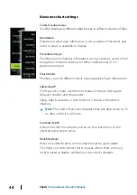
Chart detail
•
Full
All available information for the chart in use.
•
Medium
Minimum information sufficient for navigation.
•
Low
Basic level of information that cannot be removed, and includes
information that is required in all geographic areas. It is not
intended to be sufficient for safe navigation.
Charts
| Vulcan Series Operator Manual
37
Содержание Vulcan Series
Страница 1: ...ENGLISH VulcanSeries Operator Manual www bandg com...
Страница 2: ......
Страница 8: ...8 Preface Vulcan Series Operator Manual...
Страница 178: ...178 Alarms Vulcan Series Operator Manual...
Страница 198: ...988 11111 002 0980...

