


45
User Manual
Chart Boundaries
: On/Off/Auto. The default setting is On.
'MENU' + "MAP SETTINGS" +'ENTER' + "Other Map Configurations" + 'ENTER'
+ "Chart Boundaries" + 'ENTER'
Value Added Data
: On/Off. The default setting is On.
'MENU' + "MAP SETTINGS" +'ENTER' + "Other Map Configurations" + 'ENTER'
+ "Value Added data" + 'ENTER'
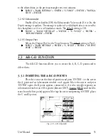
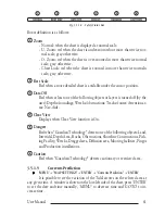
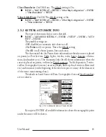
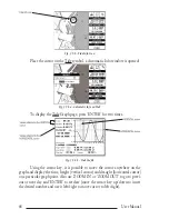
3.5.2 GETTING AUTOMATIC INFO
The type of Automatic Info is user selectable.
'MENU' + "ADVANCED SETTINGS" + 'ENTER' + "SETUP" + 'ENTER' +"AUTO
INFO" + 'ENTER'
The possible settings are:
-
Off
: disabled, no automatic info shown at all.
-
On Points
: only on points. This is the default setting.
-
On All
: on all objects (points, lines and areas).
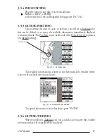
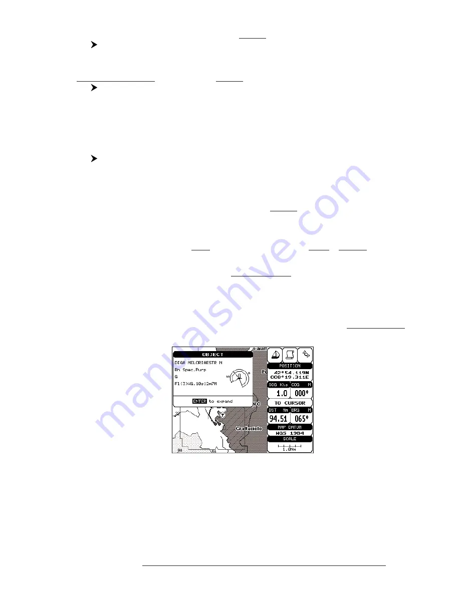
The Automatic Info On Points shows information when the cursor is placed
on points (as Port Services, Tides, lights, wrecks, rocks, buoys, beacons, obstruc-
tions, land markers, etc.). The Automatic Info On All shows information when the
cursor is placed on points, on lines (as Depth contours, Traffic Separation, Territo-
rial Sea, Cartographic Lines etc.) on areas (Depth, Built-up, Sea, Attention, Restricted
etc.) and on names (on the beginning of the text -hot spot- or on any of the characters
of the name -name message box-).
The details on Land, Source of Data, Cartographic Area and Spot Soundings
are not shown.
Fig. 3.5.2 - Automatic Info on Points window
If you press 'ENTER' all available information about the cartographic point
under the cursor will be shown.
Summary of Contents for Compact 7 Plus
Page 14: ...16 User Manual...
Page 19: ...21 User Manual Fig 2 5 1 GPS Connection on Port 3...
Page 50: ...52 User Manual...
Page 87: ...89 User Manual 6 For the Technician 6 1 DIMENSIONS Fig 6 1 EXCALIBUR models Dimensions...
Page 92: ...94 User Manual Fig 6 4a GPS Connection on Port 3 for chartplotter with external GPS receiver...
Page 98: ...100 User Manual...