Automatic Direction Finding
183
earth’s magnetic field at the current location is also entered when the “Compass” setting is
used for the north reference.
GNSS velocity
If the DF antenna is mounted on a vehicle, the earth’s magnetic field in the vicinity will
normally be heavily disturbed, especially if mounting is by means of a magnetic plate, which
is very convenient and often used. If the vehicle is also moving during the DF process, as is
often the case, only one option remains for the north reference: “GNSS velocity”.
This method assumes that the DF antenna reference direction is the same as the movement
direction of the vehicle. The position of the DF antenna on the vehicle must therefore be
carefully adjusted so that the antenna reference direction is parallel to the vehicle’s normal
direction of travel. Note that the DF antenna bearing marks may also be helpful for this
adjustment. The accuracy of the movement direction measured by the DF antenna GNSS
receiver is proportional to the magnitude of the vehicle velocity. The typical uncertainty is
about 0.3° RMS at a velocity of 100 km/h. This method therefore works only well when the
vehicle is moving faster than about 10 km/h. The GNSS receivers in NARDA DF antennas
will try to recall the last valid direction estimate even when the vehicle stops. However, this
direction is only a useful estimate of the true direction if the vehicle did not change direction
considerably while moving very slowly. Bearings taken when the vehicle is parked are thus
only useful if the vehicle did not change direction abruptly during the period of slow
movement before reaching the parked position. If this is not the case, the north reference will
need to be changed to “Compass” when the vehicle is parked. The DF antenna must then
also be unmounted from the vehicle if low bearing uncertainty is required in the fixed
position.
Azimuth Corr.
If there is a known reference direction mismatch, it can be corrected in every “North
Reference” settings by a parameter called “Azimuth Corr.”. The value of this parameter is just
added to the uncorrected azimuth result. It is worth noting that a perfect north reference is
always assumed for the specification of the DF uncertainty. The uncertainty in the north
reference is an additional source of uncertainty that must be taken into account when
calculating the overall DF accuracy.
See
Step 5 – Using Heat Map Localization
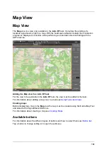
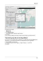
The SignalShark provides a map view that can be used to visualize data on a geographic
map, which can be imported in the form of so-called slippy map tiles.
NARDA provides a download tool for the slippy map tiles rendered by OpenStreetMap© and
other public tile servers. The SignalShark also accepts slippy map tiles rendered by any
geographic information system tool. Military or other official maps can also be imported into
the SignalShark in this way.
The data to be visualized are overlaid on the geographic map. Localization results from
different transmitters are shown as crosses and uncertainty ellipses in different colors. The
map view is also used to provide a localization heatmap and to display the current estimate
of the transmitter position during the localization process for a single transmitter.
The suspicious transmitter can be localized once the bearing line information from two
significantly different direction finder locations are known and intersect. Localization accuracy
Summary of Contents for Narda SignalShark
Page 1: ...User Manual Version 2019 07 ...
Page 2: ......
Page 14: ......
Page 15: ...15 Online Help Version 2019 07 ...
Page 16: ......
Page 31: ...Introduction 31 Figure Loop antenna frequency range 9 kHz to 30 MHz ...
Page 32: ......
Page 38: ......
Page 44: ......
Page 60: ......
Page 66: ......
Page 74: ......
Page 88: ......
Page 104: ......
Page 118: ......
Page 132: ......
Page 158: ......
Page 198: ......
Page 204: ......
Page 214: ......
Page 226: ......

