190-00820-08 Rev. A
Cirrus Perspective
™
by Garmin – Pilot’s Guide for the SR20/SR22/SR22T
SY
STEM
O
VER
VIEW
FLIGHT
INSTRUMENTS
EIS
AUDIO P
ANEL
& CNS
FLIGHT
MANA
GEMENT
HAZARD
AV
OID
ANCE
AFCS
ADDITIONAL
FEA
TURES
APPENDICES
INDEX
627
APPENDIX D
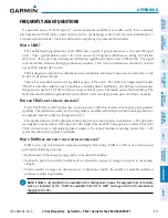
FREQUENTLY ASKED QUESTIONS
If a particular aspect of the Perspective
™
system operational capability is not addressed by these commonly
asked questions or in the index, contact Garmin (see the copyright page or back cover for contact information) or
a Garmin-authorized dealer. Garmin is dedicated to supporting its products and customers.
w
hAt
iS
SBAS?
The Satellite Based Augmentation System (SBAS) uses a system of ground stations to correct any GPS signal
errors. These ground stations correct for errors caused by ionospheric disturbances, timing, and satellite
orbit errors. It also provides vital integrity information regarding the health of each GPS satellite. The signal
correction is then broadcast through geostationary satellites. This correction information can then be received
by any SBAS-enabled GPS receiver.
SBAS is designed to provide the additional accuracy, availability, and integrity necessary to enable users to rely
on GPS for all phases of flight.
There are several SBAS systems serving different parts of the world. The Wide Area Augmentation System
(WAAS) is currently available in the United States, including Alaska and Hawaii. The European Geostationary
Navigation Overlay Service (EGNOS) offers coverage of Europe, parts of the middle east and northern Africa. The
Multi-functional Satellite Augmentation System (MSAS) covers mainly Japan and parts of northern Australia.
h
ow
doeS
SBAS
Affect
APProAch
oPerAtionS
?
Both LNAV/VNAV and LPV approaches use the accuracy of SBAS to include vertical (glide path) guidance
capability. The additional accuracy and vertical guidance capability allows improved instrument approaches to
an expanded number of airports throughout the U.S.
The implementation of LPV approaches further improves precision approach capabilities. LPV approaches
are designed to make full use of the improved GPS signal from the SBAS. This approach combines the LNAV/
VNAV vertical accuracy with lateral guidance similar to the typical Instrument Landing System (ILS). LPV
approaches allow lower approach minimums.
w
hAt
iS
rAiM
And
how
doeS
it
Affect
APProAch
oPerAtionS
?
RAIM is an acronym for Receiver Autonomous Integrity Monitoring. RAIM is a GPS receiver function that
performs the following functions:
• Monitors and verifies integrity and geometry of tracked
GPS satellites
• Notifies the pilot when satellite conditions do not provide the necessary coverage to support a certain phase
of flight
• Predicts satellite coverage of a destination area to determine whether the number of available satellites is
sufficient to satisfy requirements
NOTE
:
If RAIM is not predicted to be available for the final approach course, the approach does not become
active, as indicated by the “RAIM not available from FAF to MAP” message and the LOI annunciation
flagging on the HSI.
Summary of Contents for Cirrus Perspective SR20
Page 1: ... Cirrus SR20 SR22 SR22T Integrated Avionics System Pilot s Guide ...
Page 2: ......
Page 655: ......

