


IFD500 Series Pilot Guide
4-70 Map Subsystem
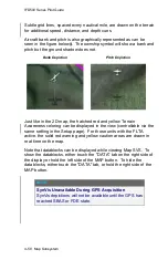
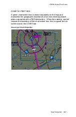
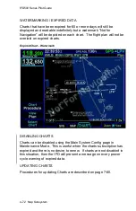
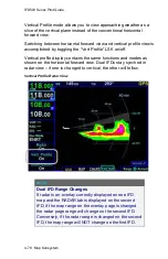
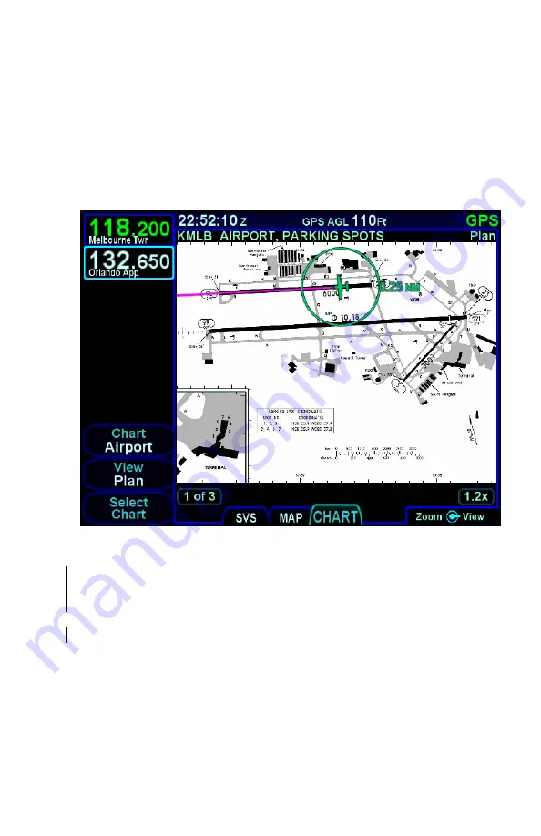
TAXI CHARTS/AIRPORT DIAGRAMS
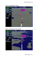
If a published procedure was used via the Charts tab for the landing
airport, the display chart will automatically switch over to the airfield
diagram during post-landing roll out. Your ownship position on the
airfield diagram chart will be displayed as an aid in surface
navigation.
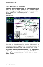
Airport Diagram
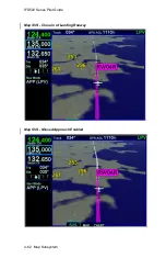
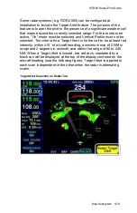
The charts can be pinch-zoomed and panned or knob zoomed to see
close ups of the airfield diagram. When the chart is zoomed and not
being manually panned, the chart will be centered on the aircraft.
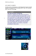
If you did not select or use a published approach via Charts, the local
airfield diagram can still be accessed. Select the
“CHART” tab of the
MAP page and then use the left-hand LSKs to select the desired
airfield diagram.
Summary of Contents for IFD510
Page 1: ......
Page 140: ...IFD500 Series Pilot Guide 3 50 FMS Subsystem Weather Data on Info Tab Info Tab Nearby Navaids ...
Page 150: ...IFD500 Series Pilot Guide 3 60 FMS Subsystem User Waypoint Airfield Naming Example ...
Page 156: ......
Page 180: ...IFD500 Series Pilot Guide 4 24 Map Subsystem ADS B Lightning Coverage Area Shadow ...
Page 252: ...IFD500 Series Pilot Guide 5 16 Aux Subsystem Trip Statistics Calculator ...
Page 460: ...IFD500 Series Pilot Guide 7 82 General Bluetooth pairing pairing code ...