
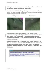
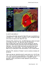
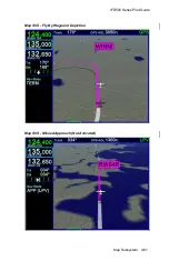


IFD500 Series Pilot Guide
Map Subsystem 4-67
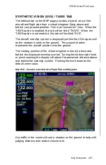
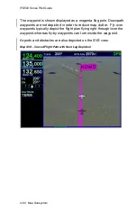
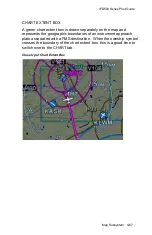
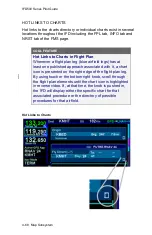
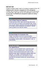
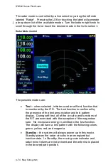
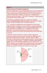
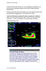
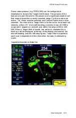
CHART EXTENT BOX
A green chart extent box is drawn separately on the map and
represents the geographic boundaries of an instrument approach
plate associated with a FMS destination. When the ownship symbol
crosses the boundary of the chart extent box, this is a good time to
switch over to the CHART tab.
Close Up of Chart Extent Box
Summary of Contents for IFD510
Page 1: ......
Page 140: ...IFD500 Series Pilot Guide 3 50 FMS Subsystem Weather Data on Info Tab Info Tab Nearby Navaids ...
Page 150: ...IFD500 Series Pilot Guide 3 60 FMS Subsystem User Waypoint Airfield Naming Example ...
Page 156: ......
Page 180: ...IFD500 Series Pilot Guide 4 24 Map Subsystem ADS B Lightning Coverage Area Shadow ...
Page 252: ...IFD500 Series Pilot Guide 5 16 Aux Subsystem Trip Statistics Calculator ...
Page 460: ...IFD500 Series Pilot Guide 7 82 General Bluetooth pairing pairing code ...


