
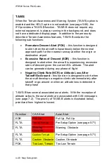


IFD500 Series Pilot Guide
Map Subsystem 4-57
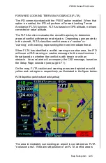
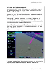
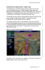
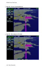
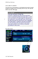
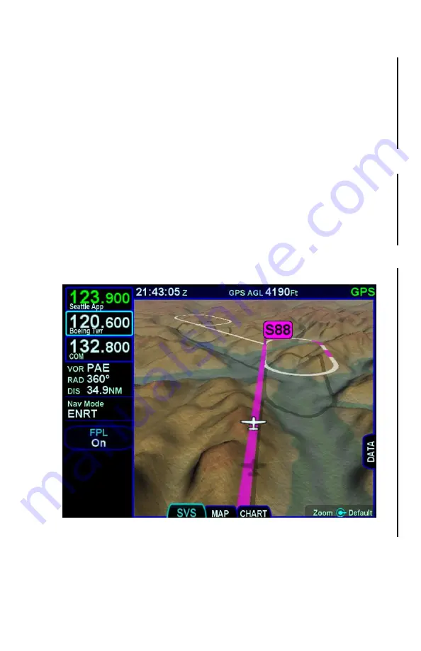
SYNTHETIC VISION (SVS) / TAWS TAB
The leftmost tab on the MAP page provides a hybrid view of the
aircraft and flight plan from a virtual wingman flying above and
behind your present position. This is an “exocentric” view. When the
TAWS option is enabled, this tab will be titled “TAWS”. When the
TAWS option is not enabled, this tab will be titled “SVS”.
The aircraft ownship symbol is displayed just like the 2D map as well
as the shadow it casts on the ground. The ground shadow
represents the aircraft position over the ground.
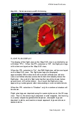
The viewing position of the virtual wingman is directly above and
behind the displayed ownship symbol. Turning the bottom right knob
or pinch zooming the display will adjust the perceived distance above
and behind the ownship symbol. Pushing the knob restores the
default zoom value.
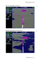
Map SVS - Zoomed out with Active Flight Plan and Waypoint
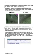
Any traffic in the scene will cast a shadow on the ground to help with
judging distance and relative closure rate.
Summary of Contents for IFD510
Page 1: ......
Page 140: ...IFD500 Series Pilot Guide 3 50 FMS Subsystem Weather Data on Info Tab Info Tab Nearby Navaids ...
Page 150: ...IFD500 Series Pilot Guide 3 60 FMS Subsystem User Waypoint Airfield Naming Example ...
Page 156: ......
Page 180: ...IFD500 Series Pilot Guide 4 24 Map Subsystem ADS B Lightning Coverage Area Shadow ...
Page 252: ...IFD500 Series Pilot Guide 5 16 Aux Subsystem Trip Statistics Calculator ...
Page 460: ...IFD500 Series Pilot Guide 7 82 General Bluetooth pairing pairing code ...


