


IFD500 Series Pilot Guide
Map Subsystem 4-25
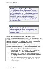
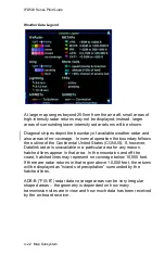
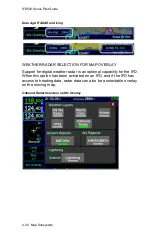
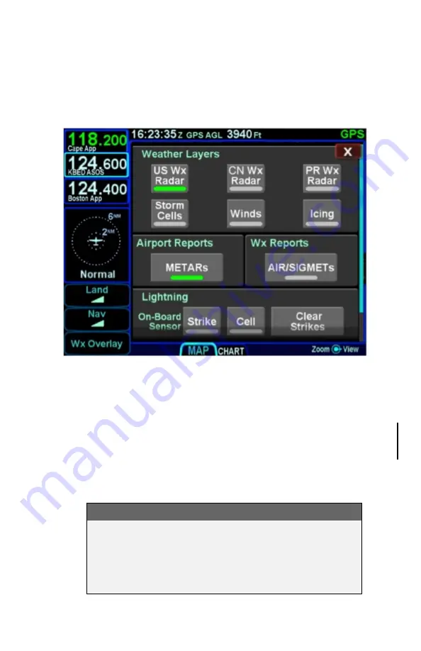
WEATHER OVERLAYS ON MAP
The “Wx Overlay” LSK on the map page brings up a control page on
which the layer combinations can be turned on or off.
Wx Overlay Selection
The options vary with the installed datalink device and subscription
level.
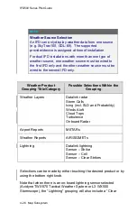
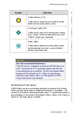
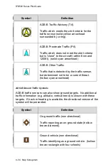
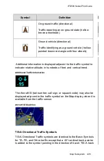
The Wx Overlay page is segmented into groupings of products.
Products selected for overlay are indicated by a green lamp. Note
that the products in the “Weather Layers” group are mutually
exclusive. The table below represents the possible set of products
available. Products that are not available due to the device type or
subscription level will not be displayed as selectable choices.
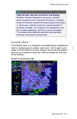
NOTE
ADS-B (FIS-B) US Weather Radar Data is Coarse
When compared to subscription Datalink service data
and even ADS-B Regional data, the CONUS weather
radar data appears as a noticeably coarser depiction
–
this is a function of the supplied data.
Summary of Contents for IFD510
Page 1: ......
Page 140: ...IFD500 Series Pilot Guide 3 50 FMS Subsystem Weather Data on Info Tab Info Tab Nearby Navaids ...
Page 150: ...IFD500 Series Pilot Guide 3 60 FMS Subsystem User Waypoint Airfield Naming Example ...
Page 156: ......
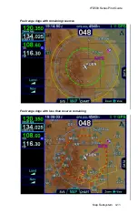
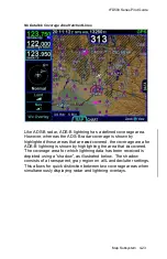
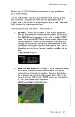
Page 180: ...IFD500 Series Pilot Guide 4 24 Map Subsystem ADS B Lightning Coverage Area Shadow ...
Page 252: ...IFD500 Series Pilot Guide 5 16 Aux Subsystem Trip Statistics Calculator ...
Page 460: ...IFD500 Series Pilot Guide 7 82 General Bluetooth pairing pairing code ...


