

Revision A9 50
GRT Avionics Mini-X Installation, Setup & User Manual
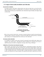
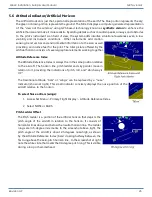
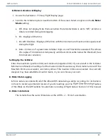
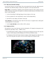
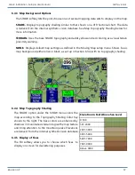
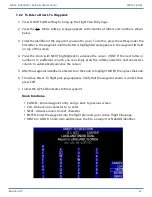
5.9.2 Obstacles
Towers and other obstacles in the 56-day Navigation Database are
displayed on the PFD as either simple lines or chart-style graphic tower
symbols. The same altitude color-coding as Terrain applies.
To choose how obstacles are depicted on the PFD screen:
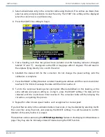
1. Press MORE > Set Menu > Primary Flight Display.
2. Scroll to
Obstacle Style
and choose Line or Chart.
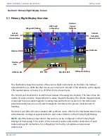
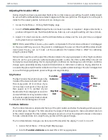
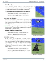
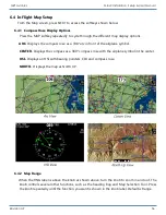
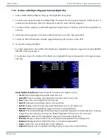
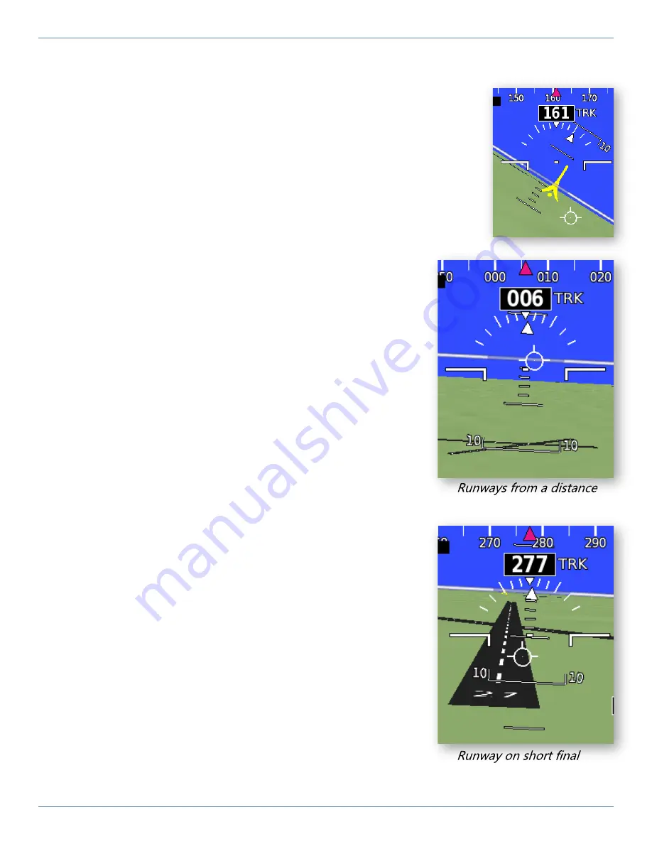
5.9.3 Artificial Runways
Runways can be displayed on the PFD as a black strip with
centerline and runway designation number. This is extremely
useful for spotting runways from the air and for flying into airports
with multiple runways.
NOTE:
Turf runways will be depicted as black strips even though
they are not paved. Private runways can be added to the database
by adding them as User Waypoints.
To display runways on synthetic vision:
1. Press MORE > Set Menu > Primary Flight Display
2. Scroll to
Artificial Runways
and select ON.
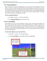
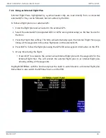
5.9.4 Grid Overlay
The HXr can lay a grid onto the terrain of the PFD, creating an
enhanced sense of depth, height and direction to the synthetic
vision. The grid is aligned with the cardinal true directions (N, S,
E, and W). It fades with height and distance to create an illusion
of space. The squares are 12 arc seconds apart, or about 1,215
feet, and follow the shape of the terrain. To display the grid on
synthetic vision:
1. Press MORE > Set Menu > Primary Flight Display
2. Scroll to
Synthetic Vision Grid Overlay
and select ON.


