background image

4

Safety Warnings and Cautions—Read This First!

WARNING:

 For use in vehicles, it is the sole responsibility of the owner/operator of the 

Navigator to place and secure the Navigator so that it will not interfere with the vehicle operating 
controls and safety devices, obstruct the operator’s view of driving conditions, or cause damage or 
personal injury in the event of an accident. Do not mount the Navigator over airbag panels or in the 
fi eld of airbag deployment. Airbags expand with a rapid force that can propel objects in their path 
towards the vehicle driver or passengers causing possible injury. Refer to airbag safety precautions 
contained in the vehicle owner’s manual. Do not mount the Navigator in a place where the driver 
or passengers are likely to impact it in an accident or collision. The mounting hardware provided by 
GARMIN is not warranted against collision damage or the consequences thereof.

WARNING:

 When used in vehicles, it is the sole responsibility of the driver of the vehicle to 

operate the vehicle in a safe manner, maintain full surveillance of all driving conditions at all times, and 
not become distracted by the Navigator to the exclusion of safe driving practices. It is unsafe to operate 
the controls of the Navigator while you are riding or driving. Failure by the driver of a vehicle equipped 
with a Navigator to pay full attention to operation of the vehicle and road conditions while the vehicle 
is in motion could result in an accident or collision with property damage and personal injury.

Introduction

Warnings and Cautions

Do Not Mount Where Driver’s Field 
of Vision is Blocked

Do Not Place Unsecured on the 
Vehicle Dash

Do Not Mount in Front of an Airbag 
Field of Deployment

Do Not Mount in Front of 
Airbag Panels

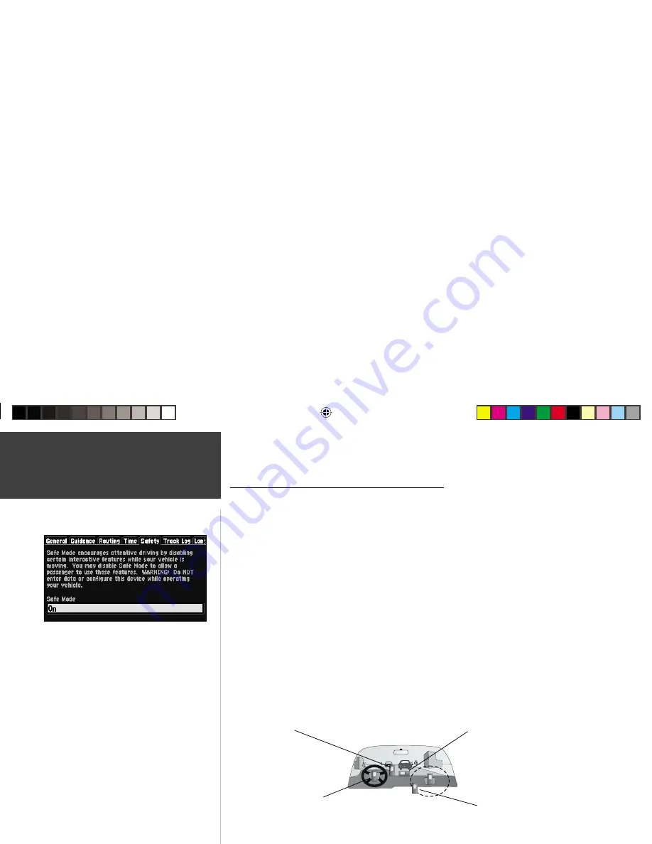
Your Navigator is equipped with a ‘Safe Mode’ 
feature to improve rider safety. By default, this feature 
is enabled. For automotive use, Safe Mode can be 
turned off to allow a passenger to operate the unit. 

When your vehicle is moving, Safe Mode disables 
certain Navigator functions 

which require 

signifi cant operator attention and may become a 
distraction to use while riding or driving. See page 46 
for details.

RF Owners Manual Rev A.indd

08/20/01, 11:23 AM

4

Содержание BMW Motorcycles Navigator

Страница 1: ...owner s manual and reference ...

Страница 2: ...nal use provided that such electronic or printed copy of this manual contains the complete text of this copyright notice and provided further that any unauthorized commercial distribution of this manual is strictly prohibited Information in this manual is subject to change without notice GARMIN Corporation reserves the right to change or improve its products and to make changes in the content with...

Страница 3: ...aps from the MapSource City Navigator CD ROM Navigator provides turn by turn guidance down to residential street level detail About This Manual Make sure you take the time to read the Quick Start Guide first to get acquainted with all of the basic features of the Navigator After you have read the Quick Start Guide you can read through this owner s manual in order to understand the operating feature...

Страница 4: ...nting 15 Routing to a Map Feature or Location 17 Map Page Options 18 Next Turn Page 21 Current Route Page 22 Trip Information Page 24 Marking Waypoints 26 Using the Find Menu 27 Finding Items by Name or by Nearest 27 Finding a Waypoint 28 Finding a City 28 Finding an Exit 29 Finding a Point of Interest 30 Finding an Address or Intersection 31 Recently Found Places 32 Using the Routes Menu 32 GPS I...

Страница 5: ...2 Routing Tab 43 Time Tab 45 Safety Tab 46 Track Log Tab 46 Language Tab 47 Interface Tab 48 Appendices 50 Appendix A Optional Accessories 50 Appendix B Wiring and Interfacing 52 Appendix C Maintenance 53 Appendix D Messages 54 Appendix E Specifications 56 Appendix F Time Offset 58 Appendix G Index 59 ...

Страница 6: ...driver of the vehicle to operate the vehicle in a safe manner maintain full surveillance of all driving conditions at all times and not become distracted by the Navigator to the exclusion of safe driving practices It is unsafe to operate the controls of the Navigator while you are riding or driving Failure by the driver of a vehicle equipped with a Navigator to pay full attention to operation of t...

Страница 7: ...y as required in product literature and copyright messages displayed to the consumer Virtually all data sources contain inaccurate or incomplete data to some degree This is particularly true outside the United States where complete and accurate digital data is either not available or prohibitively expensive CAUTION IT IS THE USER S RESPONSIBILITY TO USE THIS PRODUCT PRUDENTLY THIS PRODUCT IS INTEN...

Страница 8: ...roperty of GARMIN and is protected under the United States of America copyright laws and international copyright treaties You further acknowledge that the structure organization and code of the Software are valuable trade secrets of GARMIN and that the Software in source code form remains a valuable trade secret of GARMIN You agree not to decompile disassemble modify reverse assemble reverse engin...

Страница 9: ...accordance with instructions may cause harmful interference to radio communications However there is no guarantee that interference will not occur in a particular installation If this device does cause harmful interference to radio or television reception which can be determined by turning this device off and on the user is encouraged to try and correct the interference by one or more of the follo...

Страница 10: ...TATE TO STATE IN NO EVENT SHALL GARMIN BE LIABLE FOR ANY INCIDENTAL SPECIAL INDIRECT OR CONSEQUENTIAL DAMAGES WHETHER RESULTING FROM THE USE MISUSE OR INABILITY TO USE THIS PRODUCT OR FROM DEFECTS IN THE PRODUCT SOME STATES DO NOT ALLOW THE EXCLUSION OF INCIDENTAL OR CONSEQUENTIAL DAMAGES SO THE ABOVE LIMITATIONS MAY NOT APPLY TO YOU To obtain warranty service contact your GARMIN dealer or call th...

Страница 11: ...AGE key to select a different screen Power Backlight Key Press and hold to turn on off Press momentarily to adjust screen backlight and contrast Battery Door Back Side To open turn metal D ring counterclockwise 1 4 turn and pull battery door away from unit Cartridge Door Bottom Insert programmed card for increased map detail and infor mation lookup capability Rocker Keypad Moves the cursor pans th...

Страница 12: ...r area more detail or a larger area less detail FIND Searches the database for Cities Interstate Exits Waypoints BMW Dealers and Recently found places If an optional MapSource City Navigator or MetroGuide map data card is installed it also searches for Points of Interest Addresses or Intersections Allows the listed items to be viewed on a map or selected as a destination Note MetroGuide will not p...

Страница 13: ...utton and press ENTER to select the action corresponding to that button An example of an on screen button is the Route to It button appearing at the bottom of the Waypoint Marked Page SCROLL BAR When viewing a list of items too long to display on a single page a scroll bar will appear along the right hand side of the list The position of the scroll bar indicates which portion of the list is curren...

Страница 14: ...s selected A fourth screen the Next Turn Page is also available during navigation Press the PAGE or QUIT key to switch back and forth between pages The Reference Section describes in detail what each page does and how they are configured Introduction Unit Pages Map Page Trip Information Page Next Turn Page Available only during navigation PAGE KEY Current Route Page Available only during navigation...

Страница 15: ...ar Position Icon in the center of the map The map display also shows the map scale and geographic details such as lakes rivers highways and towns You can use the IN and OUT keys to change the map scale to show more map area with less detail or less map area with more detail Press and hold either key to zoom the map scale rapidly Reference The Map Page Map Scale Vehicle Speed Route Line Your Curren...

Страница 16: ...l letters indicate the direction you are traveling when not navigating a route This is not displayed when you are navigating Direction To Go Arrow An arrow that points to the next turn in the route when moving on an active route Speed Your rate of travel which can be displayed in miles per hour or kilometers per hour Distance To Go When navigating a Route the distance remaining to reach the next t...

Страница 17: ...ea This provides a look ahead capability which is particularly useful with smaller map areas To pan use the ROCKER KEYPAD to move the map in any direction including diagonally Once you are finished with panning you can quickly remove the panning arrow and re center the map on your present position by pressing the QUIT key As you begin to pan the map a pointer appears This map pointer will serve as ...

Страница 18: ... waypoint from the Map Page 1 Use the ROCKER KEYPAD to point to the desired location on the map and press ENTER briefly A Waypoint Created Page will appear with an auto assigned name 3 digit number for the waypoint 2 You can delete the waypoint show it on the map or Route to It Select the desired option and press ENTER Once you are finished with panning you can quickly remove the panning arrow and r...

Страница 19: ...d and press ENTER A list of available symbols will appear Use the ROCKER KEYPAD to select the desired symbol and press ENTER 4 You can route to the waypoint show it on the map page or delete it Use the ROCKER KEYPAD to select the option you desire and press ENTER Routing to a Map Feature or Location 1 Use the ROCKER KEYPAD to move the arrow to the desired feature or location on the map 2 Press ENT...

Страница 20: ...on conserves power usage and speeds Map Page drawing The Use Outdoors option listens to satellites for real time navigation Measure Distance Allows you to measure the distance between any two points you choose on the Map Page Also displays the latitude and longitude of the pointer Select Layout Selects between Square Map and Wide Map Square Map shows the map on one half of the display navigation i...

Страница 21: ... to your preferences including map detail map orientation automatic zooming and color mode The map setup options are organized under a series of file tabs making individual selections easier to locate and change The following table describes the file tabs and settings available under each tab Common Settings Text Specifies the text size that a map item will be displayed in Selecting None will turn of...

Страница 22: ... option will automatically adjust the map scale to show both your current location and the next item you are navigating to Line Options Track Log Controls the display of the Track Log on the map Railroad Controls the display of railroads on the map Street Label Controls the display of street names on the map Other Options Point Controls the display of points of interest on the map City Controls th...

Страница 23: ... the previous page at any time press either the QUIT or ENTER key The Next Turn Page can be turned off completely set to automatically appear when navigating a route set to appear only when the SPEAK key is pressed or both See the System Setup on page 42 for instructions on configuring the Next Turn Page When not navigating a route the Next Turn Page is no longer available Reference Next Turn Page ...

Страница 24: ...e next three turns and the destination turn direction arrow turn description distance and time for each To change the time displayed on the Current Route Page 1 With the Current Route Page displayed press MENU 2 Select Show Times to Go or Show Arrival Time Press ENTER It is often desirable to view the Next Turn Page from the Current Route Page Reference Current Route Page Scroll Bar Distance to Go...

Страница 25: ...ight any of the turns in the list and view the next turn page for that turn To scroll through the list 1 Use the ROCKER KEYPAD and scroll through the list stopping at the desired turn Press ENTER and view the Next Turn Page for that turn Press ENTER or QUIT to get back to the Route List Page Reference Current Route Page The Next Turn Page can be viewed from the Current Route List Page by pressing ...

Страница 26: ...on Page Driving Status Information Displayed at the top of the page Shows the next intersection the crossroad name or exit if you are on an interstate if one is approaching Otherwise it tells you what road you are on Speed This is the current vehicle speed Odometer A running total of distance traveled based upon the distance between second by second location readings since the Trip Computer was la...

Страница 27: ...reset Stopped Time The length of time that the vehicle has been stopped stationary during the time the Navigator has been tracking your location since the Trip Computer was last reset Time Shown to the right of the odometer Total Time The total length of time that the Navigator has been tracking your location since the Trip Computer was last reset This is always equal to Driving Time plus Stopped ...

Страница 28: ...new waypoint name using the ROCKER KEYPAD and press ENTER Each waypoint may also be assigned a custom waypoint symbol for easy recognition on the Map Page To change the Waypoint symbol 1 Highlight the Waypoint symbol immediately to the left of the waypoint name and press ENTER Use the ROCKER KEYPAD to select the desired symbol 2 Press ENTER when you find the most appropriate symbol The new Waypoint...

Страница 29: ... dealers and exits update continuously The yellow highlight can be introduced by pressing ENTER or any direction on the rocker keypad Introducing the highlight allows you to scroll through and select any of the nearest items listed and it also freezes the list in its current order To remove the highlight and resume continuous searching for nearest items press the QUIT key To switch between By Name...

Страница 30: ...Page step 2 above displays the waypoint name a map symbol the location in lat lon elevation and three on screen buttons Route to It Show it on the Map or Delete the waypoint Finding a City Cities listed in the map database can be found by selecting the Cities option of the Find Menu The City Information Page for the selected city displays the city name the size by population and the distance from ...

Страница 31: ...ht the type of exits you wish to view then press ENTER 4 A list of the nearest exits ahead of you will be displayed The title of the list indicates the interstate which the exits are on Direction and distance is shown on the right side of the list from your location to the selected exit 5 Scroll through the list to select the desired exit 6 Press ENTER to display the Exit Page for that exit This p...

Страница 32: ...r that type 4 Follow instructions on page 27 to find a point of interest by name or nearest 5 Select the desired point of interest on the list and press ENTER to display the information page The information page will include the full name type address and phone number You can choose to save the selection as a waypoint show it on the map or route to it Select your choice and press ENTER When searchi...

Страница 33: ...n page 27 of this manual 5 With the desired street selected press ENTER to place the street name on the find page 6 Select the Find button and press ENTER to view the Select Address page with a list of possible address matches A window at the bottom of the list displays the quality of each address match 7 Select an address and press ENTER to display the Address page from which you can view the addr...

Страница 34: ...d item on the list and press ENTER to display the information page The information page will include the full name type address and phone number only for points of interest You can choose to save the selection as a waypoint Save as Waypoint show it on the map Show Map or Route to It Select your choice and press ENTER Using the Routes Menu The Routes Menu gives you five options to manage the Navigat...

Страница 35: ...ROUTE key to view the Routes Menu Select List and press ENTER The Select a Route to Start window appears 2 Use the ROCKER KEYPAD to select a saved route from the list Press ENTER The unit is now ready to navigate the route To Recalculate a Route 1 Press the ROUTE key to view the Routes Menu Select Recalculate and press ENTER 2 The Route Preference Window appears unless disabled From the Route Pref...

Страница 36: ...tes Menu Select List and press ENTER The Route List appears with all routes Select the single route to delete and press the MENU key Select Delete and press ENTER Select Yes in the verification window and press ENTER To Rename a Route 1 Press the ROUTE key to view the Routes Menu Select List and press ENTER The Route List appears with all routes Select the single route to rename and press the MENU ...

Страница 37: ...ce a fix has been calculated the Navigator will then update your position ground track and ground speed by selecting and using the best satellites in view Sky View and Signal Strength Bars The sky view and signal strength bars give you an indication of what satellites are currently visible which satellites are being used to calculate a position fix and the signal quality The sky view shows a bird s ...

Страница 38: ...ar when you are receiving DGPS corrections with a two dimensional position 3D Navigation at least four satellites with good geometry have been locked onto and your position is now being calculated in latitude longitude and elevation 3D Diff will appear when you are receiving DGPS corrections with a three dimensional position Poor GPS Coverage the receiver isn t tracking enough satellites for a 2D ...

Страница 39: ...atellites Selecting Stored w o Batteries will tell the unit to search for any satellites that it can find The Poor Satellite Reception prompt may appear when you first use your Navigator The prompt may also appear during normal use if the antenna is shaded or when the unit is used indoors Accuracy The GPS Information Page indicates the accuracy of the position fix See Appendix E for the Navigator per...

Страница 40: ...gator was used In such instances without initialization the Navigator may otherwise be looking for the wrong group of satellites To select New Location highlight New Location and press ENTER New Elevation allows you to designate your approximate elevation when the Navigator is acquiring satellites or navigating with a two dimensional position By default 2D navigation will attempt to use the last k...

Страница 41: ... maps on or off 1 Optional MapSource data must first be uploaded to a cartridge installed in your Navigator 2 Select the MapSource Info option from the Main Menu then use the ROCKER KEYPAD to scroll through the list of available maps 3 If a check mark appears in the box to the left of a map name that map is turned on and will appear on the map display If necessary highlight the name of any listed m...

Страница 42: ...In most cases a list of available options is shown 4 Use the ROCKER KEYPAD to select the desired choice then press ENTER again to accept the change 5 Use the UP key to return to the file tab area and select another file tab if desired At some time you may desire to change part of the System Setup back to the way it was the first time you used your Navigator This can be done by selecting the option ca...

Страница 43: ... in more detail the available setting for each System Setup file tab item General File Tab GPS Mode Allows you to choose between three operating modes Normal with the GPS receiver operating Battery Saver with a less frequent satellite signal updating process to save on battery power and GPS Off which allows you to operate the Navigator indoors which saves on even more battery power since the unit i...

Страница 44: ...on the route leg comes right before a turn and is preceded by a higher pitched tone Battery Type Used to designate the type of batteries currently being used to power the Navigator Alkaline or Ni Cad Nickel Cadmium Units Allows you to select the desired units of measure for distance in Miles or Kilometers If you select Miles the speed will be shown in Miles per Hour and the elevation will be shown...

Страница 45: ... may be useful outside of detailed map coverage areas Calculation Method Allows you to control how thoroughly the Navigator searches for the perfect route There is a trade off between the length of time it takes to find a route and the quality of that route or how close to the ideal route as determined by your Route Preference setting The following options are available Quickest Calculation This wi...

Страница 46: ...ntage of the routing information built into the City Navigator maps Some roads have vehicle based restrictions associated with them For example a street or gate may be accessible by emergency vehicles only Or a residential street may not allow commercial trucking traffic By specifying what vehicle type you are riding or driving you can avoid getting routed somewhere that you cannot legally go Likew...

Страница 47: ...lock will read like a standard clock with 12 hour AM and PM cycles The 24 hour option sets the clock to display a 24 hour cycle Military Time Time Zone Can be set to one of the U S Time Zones or by selecting Other you can enter the UTC Time Offset for any other time zone Refer to the instructions for setting UTC Time Offset and the Time Offset Chart on page 55 Daylight Savings Time Can be turned O...

Страница 48: ...atically re enabled Track Log Tab The Navigator automatically records a history of your locations in the Track Log creating an electronic bread crumb trail of the path you have traveled Once full new track points will replace the oldest track points The beginning of the track is the earliest point while the end is the most recent The display of the track log on the map can be turned on and off in ...

Страница 49: ...es not affect the display of map data or user entered data Map data such as city street and point of interest names will always be displayed in the language in which they are stored in the map Voice Language This changes the language used for all voice commands and messages To change the Voice Language you must have a second voice installed Voice data for foreign languages are found on line at htt...

Страница 50: ...utput of standard NMEA 0183 version 2 30 data Text Out supports a standardized fixed column ASCII output with data for position track speed etc RTCM In allows Differential GPS DGPS input using a standard RTCM SC 104 format without any output capabilities RTCM In NMEA Out allows DGPS input using a standard RTCM format and also provides NMEA 0183 version 2 30 output RTCM In Text Out allows DGPS input...

Страница 51: ...the available settings 3 Use the ROCKER KEYPAD to select the desired setting and press ENTER 4 If required for the setting highlight the BAUD RATE field press ENTER select the desired rate and press ENTER again 5 For GARMIN DGPS and RTCM In NMEA Out the BEACON field may be set to Scan or Manual If Manual is selected enter the beacon frequency and bit rate in the appropriate fields System Setup You ca...

Страница 52: ... the Navigator Contact GARMIN Customer Service at 913 397 8200 or 1 800 800 1020 or your GARMIN Dealer to obtain Replacement Parts and Optional Accessories GA 26C Low Profile Remote Antenna Magnetic or suction mounts with 8 ft cable and BNC connector Non Skid Friction Mount No installation required For use in your car or other vehicle 128 MB Data Cards Max out the memory in your Navigator with this...

Страница 53: ... the back of your Navigator Single DCA Unlock Code Certificate Provides additional coverage for the U S and Canada Carrying Case With storage for data cartridges AC Adapter Allows you to operate the Navigator using standard AC household power The Handheld Portable Antenna Single DCA Unlock Code Certificate Carrying Case ...

Страница 54: ...RNING the terms of the GARMIN Warranty require that the Power Data Cable with bare wire leads be installed by experienced installers at a qualified installation facility i e your BMW dealership The user should not attempt installation without proper knowledge of motorcycle automotive electrical systems and skill in the use of special tools or hardware required for installation Consult the wiring di...

Страница 55: ...ot recommended In order to reduce the chance for battery leakage in the battery compartment and map data card slot remove the batteries when storing the unit for more than six months Water Immersion The Navigator is waterproof to IEC Standard 529 IPX7 It can withstand immersion in 1 meter of water for 30 minutes Prolonged submersion can cause damage to the unit After submersion be certain to remov...

Страница 56: ...unit from PC software has been completed Database Error A waypoint or route failed to store in memory If the problem persists return the unit to GARMIN for service GPS Turned Off for Indoor Use GPS satellite reception has been disabled for indoor use Lost Satellite Reception The unit has lost satellite signals Check antenna connections or try moving it to a location with a clear view of the sky Me...

Страница 57: ... the Day Mode display Sunset Switching to Night Mode The map is switching to the Night Mode display That Route Name is Already Used The route name you have entered is already being used by another route Too Many Maps on Data Card The data card contains more maps than the unit software can process Too Many Vias for Road Navigation The route contains too many via points intermediate destinations The...

Страница 58: ... color backlit LCD Antenna Detachable with standard BNC type connector Temp Range 5 to 158 F 15 to 70 C 1 PERFORMANCE Receiver Differential ready 12 parallel channel Acquisition Time Warm Approximately 15 seconds Cold Approximately 45 seconds AutoLocate Approximately 2 minutes Update Rate Once per second continuous GPS Accuracy Position 15 meters 49 feet 95 typical3 Velocity 0 05 meter sec steady ...

Страница 59: ...ions subject to change without notice 1 The temperature rating for the Navigator may exceed the usable range of some batteries Alkaline batteries can rupture at high temperatures 2 With optional GARMIN GBR 21 23 Beacon Receiver Input 3 Subject to accuracy degradation to 100m 2DRMS under the U S DOD imposed Selective Availability SA Program 4 Alkaline batteries lose a significant amount of their cap...

Страница 60: ...Manual page 41 or you can use the vehicle power When the battery power falls below a certain level the bar indicator turns red You should replace the batteries when this occurs In addition a battery voltage is low message appears at the bottom of the page To install the batteries 1 Lift up the metal D ring at the back of the unit and turn it turn counterclockwise to open the compartment door 2 Ins...

Страница 61: ... your longitudinal zone press MARK to show the Longitude on the Waypoint Marked Page It should fall between one of the sets of values on the chart Longitudinal Zone Offset W180 0 to W172 5 12 00 W172 5 to W157 5 11 00 W157 5 to W142 5 10 00 W142 5 to W127 5 09 00 W127 5 to W112 5 08 00 W112 5 to W097 5 07 00 W097 5 to W082 5 06 00 W082 5 to W067 5 05 00 W067 5 to W052 5 04 00 W052 5 to W037 5 03 0...

Страница 62: ...s 20 27 28 ClearingtheTrackLog 46 Configuring the Map 18 D Data Entry 2 10 11 Date Time 45 Directions Vehicle 13 15 Driving Instructions 14 21 DGPS Interface Settings 46 E External Power 24 42 Exits 27 29 F Features 11 17 File Tabs 19 40 Find 27 31 FullScreenMap 13 G GPS Info Page 35 H HowToEnterData 11 I ID Number 39 Initialization 36 38 Installation 7 49 Interfacing 50 Intersections 10 27 32 51 K...

Страница 63: ...erzoom 15 P PAGE Key 10 Points of Interest 30 Power On Off 10 Power Backlight Contrast Key 10 Q QUIT Key 10 R Restore Settings 40 41 Routes 32 34 41 44 S Safe Mode 46 Satellite Sky View Location 35 Signal Strength Bars 35 Software Version 39 Specifications 54 System Setup 40 T Time Format 45 Time Offsets 56 Time Zone 45 Trip Computer 24 25 U U Turns 41 45 W Warnings 4 Warranty 8 Waypoint Lists 26 2...

Страница 64: ...62 ...

Страница 65: ......

Страница 66: ...1200 East 151st Street Olathe Kansas 66062 U S A GARMIN Europe Ltd Unit 5 The Quadrangle Abbey Park Industrial Estate Romsey SO51 9AQ U K GARMIN Corporation No 68 Jangshu 2nd Road Shijr Taipei County Taiwan www garmin com Part Number 190 00206 10 Rev B ...

Отзывы: