N AV I G AT I O N T O O L S
Intersections
3.7
Intersections
With optional computer software and interface cable, you can
access a computer mapping database to download street level
maps. With additional maps downloaded, you can have the
receiver show you the direction of travel to an individual
intersection or use the intersection as a point to be used to
navigate along a series of points in a route.
To assist in your navigation, your GPS receiver is already
programmed with locations of hundreds of worldwide cities; U.S.
state, Canadian provincial and European country boundaries; and
U.S. interstate freeways, highways and exits. With optional
computer software, interface cable and SD Memory Card (needed
for map downloading), you can access a computer mapping
database to transfer in additional mapping information that
includes points of interest, local roads and streets, intersections
and addresses.
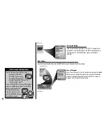
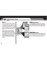
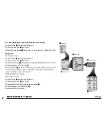
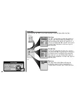
Find Options
Select the “STREET 1” field to enter a street name. Select the “STREET 2”
field to enter a street name. If necessary, select the “CITY” field to enter the
city. If necessary, select the “MAPS” field to change the current map
database. Select “FIND.” Select an intersection from the Matches List to see
details including street names and distance from your current location and to
navigate or GoTo that intersection or see that intersection on the Map Page in
relationship to your current position.
See “Find an Intersection,” page 56 for
details and instructions.
Find Screen
Intersection Screen
Matches List


