


http://www.CompeGPS.com http://Support.CompeGPS.com 31
Note:
You can review the ‘Trip review’ of the track you have done so far at any
moment from ‘Page tools > Trip review’.
5 MAPS
5.1.1 What is a map?
With TwoNav you are able to manage a great variety of maps. There are different
basic types of maps:
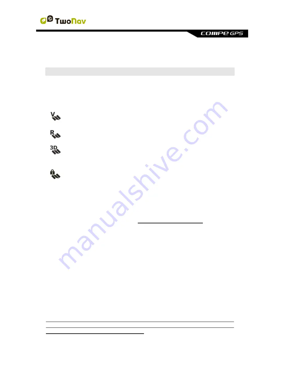
Vectorial
: Road maps. With a vectorial map loaded you will be able to
unlock the
‘On-Road’
mode.
Topo
: Topographic maps.
3D relieves
: Elevation maps. *.CDEM maps contain information
related to the altitude of the ground. With a relief map loaded you
might display the maps in 3D+.
Locked map:
Map not activated. In order to start working with it, a
license code is required.
TwoNav automatically opens the best map based on your current position. If you
prefer to manage your maps manually, disable the
‘Auto-open maps’
function
from
‘Main menu > Settings > Map > Automap’
.
Note:
CompeGPS offers you a wide range of maps from all around the world to
complement your cartography, just visit http://www.CompeGPS.com
5.1.2 Supported formats
TwoNav can open the following map formats:
*.RMAP/*.RTMAP
: CompeGPS
’ raster map format
*.ECW
: Raster map format
*.VMAP/*.MPVF
: CompeGPS
’ vectorial format
*.IMP
: Calibration file requiring image file
*.MAP
: Calibration file requiring image file
*.CDEM:
3D relief map
See your list of available maps from
‘Main menu > Data > Maps’ (all maps
available at ‘TwoNavData/Maps’ folder for your present position).
Important:
Remember that more map formats can be imported and converted to
the supported formats from Land/Air software (Windows/Mac platforms), more
information at http://www.CompeGPS.com