


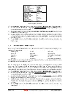


GPS Chart Plotters
Page 39
R
charts.
Classic
uses vivid chart colors presentation.
NOAA
allows setting NOAA paper
chart colors presentation.
Night
is recommended when the environment is dark in order
to reduce the glare of the display. The GPS Chart Plotter displays maps and screen in
darker colors.
Sunlight
(default) is designed to enhance the visibility of the screen when
the GPS Chart Plotter is exposed to sunlight. The maps are much brighter than in the other
modes and the depth areas are filled with the white color so different depth areas are not
easily distinguishable.
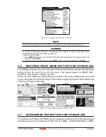
SHIP ICON
Allows selection of one of 5 choices of ship icons that represent your vessels position
shown on the chart page.
CURSOR SPEED
Selects the preferred speed among Low, Medium and High for the cursor in the Chart page
and within the menu.
MEASURE DISTANCE
When this function is turned on allows a distance to be measured between two points
using the ShuttlePoint knob and
[ENT]
.
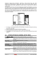
WINDOWS SETUP
This menu selection allows the data windows to be customized on the Chart and
Navigation pages.
LANGUAGE
Allows changing the language for menus and data screens.
AUTO INFO
By default when the cursor is moved over a buoy, Mark or other item a popup window will
show information of the item. This menu item allows the window to be turned on or off.
CURSOR WINDOW
By default when the cursor is moved a window is shown with the lat/lon Distance and
bearing from the vessels location to the cursor. This selection allows the window to be
turned off.
CURSOR POSITION
The position of the cursor (vessels location) can be customized so it
centered in the middle
or centered on the bottom of the chart page.
COG TIME LINE
Is a line projected from the vessel icon which indicates the distance your vessel will travel
at the current speed. Selections are 2, 10, 30 minutes, 1, 2 hours and infinite.
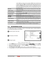
3.9
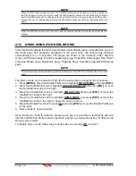
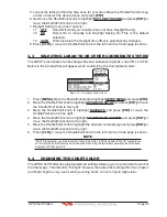
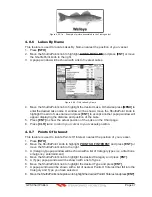
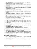
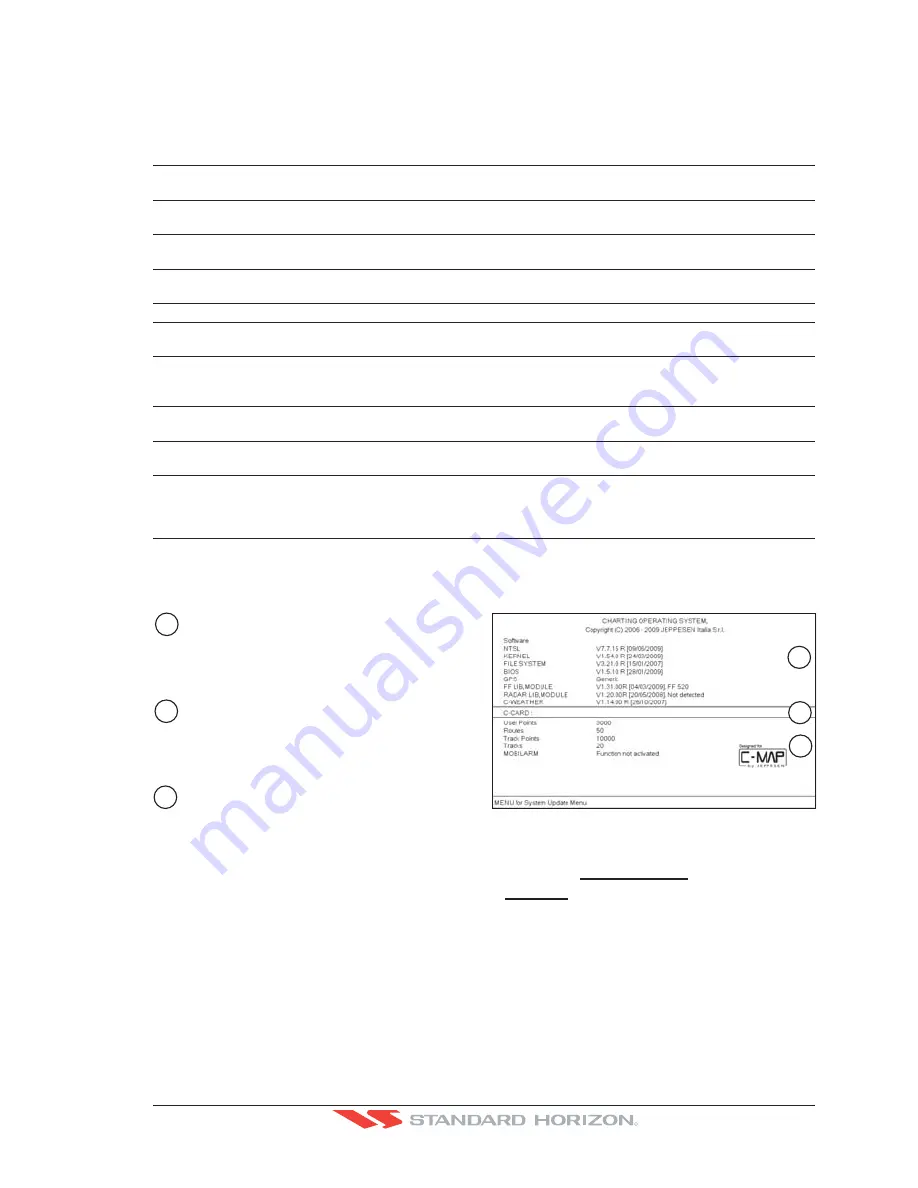
INFORMATION PAGE
From Main Menu page it is possible to select an Information page containing Software,
Chart and Optional devices information.
2
Cartography Information
Soft
w
are System Information
1
3
Storage Capacity
XXXXXX
YY.YY
M-NA-M632.00 LOS ANGELES and SAN PEDRO BAYS
1
2
3
Figure 3.9 - Example of About page on CP300
1. Press
[MENU]
. Move the ShuttlePoint knob to highlight
SETUP MENU
and press
[ENT]
.
2. Move the ShuttlePoint knob to highlight
About...
and press
[ENT]
or move the
ShuttlePoint knob to the right.
3. The Information page appears on the screen (see the previous Figure).
4. Press
[CLR]
or move the ShuttlePoint knob to the left to exit and show the Chart page.
Summary of Contents for CP180
Page 1: ...CP180 CP180i CP300 CP300i Owner s Manual Color GPS Chart Plotters R ...
Page 4: ...Page 6 GPS Chart Plotters R ...
Page 12: ...Page 14 GPS Chart Plotters R ...
Page 38: ...Page 40 GPS Chart Plotters R ...
Page 48: ...Page 50 GPS Chart Plotters R ...
Page 60: ...Page 62 GPS Chart Plotters R ...
Page 68: ...Page 70 GPS Chart Plotters R ...
Page 76: ...Page 78 GPS Chart Plotters R ...
Page 80: ...Page 82 GPS Chart Plotters R ...
Page 108: ...Page 110 GPS Chart Plotters R ...
Page 118: ...Page 120 GPS Chart Plotters R ...
Page 120: ...Page 122 GPS Chart Plotters R ...
Page 126: ...Page 128 GPS Chart Plotters R ...
Page 130: ...Page 132 GPS Chart Plotters R ...


