122 |
Maps |
Argus Radar Operator Manual
To move the map:
1.
Press the “Shift/Rotate” button and move the trackball on the PPI. The Help line will change to
“Posit Adj”, “Undo Adj” and “Angle Adj”. “Adj” stands for Adjustment.
2.
Press the left SK and the map will be anchored to the trackball. The Help line will show “Apply
Shift”, “Undo Adj” and “Unused”. Note that to anchor the map to the trackball, it is not neces-
sary to hold the SK pressed down. It is anchored with th
e first click, and released with the
second click.
3.
Move the trackball and consequently the whole map to a desired location.
4.
Press the left SK again and the map will be released. To move it again, press “Shift/Rotate” a
second time.
To rotate the map:
1.
Press the “Shift/Rotate” button and move the trackball on the PPI. The Help line will change to
“Posit Adj”, “Undo Adj” and “Angle Adj”. “Adj”. Stands for Adjustment. This is the same step as in
the “move map” procedure.
2.
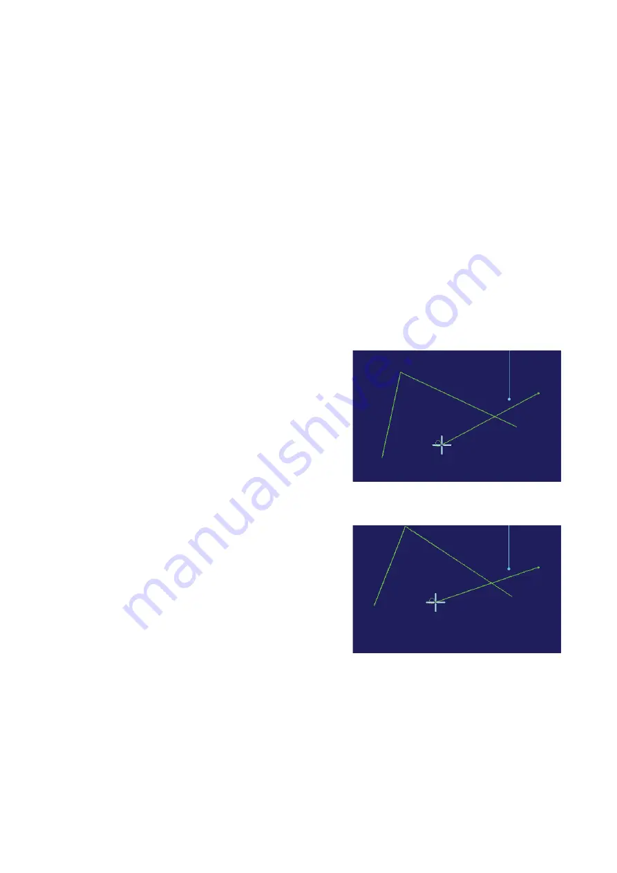
Press now the right SK, and the map will be anchored to the trackball and a line will be drawn
from the trackball cursor to the origin of the map. Normally the origin of the map is own ship
position. It can be moved from that position if the map has been shifted. The Help line will
show “Unused”, “Undo Adj” and “Apply Rot”. Note that to anchor the map to the trackball, it
is not necessary to hold the SK pressed down. It is anchored with the first click, and released
with the second click.
Help line in “Apply Rotation” mode
and appearance of the map before
rotation.
3.
Move the trackball and consequently rotate the map to the desired orientation.
Appearance of the map during the
rotation.
4.
Pressing the right SK again, the map will be released. To rotate it again, press “Shift/Rotate” a
second time.
During rotating and shifting, it is possible to return to the original position just by pressing the
centre SK button, corresponding to the “Undo Adj” function of the Help line.
To change the map type:
To change the map type, press the button located under the “Clear Map” button, which indi-
cates the type of the current map: “Relative Map”, “Dead Reckoning Map” or “Geographic Map”.
After it has been pressed down, a short list with the 3 possibilities, as listed above, will be
displayed. By selecting one of them with the trackball, the new map type will be applied and
the text on the button will be changed consequently.
Summary of Contents for ARGUS FMCW 3G
Page 1: ...ENGLISH ARGUSRADAR SYSTEM User Manual navico commercial com...
Page 2: ......
Page 149: ......
Page 150: ...988 10185 004...


