9
Fig.013
Fig.008
Fig.003
Fig.015
Fig.016
Fig.017
Fig.018
4.4
The different main functions and how to find them
When the instrument is started you reach five of the six main functions by pressing the
UP/DOWN
buttons. If you
are indoors and want to become familiar with the Multi-Navigator
TM
functions, we recommend you turn off the GPS
receiver by pressing YES in the POSITION function and press
YES
once more when answering the question SHUT
OFF GPS RECEIVER. Now you can explore the functions without having the GPS trying to find satellites from
indoors.
The main functions are, in order (by repeatedly pressing
DOWN
-button) FIG. 010: POSITION-GPS-TIME-BAROME-
TER-ALTIMETER and back to POSITION again. (Naturally you can press UP instead to find the different functions in
reverse order).
The Multi-Navigator
TM
also has a built-in electronic compass that has its own dedicated COMPASS-button (FIG.008),
which is easily accessible in any of the other functions at any time. You can now try on your own to scroll through
the different functions starting with the POSITION function
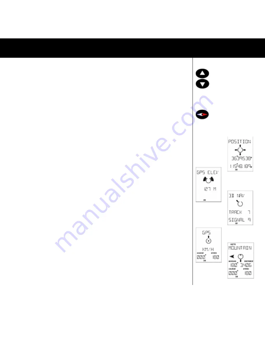
4.4.1 POSITION FUNCTION (FIG. 003)
In this function you see your current position (if the GPS receiver is on) shown in either Lat/Lon or a grid system
depending upon which you have selected. You will also see icons at the bottom of the LCD, showing if the GPS
receiver is searching for satellites (Acquisition - AQU), or is navigating with the help of three (2D) or more (3D)
”visible” satellites. Note that a flashing 3D or 2D when the Multi-Navigator
TM
is started means that less than 5
satellites have been found for the position calculation. To achieve highest possible accuracy it is recommendable to
wait unil the 3D (or 2D) symbol has stopped flashing. Now check which side-functions are available by pressing
RIGHT.
4.4.1.1 GPS ELEVATION (FIG. 015)
This is the elevation (altitude) calculated by the GPS receiver. It normally varies /- 30 metres. The graphic
indicator shows current rate of ascent/descent (one segment pointing up means the rate of ascent is 1 metre/
second). Press
RIGHT
and you will find....
4.4.1.2 SATELLITE STATUS (FIG. 016)
Indication of GPS receiver status, number of satellites found and also a signal level indication 1-9 where 9 is the
highest signal level. ACQUISITION means collection of satellite data but not yet navigating, 2D or 3D means that
the GPS receiver has calculated a three or two dimensional position. SEARCH means that the receiver is searching
for satellites. TRACK means that the GPS receiver is using the showed no. of satellites for its navigation. GPS OFF
is shown if the GPS receiver is shut off. Press
RIGHT
again and you are back in POSITION. Now press
DOWN
to
reach the next main function which is....
4.4.2 GPS NAVIGATION FUNCTION (FIG. 017-018)
This function can appear in three ways, depending on whether you have a stored waypoint or a stored * HOME *
you want to go to. If you have no waypoint or * HOME * stored you will see in the LCD, the current course you are
travelling on and your speed over the ground. (FIG. 017) If you have a waypoint stored which you have selected to
go to, it will look like this.(FIG. 018) Here there is information added that relates to the selected waypoint. You see
the waypoints name, bearing and distance to waypoint and on the lower row your current course and speed
calculated by the GPS receiver. In the top row you see Time To Go and also Cross Track Error if you have selected
that. (See 4.5.1.8) In the middle of the LCD you have the steering information i.e. in what direction and how much
you have to turn, in order to head straight towards the waypoint. Important! Note that the steering indicator shows
the direction in relation to your current direction of travel. This means that it will not react if you turn the unit left or
right - you will have to change the direction you are moving for the steering pointer to move. If you are navigating
towards a * HOME * position the text ”* HOME *” is lit in the upper part of the display. By pressing
RIGHT
repeatedly you will see the different alternatives (navigation with wpt (if one is selected), with * HOME *(if selected)
otherwise the function will show just GPS and the course and speed.
Fig.013
Fig.008
Fig.003
Fig.015
Fig.016
Fig.017
Fig.018
THE MAIN FUNCTIONS


