background image

Chapter 5: Using Stored Lists (EDIT)

53

Route Details

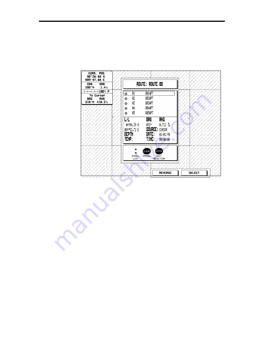
To display the details of the currently highlighted route:

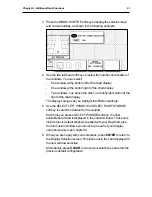
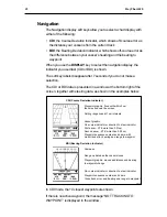
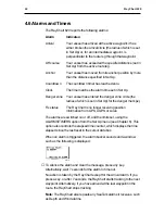
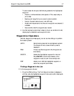
1. Press the ROUTE DETAILS soft key. The Route Details screen is

displayed.

D3817-1

This displays the details of the waypoints in the route, in the same
format as the Waypoint List (see Section 5.2).

2. You can press the REVERSE soft key to reverse the order in which

the waypoints will be followed in the route (although the listed order
remains the same), and the SELECT then the FOLLOW soft key to
start following the route. The soft key label is updated to OFF.

3. Press CLEAR to return to the Route List, or ENTER to go to the

Route Edit screen (see below).

Summary of Contents for RayChart 620

Page 1: ...Distributed by Any reference to Raytheon or RTN in this manual should be interpreted as Raymarine The names Raytheon and RTN are owned by the Raytheon Company...

Page 2: ...ELECTRONIC CHARTING SYSTEM OPERATION MANUAL N 43 34 944 W 72 26 223 N 43 34 944 W 72 26 223 12...

Page 3: ...RayChart 620...

Page 4: ...ation Its accuracy can be affected by many factors including equipment failure or defects environmental conditions and improper handling or use It is the user s responsibility to exercise common prude...

Page 5: ...694642 Copyright Raytheon Marine Company 1997 The technical and graphical information contained in this handbook to the best of our knowledge was correct as it went to press However the Raytheon polic...

Page 6: ...g the chart scale and using the default soft keys to set up and use on screen routes Chapter 4 Explains how to use additional basic functions such as track histories marks and events and how to displa...

Page 7: ...m all your routine tasks and refer to Chapter 5 for information about more advanced features If you experience any difficulties with your RayChart 620 refer to Chapter 8 Note The Quick Reference Card...

Page 8: ...Chart Controls 8 The Trackpad 8 The Soft Keys 8 Soft Key Default Functions 10 Other Soft Key Functions 11 2 5 djusting the Lighting and Contrast 11 2 6 Using Chart Cards 12 Inserting a Chart Card 12 R...

Page 9: ...29 Advancing to the Next Leg of the Route 30 Erasing a Route 30 3 5 Measuring Distances Using the RULER Key 31 Chapter 4 Additional Basic Functions 33 4 1 Introduction 33 4 2 Marks and Events 34 Plac...

Page 10: ...rrent Route Operations 50 5 4 The Route List 51 Viewing the Route List 51 Route List Operations 52 Route Details 53 Editing a Route or Building a New Route 54 5 5 Finding and Displaying a Waypoint 55...

Page 11: ...sition Correction 64 Setting Up the Chart Plotter 64 Waypoint Name 65 Waypoint Display 65 Course Vector 65 Heading Vector 66 Wind Vector 66 Tide Vector 66 Dead Reckoning 66 Cursor Data Box 66 Setting...

Page 12: ...7 5 RayChart Connections 84 Power and I O Connection 85 DC Power 85 NMEA Connection 86 Printer Connection 86 GPS Connection 86 SeaTalk Connection 87 7 6 System Check and Initial Setup 87 System Check...

Page 13: ...endix A Data Input and Output 93 A 1 Data Standards 93 SeaTalk 93 NMEA 93 A 2 SeaTalk or NMEA Data Input and Output 94 A 3 Loran GRIs 95 Appendix B Specification 97 Glossary 99 G 1 Terms 99 G 2 Abbrev...

Page 14: ...d menu system from which you can select the functions and options you require simplifies even complex tasks such as editing stored route data The display unit can be installed either above or below de...

Page 15: ...tion Memory C cards can be used to store and transfer route waypoint event and track history data If two RayCharts are installed on the system each can be operated independently but the active route i...

Page 16: ...d 5 Basics The RayChart 620 is controlled using a trackpad and 12 keys Eight of the keys are labelled and are dedicated to specific functions The remaining four at the bottom of the display are soft k...

Page 17: ...ptions are shown in normal capitals for example ROUTE Operating procedures which may consist of a single key press or a sequence of numbered steps are indicated by the symbol in the margin The short e...

Page 18: ...RayChart searches for the strongest signals at least four are required for an accurate position fix If the signals from the currently located satellites are not strong enough the RayChart searches for...

Page 19: ...fault configuration but with a chart card installed is shown in the top illustration opposite The cursor data box normally provides the following information The cursor position in either latitude and...

Page 20: ...ition Cursor position controlled by the trackpad Cursor data box Shows the current cursor position as either Lat Long or TDs Scale rule in nautical miles D3819 1 Vessel s heading vector Mark Event Act...

Page 21: ...the cursor to the edge of the display the display pans across the chart so that the area you have moved to remains in view If you continue to scroll the chart is redrawn on the screen at intervals If...

Page 22: ...Press to display the Main Menus with the last used option highlighted Use the soft keys or trackpad to highlight the required option and press ENTER Press CLEAR to finish Soft keys Press to select the...

Page 23: ...n the screen press the CLEAR key to select the default functions Note that when you press a soft key the action depends on the function type It can have the following effects Perform the action immedi...

Page 24: ...showing the current settings for brightness and contrast and the soft key labels are updated to provide control of the sliders D3820 1 2 Press the appropriate soft key to adjust the backlighting brig...

Page 25: ...as waypoints and routes Note You can insert and remove cards while a chart is displayed The previous information is retained until the RayChart redraws the screen for example it will do this if you s...

Page 26: ...e chart boxes and press the lower part of the RANGE key That area is expanded so that you can see more detail Note that the smaller the chart box is on the screen the greater the amount of detail that...

Page 27: ...ut due to a catch to prevent it being ejected accidentally you need to pull a little harder to pass this point 4 If required insert a new card as described above Remember to close the card cover so th...

Page 28: ...ut objects Using the GO TO key to navigate towards a selected point Setting up and using on screen routes Measuring distances using the RULER key Further basic functions including track histories and...

Page 29: ...n You will need to move the chart if your vessel moves out of the area currently displayed or if you wish to examine or place marks waypoints in another area There are three ways in which you can move...

Page 30: ...ies of the charts digitized in the current card To zoom in to a larger scale chart 1 Use the trackpad to position the cursor in the area you wish to see in more detail 2 Press the lower part of the RA...

Page 31: ...using the CENTER soft key The chosen point can be the vessel s position the cursor position or a specified position You can also select Home Mode which centers the vessel homes the cursor and changes...

Page 32: ...ll the digits are set to the required values d Press ENTER to set the position 4 The display returns to the CENTER soft keys display with the new chart position Press CLEAR to return to the default di...

Page 33: ...ct Data Box appears at the top of the screen as shown at the top of the example above If the cursor is over more than one object for which information is available the number of objects is shown and t...

Page 34: ...data 5 Press CLEAR to clear the detailed information display and return to the EXPAND and ALLINFO soft key display 6 Press CLEAR to return to the default display 3 3 Using the GOTO Key The GO TO defa...

Page 35: ...t the waypoint details 1 Press the EDIT soft key that is displayed for 7 seconds after you request the GO TO A window such as the following is displayed D3825 1 2 Use the left or right sides of the tr...

Page 36: ...and using a route Note You can also create edit and control routes using the EDIT menu options as described in Chapter 5 The RayChart 620 can store up to 20 routes When you want to create a new route...

Page 37: ...ou wish to make the route and select a suitable chart scale 2 Press the ROUTE soft key to display the Route menu and the current route Note If the full list of ROUTE options is displayed a route alrea...

Page 38: ...a solid line Note If you make a mistake you can delete a wrongly placed waypoint or insert an additional one as described below 9 Repeat steps 7 and 8 until you have placed all your waypoints You can...

Page 39: ...aypoints to the route in the same way as for a new route You can now add delete or insert waypoints although you cannot delete a waypoint if you are tracking towards it Note You can also use this opti...

Page 40: ...d named with the first available waypoint number Editing Route Information Once you have created a route you can edit the route information including the route name and the waypoint names symbols and...

Page 41: ...oints so that they are grouped together in the list Sym The waypoint symbol The default is a circle but you can change it to any of the mark event symbols see page 35 Source The source of the position...

Page 42: ...econd unit to control the route tracking on the first unit Following Reversing and Stopping a Route Once you have set up a route you can start navigating towards the first waypoint or if you are retra...

Page 43: ...7 seconds You can clear the alarm earlier by pressing any key D3832 1 Note If you are tracking to a single waypoint or to the last waypoint of the route you must arrive at the waypoint circle to trig...

Page 44: ...y the waypoints for the current route are displayed so the waypoints for the deleted route will disappear 3 5 Measuring Distances Using the RULER Key You can obtain an accurate measurement of the dist...

Page 45: ...If required repeat with further FROM and TO positions The ruler information is updated each time you select a new FROM or TO location 7 Press CLEAR or EXIT to clear the ruler display and return to th...

Page 46: ...ould have set up the basic data and the customized the display as described in Chapter 6 Once you have explored the display possibilities you may wish to return to the customization and make further c...

Page 47: ...The RayChart assigns a unique identifier to each event in the format xxxEV where xxx is the next available number The events are stored in the waypoint list and can be recalled and edited later see Ch...

Page 48: ...wish to delete 3 Press the DELETE MARK soft key to delete the mark 4 Press EXIT or CLEAR to return to the default screen Placing and Deleting an Event The procedure for placing an event is the same as...

Page 49: ...5 track history files including the current track can be displayed on screen at one time The length of track that can be displayed is limited by the frequency of the track points The more frequent the...

Page 50: ...nd press ENTER 3 Press ENTER again to confirm the deletion The track data in the current track file is deleted If the track is currently active the old data is cleared from the file and the screen but...

Page 51: ...3 Use the trackpad sides to scroll around the fields and the trackpad top and bottom to change the settings You can toggle the Display option on or off for any track change the current track file num...

Page 52: ...T Displays the chart type you used last full or window The soft keys allow you to choose between a full screen chart and one with the current window s configuration In windowed mode you can also chang...

Page 53: ...the display again press DISPLAY The soft key labels are redisplayed Changing theWindow Setup The WINDOW SETUP soft key allows you to change the default windows configuration You can select The number...

Page 54: ...as you highlight the different settings 5 Use the SELECT LEFT WINDOW or SELECT RIGHT WINDOW soft key to select the data set for the window Each time you press a SELECT WINDOW soft key the next availab...

Page 55: ...en together with steering data as shown in the examples below D3834 1 CDI Course Deviation Indicator BDI Bearing Deviation Indicator On course indicator or direction to steer indicator On course indic...

Page 56: ...nm per inch in North Up mode If Plotter Mode is switched off see Section 6 3 the display then changes to the nearest range scale for which cartographic information is available Places the cursor over...

Page 57: ...or the danger mark Fix status The RayChart is no longer receiving position information from GPS dGPS or Loran The alarms are switched on or off and the limits set using the ALARMS TIMERS option from t...

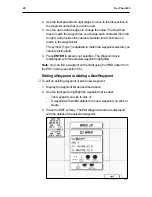
Page 58: ...waypoint to steer towards immediately Adding a new waypoint or editing the details for an existing waypoint Making a new route by selecting existing waypoints from the waypoint list Selecting an exis...

Page 59: ...Find a waypoint of known name and display its details GO TO a selected waypoint Delete a waypoint Edit the details of an existing waypoint or add a new waypoint Viewing theWaypoint List To view the l...

Page 60: ...rn Waypoint List Operations With the Waypoint List displayed you can use the soft keys to perform the following tasks GOTO Starts tracking towards the highlighted waypoint The Waypoint List is cleared...

Page 61: ...ld 4 Press ENTER to accept your selection The Waypoint List is redisplayed with the selected waypoint highlighted Note You can find a waypoint on the chart using the FIND option from the EDIT menu see...

Page 62: ...he Waypoint List or CLEAR to abandon your changes 5 3 The Current Route The Current Route option allows you to view the currently selected route with progress details and to specify a planned Speed Ov...

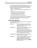
Page 63: ...ending on your selection Current Route Operations With the current route summary displayed you can use the soft keys to perform the following tasks NEXT LEG Jumps to the next leg of the route This has...

Page 64: ...route Delete a route Edit the details of an existing route or construct a new route by selecting existing waypoints You select the option and make the edits in the same way as described for the Waypo...

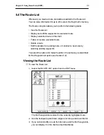
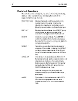
Page 65: ...hat this only deletes the route from the route list it does not delete the component waypoints SELECT Selects the route so that it can be displayed or activated When a route is selected the SELECT sof...

Page 66: ...oints in the route in the same format as the Waypoint List see Section 5 2 2 You can press the REVERSE soft key to reverse the order in which the waypoints will be followed in the route although the l...

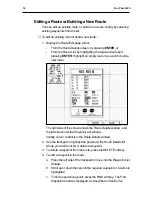
Page 67: ...ide of the screen shows the Route Details window and the left side shows the Waypoint List window Initially cursor control is in the Route Details window 2 Use the trackpad to highlight the position i...

Page 68: ...route 5 Press the EDIT RTE NAME key to edit the route name Use the trackpad to change the letters and numbers and press ENTER when you have finished 6 When you have finished editing the route press EN...

Page 69: ...s position Course Made Good CMG and Distance Made Good DMG since the previous log entry Use the trackpad to scroll up or down the list To print the log check that your printer is connected and on line...

Page 70: ...sing two of the Main Menus that are displayed using the MENU key the SET UP menu and the SCREEN menu D3360 1 Most of the options on these menus you will only need to use when you first set up your sys...

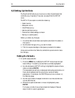
Page 71: ...e you have done this follow the instructions given below to make the changes Setting the Defaults To set the setup defaults 1 Press the MENU key to display the SET UP menu above the right hand soft ke...

Page 72: ...the menu 7 Once you have reset all the required values press CLEAR If you were in a sub menu the previous menu is displayed and you can continue changing parameter settings If you were in one of the s...

Page 73: ...alianio English Francais Deutsch Espanol Norge Svensk Date Time Menu Time Format 24 hour 24 hour 12 hour Time Offset UTC UTC Local offset value Date Format MMM DD YY MMM DD YY DD MMM YY Head Up Respon...

Page 74: ...be used for screen text labels menus and options but will not affect the chart information Note The selected language is also used for the setup information If you set the language incorrectly you ca...

Page 75: ...the required settings for the speed and heading 2 Select the Starting Point option The chart is displayed 3 Move the cursor to the required starting position and press ENTER The set up menu is redispl...

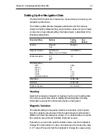
Page 76: ...ASF 1 0 0 ASF 2 0 0 Alternate Solution OFF Map Datum WGS 1984 Fix Datum WGS 1984 Position correction No correction Heading Select either degrees magnetic or degrees true for your heading data The uni...

Page 77: ...n and you cannot correct it by selecting the appropriate map datum or fix datum you can apply a position correction The value of the current correction is displayed on this menu To apply a position co...

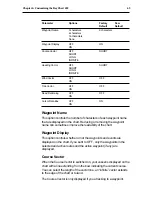
Page 78: ...isplayed on the chart Reducing or removing the waypoint name can sometimes improve the readability of the chart Waypoint Display This option controls whether or not the waypoints and events are displa...

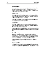
Page 79: ...tched on your vessel is displayed on the chart with a line extending from it indicating the tide angle The length of the line indicates the current tide speed The tide information is calculated from t...

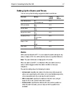
Page 80: ...m All the alarms relate to a specified distance Note The alarm limits are not displayed on the chart When an alarm is set OFF it is disabled When an alarm is set to a value it will be triggered when t...

Page 81: ...ro and is displayed in the cursor data box on the chart Clock alarm if set sounds when the time data received by the system matches the time specified here in hours minutes and seconds you can only se...

Page 82: ...rn to the chart Memory C Card The MEMORY C CARD option allows you to save or load data to or from a Memory C Card Data is saved or loaded in files by type a file can be used to store all waypoints all...

Page 83: ...utomatically formats it before saving the file 8 Press CLEAR to return to the chart display To load data from a C Card into the RayChart 620 s memory 1 Insert the Memory C Card into one of the chart s...

Page 84: ...WS Setting up the contents of the windows that can be displayed using the DISPLAY menus Setting the Cartography Detail The CARTOGRAPHY option allows you to select the types of cartographic features th...

Page 85: ...ting Items can be set either OFF or ON unless indicated Menu Parameters Factory New Default Default Land Settings Menu Natural Features ON Rivers Lakes ON Cultural Features ON Landmarks ON Marine Sett...

Page 86: ...r if you select Home Mode when in Head Up Mode the cursor is homed on the vessel and the RayChart display is in Relative Motion mode In this mode the chart moves to keep the vessel in the centre of th...

Page 87: ...addition to the 6 default windows To set up a customized window 1 Press MENU to display the main menus 2 Use the trackpad or the SCREEN soft key to highlight the WINDOWS option from the SCREEN menu an...

Page 88: ...can delete the last item using the DELETE LAST ITEM option from the EDIT menu Alternatively you can clear all the items in the window using the CLEAR WINDOW option RESTORE WIN will restore a cleared w...

Page 89: ...76 RayChart 620...

Page 90: ...n fixer and can also be connected to other units via the SeaTalk or NMEA connections You can install more than one RayChart 620 as part of a larger system Details of the current route or GO TO are sen...

Page 91: ...lf tapping screws 4 for fixing trunnion bracket Power cable SeaTalk cable Sun cover Panel mounting kit consisting of a gasket thumb studs 4 thumb nuts 4 and fixing template This handbook Quick referen...

Page 92: ...llation 79 Selecting a Location The RayChart can be mounted in two ways Attached to a bulkhead using the trunnion bracket already fitted to the display On a panel tabletop or console using the mountin...

Page 93: ...figured to operate in one of three different operating modes SeaTalk using the dedicated SeaTalk input output ports Navigation data can be received from the dedicated GPS port or from the SeaTalk port...

Page 94: ...before turning off the RayChart or NMEA data will be repeated to the printer If you need to use both SeaTalk and NMEA equipment in your system you can do so by connecting the NMEA equipment via a uni...

Page 95: ...SSB radios the distance should be increased to 7ft 2m More than 7ft 2m from the path of a radar beam A radar beam can normally be assumed to spread 20 degrees above and below the radiating element The...

Page 96: ...e knobs Panel Mounting To mount the RayChart on a tabletop or console as shown in the illustration on the following page 1 Select a clear location at least 350mm 13 in by 250mm 9 in Caution Make sure...

Page 97: ...panel connectors as follows 1 SeaTalk input and output two 3 pin flat connectors each providing data input and output 2 Power and input output NMEA and printer 7 pin male connector 3 GPS input 5 pin m...

Page 98: ...ery positive 10 7 32 VDC Red 2 Battery negative Black 3 NMEA data input ve White 4 NMEA input ve common Green 5 Printer ready Grey 6 NMEA data out OR printer out Yellow 7 Data output common Brown Grou...

Page 99: ...Talk interface you can use this port to interface the RayChart with other equipment capable or receiving transmitting data to the NMEA 0183 standard see Appendix A Note In this case you must connect y...

Page 100: ...d from instrument to instrument via the daisy loom cable Note The SeaTalk connector cannot be used to power the RayChart Power from the RayChart cannot be used to supply power to other SeaTalk equipme...

Page 101: ...red option and press ENTER again c Press CLEAR to return to the chart 5 If you are using a Loran position fixer select the NAVIGATE options from the SET UP menu Select TD from the Position Resolution...

Page 102: ...g and Safety Guidelines Raytheon equipment should be serviced only by authorized Raytheon service engineers They will ensure that service procedures and replacement parts used will not affect performa...

Page 103: ...if necessary Check in line fuse Replace if necessary Check vessel s power battery for correct voltage readings 10 35V DC Poor chart definition Adjust contrast setting and or backlight level No positi...

Page 104: ...each key s correct operation by updating the key display on the diagram CARTRIDGES Reports the current charts found and provides a cartridge connector test CONNECTORS Reports the current connections...

Page 105: ...92 RayChart 620...

Page 106: ...ago on board electronic instruments were stand alone The information they provided was only available in one location and could not be shared easily with other instruments or navigation equipment The...

Page 107: ...er data in both directions between equipment For this reason NMEA 0183 is generally used to connect a data receiver and a transmitter together for example a compass sensor transmitting heading to a ra...

Page 108: ...LL GGA RMC VTG VHW HDM HDT HDG BWC GSA GSV and Raytheon sentences Out APB BWC GGA GLL RMB RMC VTG XTE HDG HSC APB BWC GGA GLL RMB RMC VTG XTE HDG HSC reset and init A 3 Loran GRIs The RayChart 620 all...

Page 109: ...96 RayChart 620...

Page 110: ...than 6W internal Controls 8 defined keys 4 soft keys and trackpad Display type 640 x 480 VGA quality LCD monochrome with 4 grey scales Display size 10 diagonal 19 x 14 5 cm Interfaces SeaTalk receive...

Page 111: ...98 RayChart 620...

Page 112: ...gives the vessel s position and the range and bearing to the active waypoint if any Latitude Angular measure 0 to 90 North and South from the equator On a chart these lines are drawn from right to le...

Page 113: ...at has been stored in memory with Lat Long or TD as the coordinates which is to be used as a destination or a turning point on the route to the destination Window A boxed area inset on the main screen...

Page 114: ...vessel over the ground TD Time Difference The difference in time of arrival measured in microseconds of the two Loran signals one from the master transmitting station and the other from the secondary...

Page 115: ...102 RayChart 620...

Page 116: ...Cursor 8 Cursor data box 6 turning on off 66 Customizing the display 71 Customizing the RayChart 57 75 D Danger zone 34 Data sources 93 96 Date and time 61 Dead Reckoning 66 Deleting a route 30 Delet...

Page 117: ...5 Next leg 30 50 NMEA connection 86 NMEA data 61 74 80 94 NMEA standard 93 North Up 73 O Objects 20 Orientation of chart 73 P Packing list 78 Planning routes 49 Plotter setup 64 Plotter Mode 17 72 Pop...

Page 118: ...nned 50 Specification 97 Stopping a GO TO 22 Stopping a route 29 Stored lists 45 56 System setup 59 System test 87 T TD settings 64 Testing the unit 90 Tide vector 66 Timers 44 setting up 67 Trackpad...

Page 119: ...106 RayChart 620 81125 1...

Page 120: ...RayChart 620...

Page 121: ...arine Company 676 Island Pond Road Manchester NH 03109 5420 TEL 603 647 7530 FAX 603 634 4756 Raytheon Marine Europe Ltd Anchorage Park Portsmouth Hampshire PO3 5TD England TEL 01705 693611 FAX 01705...

Reviews: