36 / 62
37 / 62
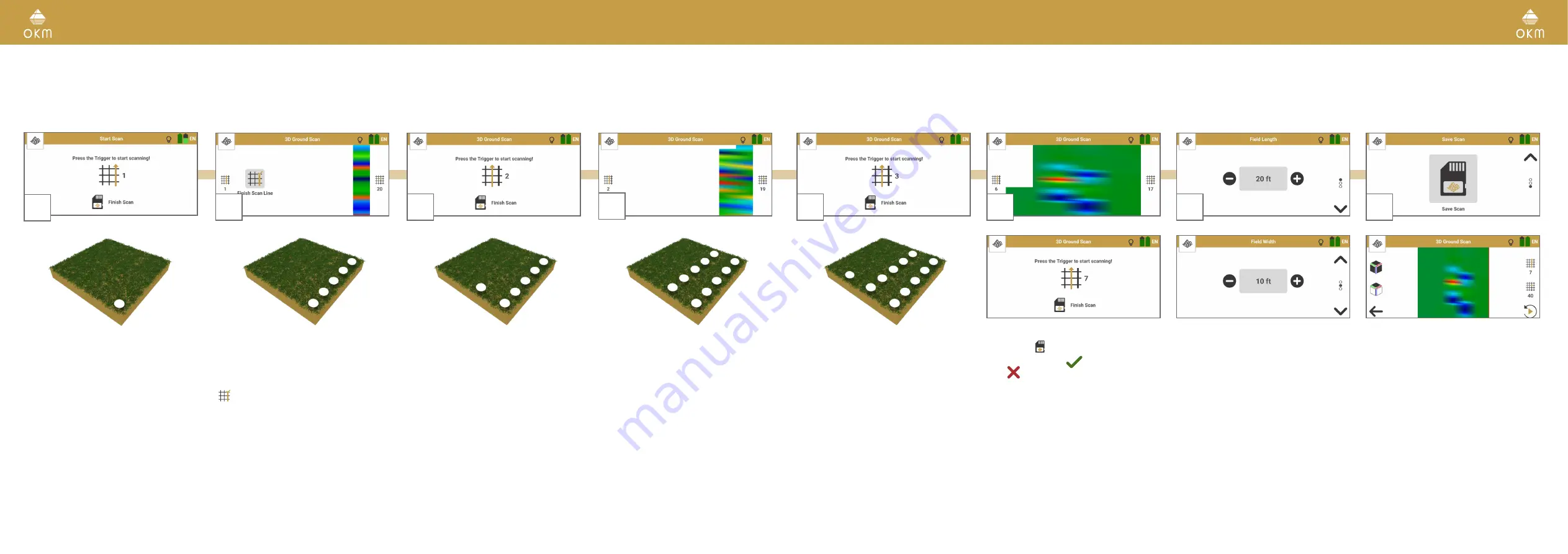
5.7.4 Perform Manual 3D Ground Scan
The parameters Field Length: Auto | Impulse Mode: Manual | Scan Mode: Parallel
are recommended for rough terrain.
3
Return to your first starting point without
scanning and take one step to the left: This
is the starting point of the second scan line.
Press the trigger to record the first impulse
of your second scan line.
1
Go to the starting point of the first scan line
(bottom right corner).
When using Impulse Mode Manual each
single impulse (scan value) is released
manually one by one by pushing the trigger.
2
Press the trigger to start the measurement.
Take a step forward and press the trigger
again to record an impulse.
Continue in this way until you reach the end
of the first scan line. Tap on Finish Scan Line
to set the field length.
The scan image will be generated line by
line to help you to follow your progress while
measuring.
The first scan lines may initially look incor-
rect. However, the inconsistent scan image
will stabilize in the course of the scan.
6
Complete the measurement by tapping on
Finish Scan .
Confirm saving with
or discard the scan
with
.
4
Take a step forward and press the trigger
again to record the next impulse. Continue
until you reach the end of the scan line.
Scan parallel to your first scan line with the
probe heading into the same direction as in
the first scan line.
The App indicates the end of the scan line.
7
If you chose to save the scan, enter the Field
Length and Field Width that you actually
measured.
8
The scan file is opened in the File Explorer –
see
.
5
Return to the last starting point and take a
step to the left (without scanning): This is the
starting point of the next scan line.
Press the trigger to start scanning. Release
an impulse at each step forward until you
reach the end of the scan line.
Repeat this to scan as many lines as you like.


